
GLOVIS SKY
Cargo
Current Trip
| Time Travelled | 1 day |
|---|---|
| Remaining Time | 12 h, 33 mins |
| Distance Travelled | 528.21 nm |
| Remaining Distance | 227.42 nm |
| AVG Speed | 15.5 Knots |
| MAX Speed | 18.8 Knots |
| AVG Wind | 12.4 knots |
| MAX Wind | 16.7 knots |
| MIN Temp | 2.8°C / 37.04°F |
| MAX Temp | 17.7°C / 63.86°F |
| Draught | 9.7 m |
| Position Received | 1 m ago |
Current Position
| Longitude | --- |
|---|---|
| Latitude | --- |
| Status | Under way using engine |
| Speed | 17.4 Knots |
| Course | 234.2° |
| Area | North Atlantic Ocean |
| Station | T-AIS |
| Position Received | 1 m ago |
Info
Information
The current position of GLOVIS SKY is in North Atlantic Ocean with coordinates 33.14677° / -77.98039° as reported on 2025-12-05 10:30 by AIS to our vessel tracker app. The vessel's current speed is 17.4 Knots and is heading at the port of BRUNSWICK. The estimated time of arrival as calculated by MyShipTracking vessel tracking app is 2025-12-05 18:05 LT
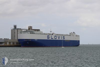
The vessel GLOVIS SKY (IMO: 9798404, MMSI: 538007439) is a Cargo It's sailing under the flag of [MH] Marshall Is.
In this page you can find informations about the vessels current position, last detected port calls, and current voyage information. If the vessels is not in coverage by AIS you will find the latest position.
The current position of GLOVIS SKY is detected by our AIS receivers and we are not responsible for the reliability of the data. The last position was recorded while the vessel was in Coverage by the Ais receivers of our vessel tracking app.
The current draught of GLOVIS SKY as reported by AIS is 9.7 meters
Weather
| Temperature | 17.3°C / 63.14°F |
|---|---|
| Wind Speed | 5 knots |
| Direction | 143° SE |
| Pressure | 1018 hPa |
| Humidity | 60.4 % |
| Cloud Coverage | 100 % |
Featured Company
Last Port Calls
| Port | Arrival | Departure | Time In Port |
|---|---|---|---|
| 2025-12-02 23:32 | 2025-12-03 21:54 | 22 h | |
| 2025-11-06 06:40 | 2025-11-06 15:48 | 9 h | |
| 2025-11-02 05:01 | 2025-11-03 23:48 | 1 d | |
| 2025-10-28 09:36 | 2025-10-31 22:12 | 3 d | |
| 2025-10-26 05:52 | 2025-10-26 20:32 | 14 h | |
| 2025-10-23 00:33 | 2025-10-25 18:26 | 2 d | |
| 2025-10-17 18:55 | 2025-10-22 18:04 | 4 d |
Most Visited Ports (Last year)
| Port | Arrivals | |
|---|---|---|
| 5 | ||
| 5 | ||
| 4 | ||
| 3 | ||
| 3 | ||
| 3 |
Last Trips
| Origin | Departure | Destination | Arrival | Distance | |
|---|---|---|---|---|---|
| 2025-11-06 15:48 | 2025-12-02 23:32 | 10304.23 nm | |||
| 2025-11-03 23:48 | 2025-11-06 06:40 | 657.84 nm | |||
| 2025-10-31 22:12 | 2025-11-02 05:01 | 459.12 nm | |||
| 2025-10-26 20:32 | 2025-10-28 09:36 | 475.91 nm | |||
| 2025-10-25 18:26 | 2025-10-26 05:52 | 94.78 nm | |||
| 2025-10-22 18:04 | 2025-10-23 00:33 | 87.02 nm | |||
| 2025-09-21 13:50 | 2025-10-17 18:55 | 10937.94 nm |
Events
| Time | Event | Details | Position / Dest | Info |
|---|---|---|---|---|
| 2025-12-05 08:37 | Status Changed | Under way using engine Default |
33.46554 / -77.43485
USSSI
|
Speed: 17.7 kn Course: 236° |
| 2025-12-05 08:31 | IN Coverage |
33.46554 / -77.43485
North Atlantic Ocean
USSSI
|
Speed: 17.7 kn Course: 234° |
|
| 2025-12-05 01:06 | Status Changed | Default Under way using engine |
34.72503 / -75.37472
USSSI
|
Speed: 14.6 kn Course: 223.6° |
| 2025-12-05 00:54 | OUT of Coverage |
34.75874 / -75.33615
North Atlantic Ocean
USSSI
|
Speed: 14.6 kn Course: 223.6° |
|
| 2025-12-05 00:15 | Status Changed | Under way using engine Default |
34.87621 / -75.20019
USSSI
|
Speed: 14.8 kn Course: 222° |
| 2025-12-05 00:15 | IN Coverage |
34.87344 / -75.20338
North Atlantic Ocean
USSSI
|
Speed: 14.9 kn Course: 223.9° |
|
| 2025-12-04 09:42 | Status Changed | Default Under way using engine |
39.03619 / -74.00076
USSSI
|
Speed: 17.8 kn Course: 190.1° |
| 2025-12-04 09:32 | OUT of Coverage |
39.08743 / -73.98783
North Atlantic Ocean
USSSI
|
Speed: 17.8 kn Course: 190.1° |
|
| 2025-12-04 08:09 | Status Changed | Under way using engine Default |
39.49386 / -73.88731
USSSI
|
Speed: 17.9 kn Course: 190° |
| 2025-12-04 08:05 | Status Changed | Default Under way using engine |
39.51495 / -73.88287
USSSI
|
Speed: 17.9 kn Course: 189.5° |