
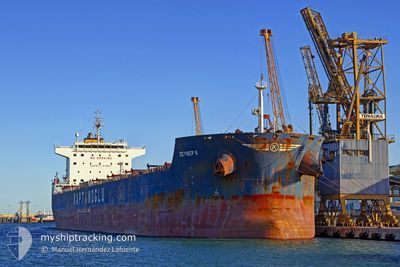
GLOBE ELECTRA
Bulk Carrier
Current Trip
| Time Travelled | 18 days |
|---|---|
| Remaining Time | 22 days |
| Distance Travelled | 4440.42 nm |
| Remaining Distance | 4658.92 nm |
| AVG Speed | 9.5 Knots |
| MAX Speed | 11.3 Knots |
| AVG Wind | 14.5 knots |
| MAX Wind | 25 knots |
| MIN Temp | 16°C / 60.8°F |
| MAX Temp | 26.8°C / 80.24°F |
| Draught | 13.5 m |
| Position Received | 1 d ago |
Current Position
| Longitude | 32.72755° |
|---|---|
| Latitude | -33.05772° |
| Status | Under way using engine |
| Speed | 9.5 Knots |
| Course | 69° |
| Area | Indian Ocean |
| Station | T-AIS |
| Position Received | 1 d ago |
Info
Information
The current position of GLOBE ELECTRA is in Indian Ocean with coordinates -33.05772° / 32.72755° as reported on 2024-05-31 00:59 by AIS to our vessel tracker app. The vessel's current speed is 9.5 Knots and is heading at the port of SINGAPORE. The estimated time of arrival as calculated by MyShipTracking vessel tracking app is 2024-06-23 15:16 LT
The vessel GLOBE ELECTRA (IMO: 9483827, MMSI: 538003822) is a Bulk Carrier that was built in 2010 ( 14 years old ). It's sailing under the flag of [MH] Marshall Is.
In this page you can find informations about the vessels current position, last detected port calls, and current voyage information. If the vessels is not in coverage by AIS you will find the latest position.
The current position of GLOBE ELECTRA is detected by our AIS receivers and we are not responsible for the reliability of the data. The last position was recorded while the vessel was in Coverage by the Ais receivers of our vessel tracking app.
The current draught of GLOBE ELECTRA as reported by AIS is 13.5 meters
Weather
| Temperature | 22.5°C / 72.5°F |
|---|---|
| Wind Speed | 15 knots |
| Direction | 349° N |
| Pressure | 1015.8 hPa |
| Humidity | 87.8 % |
| Cloud Coverage | 100 % |
Featured Company
Most Visited Ports (Last year)
| Port | Arrivals | |
|---|---|---|
| 2 | ||
| 1 | ||
| 1 | ||
| 1 | ||
| 1 |
Events
| Time | Event | Details | Position / Dest | Info |
|---|---|---|---|---|
| 2024-05-31 01:04 | Status Changed | Default Under way using engine |
-33.05323 / 32.74130
SINGAPORE PEBGB
|
Speed: 9.5 kn Course: 69° |
| 2024-05-31 00:59 | OUT of Coverage |
-33.05772 / 32.72755
Indian Ocean
SINGAPORE PEBGB
|
Speed: 9.5 kn Course: 69° |
|
| 2024-05-31 00:17 | Status Changed | Under way using engine Default |
-33.10302 / 32.60658
SINGAPORE PEBGB
|
Speed: 9.4 kn Course: 68° |
| 2024-05-31 00:12 | Status Changed | Default Under way using engine |
-33.10803 / 32.59177
SINGAPORE PEBGB
|
Speed: 9.3 kn Course: 66° |
| 2024-05-31 00:02 | Status Changed | Under way using engine Default |
-33.11730 / 32.56558
SINGAPORE PEBGB
|
Speed: 9.3 kn Course: 67° |
| 2024-05-31 00:00 | Status Changed | Default Under way using engine |
-33.12017 / 32.55732
SINGAPORE PEBGB
|
Speed: 9.4 kn Course: 67° |
| 2024-05-30 23:29 | Status Changed | Under way using engine Default |
-33.15085 / 32.46913
SINGAPORE PEBGB
|
Speed: 9.4 kn Course: 68° |
| 2024-05-30 23:20 | Status Changed | Default Under way using engine |
-33.15942 / 32.44323
SINGAPORE PEBGB
|
Speed: 9.3 kn Course: 69° |
| 2024-05-30 22:17 | Status Changed | Under way using engine Default |
-33.21772 / 32.26083
SINGAPORE PEBGB
|
Speed: 9.4 kn Course: 67° |
| 2024-05-30 21:22 | Status Changed | Default Under way using engine |
-33.27235 / 32.10415
SINGAPORE PEBGB
|
Speed: 9.1 kn Course: 66° |