
GLOBAL DISCOVERY
Cargo
Current Trip
| Time Travelled | 37 days |
|---|---|
| Remaining Time | --- |
| Distance Travelled | 7322.48 nm |
| Remaining Distance | --- |
| AVG Speed | 11.2 Knots |
| MAX Speed | 16.1 Knots |
| AVG Wind | 14.3 knots |
| MAX Wind | 47 knots |
| MIN Temp | -2°C / 28.4°F |
| MAX Temp | 20.4°C / 68.72°F |
| Draught | 10.4 m |
| Position Received | 7 d ago |
Current Position
| Longitude | --- |
|---|---|
| Latitude | --- |
| Status | Under way using engine |
| Speed | 8.9 Knots |
| Course | 309.7° |
| Area | North Pacific Ocean |
| Station | T-AIS |
| Position Received | 7 d ago |
Info
Information
The current position of GLOBAL DISCOVERY is in North Pacific Ocean with coordinates 49.54934° / -127.05994° as reported on 2025-12-11 03:12 by AIS to our vessel tracker app. The vessel's current speed is 8.9 Knots and is heading at the port of KURE. The estimated time of arrival as calculated by MyShipTracking vessel tracking app is 2025-12-28 12:00 LT
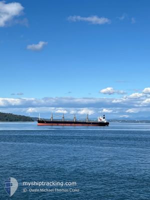
The vessel GLOBAL DISCOVERY (IMO: 9725691, MMSI: 577332000) is a Cargo It's sailing under the flag of [VU] Vanuatu.
In this page you can find informations about the vessels current position, last detected port calls, and current voyage information. If the vessels is not in coverage by AIS you will find the latest position.
The current position of GLOBAL DISCOVERY is detected by our AIS receivers and we are not responsible for the reliability of the data. The last position was recorded while the vessel was in Coverage by the Ais receivers of our vessel tracking app.
The current draught of GLOBAL DISCOVERY as reported by AIS is 10.4 meters
Weather
| Temperature | 4.4°C / 39.92°F |
|---|---|
| Wind Speed | 15 knots |
| Direction | 222° SW |
| Pressure | 1033.1 hPa |
| Humidity | 80.8 % |
| Cloud Coverage | 100 % |
Featured Company
Most Visited Ports (Last year)
| Port | Arrivals | |
|---|---|---|
| 19 | ||
| 3 | ||
| 2 |
Events
| Time | Event | Details | Position / Dest | Info |
|---|---|---|---|---|
| 2025-12-11 03:22 | Status Changed | Default Under way using engine |
49.56596 / -127.09034
US OLM>JP KRE
|
Speed: 8.9 kn Course: 309.7° |
| 2025-12-11 03:12 | OUT of Coverage |
49.54934 / -127.05994
North Pacific Ocean
US OLM>JP KRE
|
Speed: 8.9 kn Course: 309.7° |
|
| 2025-12-11 02:31 | Status Changed | Under way using engine Default |
49.48379 / -126.94520
US OLM>JP KRE
|
Speed: 8.9 kn Course: 311° |
| 2025-12-11 02:29 | Status Changed | Default Under way using engine |
49.48030 / -126.93884
US OLM>JP KRE
|
Speed: 8.8 kn Course: 309.5° |
| 2025-12-10 16:56 | Status Changed | Under way using engine Default |
48.51479 / -125.20655
US OLM>JP KRE
|
Speed: 9.6 kn Course: 270° |
| 2025-12-10 16:55 | Status Changed | Default Under way using engine |
48.51473 / -125.19971
US OLM>JP KRE
|
Speed: 9.5 kn Course: 269.8° |
| 2025-12-10 16:54 | Status Changed | Under way using engine Default |
48.51473 / -125.19705
US OLM>JP KRE
|
Speed: 9.3 kn Course: 268° |
| 2025-12-10 16:51 | Status Changed | Default Under way using engine |
48.51468 / -125.18383
US OLM>JP KRE
|
Speed: 9.2 kn Course: 268.6° |
| 2025-12-10 16:50 | Status Changed | Under way using engine Default |
48.51474 / -125.18125
US OLM>JP KRE
|
Speed: 8.8 kn Course: 268° |
| 2025-12-10 16:47 | Status Changed | Default Under way using engine |
48.51467 / -125.16937
US OLM>JP KRE
|
Speed: 9.2 kn Course: 270.6° |