
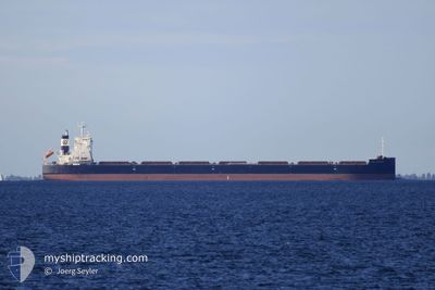
GCL LEADER
Cargo
Current Trip
| Time Travelled | 15 days |
|---|---|
| Remaining Time | --- |
| Distance Travelled | 3644.31 nm |
| Remaining Distance | 506.17 nm |
| AVG Speed | 9.5 Knots |
| MAX Speed | 14 Knots |
| AVG Wind | 20 knots |
| MAX Wind | 37 knots |
| MIN Temp | 3.6°C / 38.48°F |
| MAX Temp | 21.6°C / 70.88°F |
| Draught | 8.8 m |
| Position Received | 7 d ago |
Current Position
| Longitude | --- |
|---|---|
| Latitude | --- |
| Status | Under way using engine |
| Speed | 12.6 Knots |
| Course | 265.4° |
| Area | North Atlantic Ocean |
| Station | T-AIS |
| Position Received | 7 d ago |
Info
Information
The current position of GCL LEADER is in North Atlantic Ocean with coordinates 37.66799° / -30.46649° as reported on 2025-12-04 07:04 by AIS to our vessel tracker app. The vessel's current speed is 12.6 Knots and is heading at the port of BALTIMORE. The estimated time of arrival as calculated by MyShipTracking vessel tracking app is 2025-12-10 22:00 LT
The vessel GCL LEADER (IMO: 9902550, MMSI: 636020450) is a Cargo It's sailing under the flag of [LR] Liberia.
In this page you can find informations about the vessels current position, last detected port calls, and current voyage information. If the vessels is not in coverage by AIS you will find the latest position.
The current position of GCL LEADER is detected by our AIS receivers and we are not responsible for the reliability of the data. The last position was recorded while the vessel was in Coverage by the Ais receivers of our vessel tracking app.
The current draught of GCL LEADER as reported by AIS is 8.8 meters
Weather
| Temperature | 12.9°C / 55.22°F |
|---|---|
| Wind Speed | 25 knots |
| Direction | 297° WNW |
| Pressure | 1011.7 hPa |
| Humidity | 61.5 % |
| Cloud Coverage | 100 % |
Featured Company
Last Port Calls
Most Visited Ports (Last year)
| Port | Arrivals | |
|---|---|---|
| 2 | ||
| 2 | ||
| 1 | ||
| 1 | ||
| 1 | ||
| 1 |
Last Trips
| Origin | Departure | Destination | Arrival | Distance | |
|---|---|---|---|---|---|
| 2025-11-26 22:06 | 2025-11-27 00:11 | 9.23 nm | |||
| 2025-11-20 03:39 | 2025-11-25 22:20 | 10.21 nm | |||
| 2025-10-17 12:25 | 2025-11-20 02:33 | 5201.50 nm | |||
| 2025-10-13 23:28 | 2025-10-16 12:57 | 230.03 nm | |||
| 2025-08-22 08:28 | 2025-10-10 01:21 | 7711.73 nm |
Events
| Time | Event | Details | Position / Dest | Info |
|---|---|---|---|---|
| 2025-12-04 07:18 | Status Changed | Default Under way using engine |
37.66333 / -30.52667
USBAL
|
Speed: 12.6 kn Course: 265.4° |
| 2025-12-04 07:04 | OUT of Coverage |
37.66799 / -30.46649
North Atlantic Ocean
USBAL
|
Speed: 12.6 kn Course: 265.4° |
|
| 2025-12-04 07:04 | Status Changed | Under way using engine Default |
37.66804 / -30.46582
USBAL
|
Speed: 12.8 kn Course: 267° |
| 2025-12-04 06:59 | Status Changed | Default Under way using engine |
37.66931 / -30.44119
USBAL
|
Speed: 12.8 kn Course: 266° |
| 2025-12-03 19:47 | ETA Changed | 2025/12/11 03:00 2025/12/10 03:00 |
38.00131 / -27.50574
USBAL
|
Speed: 12.5 kn Course: 249.4° |
| 2025-12-03 19:31 | Status Changed | Under way using engine Default |
38.02103 / -27.43825
USBAL
|
Speed: 12 kn Course: 248° |
| 2025-12-03 19:06 | Status Changed | Default Under way using engine |
38.05167 / -27.33667
USBAL
|
Speed: 12.9 kn Course: 250° |
| 2025-12-03 18:52 | Status Changed | Under way using engine Default |
38.07138 / -27.27662
USBAL
|
Speed: 13 kn Course: 248° |
| 2025-12-03 18:33 | Status Changed | Default Under way using engine |
38.09448 / -27.19894
USBAL
|
Speed: 13 kn Course: 247.8° |
| 2025-12-03 18:29 | Status Changed | Under way using engine Default |
38.09950 / -27.18107
USBAL
|
Speed: 13 kn Course: 250° |