
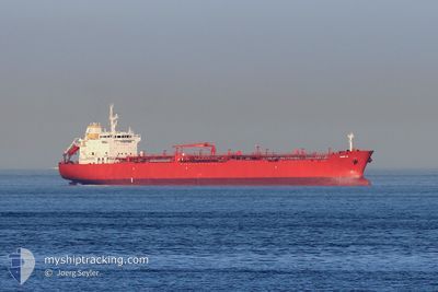
GAVI C
Oil/Chemical Tanker
Current Trip
BRTUB>BRSSZ
| Time Travelled | 2 days |
|---|---|
| Remaining Time | --- |
| Distance Travelled | 496.20 nm |
| Remaining Distance | --- |
| AVG Speed | 10.5 Knots |
| MAX Speed | 12.3 Knots |
| AVG Wind | 10.5 knots |
| MAX Wind | 21 knots |
| MIN Temp | 22.7°C / 72.86°F |
| MAX Temp | 24.7°C / 76.46°F |
| Draught | 7.8 m |
| Position Received | 22 h, 45 m ago |
Current Position
| Longitude | --- |
|---|---|
| Latitude | --- |
| Status | Under way using engine |
| Speed | 8 Knots |
| Course | 269.2° |
| Area | South Atlantic Ocean |
| Station | T-AIS |
| Position Received | 22 h, 45 m ago |
Info
Information
The current position of GAVI C is in South Atlantic Ocean with coordinates -24.42812° / -45.82456° as reported on 2025-12-07 17:00 by AIS to our vessel tracker app. The vessel's current speed is 8 Knots
The vessel GAVI C (IMO: 9391361, MMSI: 636019418) is a Oil/Chemical Tanker that was built in 2008 ( 17 years old ). It's sailing under the flag of [LR] Liberia.
In this page you can find informations about the vessels current position, last detected port calls, and current voyage information. If the vessels is not in coverage by AIS you will find the latest position.
The current position of GAVI C is detected by our AIS receivers and we are not responsible for the reliability of the data. The last position was recorded while the vessel was in Coverage by the Ais receivers of our vessel tracking app.
The current draught of GAVI C as reported by AIS is 7.8 meters
Weather
| Temperature | 24.4°C / 75.92°F |
|---|---|
| Wind Speed | 6 knots |
| Direction | 171° S |
| Pressure | 1012.4 hPa |
| Humidity | 82.5 % |
| Cloud Coverage | 100 % |
Featured Company
Last Port Calls
| Port | Arrival | Departure | Time In Port |
|---|---|---|---|
| 2025-12-04 14:37 | 2025-12-05 22:07 | 1 d | |
| 2025-11-11 10:36 | 2025-11-13 02:48 | 1 d | |
| 2025-11-06 20:21 | 2025-11-06 21:09 | 48 m | |
| 2025-11-05 00:33 | 2025-11-05 01:25 | 52 m | |
| 2025-11-01 06:43 | 2025-11-02 19:19 | 1 d | |
| 2025-10-23 11:29 | 2025-10-23 12:17 | 47 m | |
| 2025-10-21 14:33 | 2025-10-21 15:15 | 41 m | |
| 2025-10-13 07:02 | 2025-10-14 22:04 | 1 d | |
| 2025-10-07 12:01 | 2025-10-07 12:57 | 56 m | |
| 2025-10-01 11:27 | 2025-10-02 16:49 | 1 d |
Most Visited Ports (Last year)
| Port | Arrivals | |
|---|---|---|
| 23 | ||
| 21 |
Last Trips
| Origin | Departure | Destination | Arrival | Distance | |
|---|---|---|---|---|---|
| 2025-11-13 02:48 | 2025-12-04 14:37 | 1137.06 nm | |||
| 2025-11-06 21:09 | 2025-11-11 10:36 | 507.71 nm | |||
| 2025-11-05 01:25 | 2025-11-06 20:21 | 8.46 nm | |||
| 2025-11-02 19:19 | 2025-11-05 00:33 | 523.49 nm | |||
| 2025-10-23 12:17 | 2025-11-01 06:43 | 546.39 nm | |||
| 2025-10-21 15:15 | 2025-10-23 11:29 | 9.87 nm | |||
| 2025-10-14 22:04 | 2025-10-21 14:33 | 533.33 nm | |||
| 2025-10-07 12:57 | 2025-10-13 07:02 | 536.59 nm | |||
| 2025-10-02 16:49 | 2025-10-07 12:01 | 507.69 nm | |||
| 2025-09-20 13:16 | 2025-10-01 11:27 | 1055.43 nm |
Events
| Time | Event | Details | Position / Dest | Info |
|---|---|---|---|---|
| 2025-12-07 22:26 | STOP Moving | 10.81 nm, South of SANTOS |
-24.14196 / -46.37468
BRTUB>BRSSZ
|
Speed: 0.3 kn Course: 110° |
| 2025-12-07 17:04 | Status Changed | Default Under way using engine |
-24.42667 / -45.83333
BRTUB>BRSSZ
|
Speed: 8 kn Course: 269.2° |
| 2025-12-07 17:00 | Status Changed | Under way using engine Default |
-24.42812 / -45.82456
BRTUB>BRSSZ
|
Speed: 8 kn Course: 270° |
| 2025-12-07 17:00 | OUT of Coverage |
-24.42812 / -45.82456
South Atlantic Ocean
|
Speed: 8 kn Course: 269.2° |
|
| 2025-12-07 16:49 | IN Coverage |
-24.42812 / -45.82456
South Atlantic Ocean
|
Speed: 8 kn Course: 269.2° |
|
| 2025-12-06 01:07 | PORT DEPARTURE |
|
-20.29833 / -40.24833
BRTUB>BRSSZ
|
Speed: 4.1 kn Course: 223° |
| 2025-12-06 01:00 | START Moving |
-20.28951 / -40.24664
[BR] JARDIM CAMBURI
|
Speed: 4.1 kn Course: 223° |
|
| 2025-12-04 17:55 | STOP Moving |
-20.28833 / -40.24500
[BR] JARDIM CAMBURI
|
Speed: Course: -1° |
|
| 2025-12-04 17:37 | PORT ARRIVAL |
|
-20.29333 / -40.24833
[BR] JARDIM CAMBURI
|
Speed: 3.2 kn Course: 355° |
| 2025-12-04 17:06 | START Moving | 2.93 nm, South of JARDIM CAMBURI |
-20.33127 / -40.23155
BRTUB>BRSSZ
|
Speed: 4.5 kn Course: 321° |