
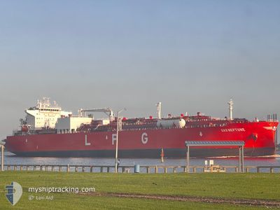
GAS NEPTUNE
Tanker
Current Trip
| Time Travelled | 2 days |
|---|---|
| Remaining Time | 1 day |
| Distance Travelled | 518.73 nm |
| Remaining Distance | 813.12 nm |
| AVG Speed | 14.1 Knots |
| MAX Speed | 17.4 Knots |
| AVG Wind | 14.6 knots |
| MAX Wind | 25.2 knots |
| MIN Temp | 11.5°C / 52.7°F |
| MAX Temp | 18.1°C / 64.58°F |
| Draught | 11.8 m |
| Position Received | 15 d ago |
Current Position
| Longitude | --- |
|---|---|
| Latitude | --- |
| Status | Under way using engine |
| Speed | 11.7 Knots |
| Course | 81.9° |
| Area | Singapore Strait |
| Station | T-AIS |
| Position Received | 15 d ago |
Info
Information
The current position of GAS NEPTUNE is in Singapore Strait with coordinates 1.25765° / 104.16617° as reported on 2025-11-26 21:58 by AIS to our vessel tracker app. The vessel's current speed is 11.7 Knots and is heading at the port of YANGPU. The estimated time of arrival as calculated by MyShipTracking vessel tracking app is 2025-12-14 14:50 LT
The vessel GAS NEPTUNE (IMO: 9944065, MMSI: 477895100) is a Tanker It's sailing under the flag of [HK] Hong Kong.
In this page you can find informations about the vessels current position, last detected port calls, and current voyage information. If the vessels is not in coverage by AIS you will find the latest position.
The current position of GAS NEPTUNE is detected by our AIS receivers and we are not responsible for the reliability of the data. The last position was recorded while the vessel was in Coverage by the Ais receivers of our vessel tracking app.
The current draught of GAS NEPTUNE as reported by AIS is 11.8 meters
Weather
| Temperature | 17.6°C / 63.68°F |
|---|---|
| Wind Speed | 24 knots |
| Direction | 34° NE |
| Pressure | 1020.9 hPa |
| Humidity | 75.8 % |
| Cloud Coverage | 100 % |
Featured Company
Most Visited Ports (Last year)
| Port | Arrivals | |
|---|---|---|
| 2 | ||
| 1 | ||
| 1 | ||
| 1 | ||
| 1 | ||
| 1 |
Events
| Time | Event | Details | Position / Dest | Info |
|---|---|---|---|---|
| 2025-12-11 03:41 | START Moving | 9.02 nm, South East of TAICANG |
31.56053 / 121.32394
CN YPG
|
Speed: 5.4 kn Course: 181° |
| 2025-12-10 10:57 | STOP Moving | 9.19 nm, South East of TAICANG |
31.56837 / 121.33635
CN YPG
|
Speed: Course: 178° |
| 2025-12-10 02:33 | START Moving | 0.79 nm, East of JIANGSU HANTONG |
32.11995 / 119.91544
CN YPG
|
Speed: 5.7 kn Course: 173° |
| 2025-12-10 02:33 | PORT DEPARTURE |
|
32.11995 / 119.91544
CN YPG
|
Speed: 2.9 kn Course: 264° |
| 2025-12-08 07:29 | STOP Moving |
32.12217 / 119.91853
[CN] TAIXING
|
Speed: 0.3 kn Course: 349° |
|
| 2025-12-08 07:29 | PORT ARRIVAL |
|
32.12217 / 119.91853
[CN] TAIXING
|
Speed: 0.6 kn Course: 344° |
| 2025-12-07 22:21 | START Moving | 9.04 nm, South East of TAICANG |
31.56795 / 121.33212
CN YPG
|
Speed: 4.3 kn Course: 305° |
| 2025-12-07 09:58 | STOP Moving | 9.35 nm, South East of TAICANG |
31.56333 / 121.33564
CN YPG
|
Speed: 0.1 kn Course: 330° |
| 2025-12-07 01:17 | START Moving |
31.16331 / 122.61639
CN YPG
|
Speed: 3.5 kn Course: 173° |
|
| 2025-12-06 12:04 | STOP Moving |
31.16349 / 122.61314
CN YPG
|
Speed: 0.3 kn Course: 42° |