
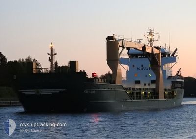
FROLAND
General Cargo
Current Trip
| Trip Time | 13 days |
|---|---|
| Trip Distance | 2892.57 nm |
| AVG Speed | 9.3 Knots |
| MAX Speed | 15 Knots |
| Draught | 8.4 m |
| AVG Wind | 16.4 knots |
| MAX Wind | 35 knots |
| MIN Temp | 6.1°C / 42.98°F |
| MAX Temp | 18.7°C / 65.66°F |
| Position Received | 6 d ago |
Current Position
| Longitude | --- |
|---|---|
| Latitude | --- |
| Status | Under way using engine |
| Speed | 11.5 Knots |
| Course | 82° |
| Area | Mediterranean Sea - Western Basin |
| Station | T-AIS |
| Position Received | 6 d ago |
Info
Information
The current position of FROLAND is in Mediterranean Sea - Western Basin with coordinates 36.98606° / 2.24473° as reported on 2025-12-07 22:53 by AIS to our vessel tracker app. The vessel's current speed is 11.5 Knots and is currently inside the port of MISURATA.
The vessel FROLAND (IMO: 9505584, MMSI: 305714000) is a General Cargo that was built in 2011 ( 14 years old ). It's sailing under the flag of [AG] Antigua Barbuda.
In this page you can find informations about the vessels current position, last detected port calls, and current voyage information. If the vessels is not in coverage by AIS you will find the latest position.
The current position of FROLAND is detected by our AIS receivers and we are not responsible for the reliability of the data. The last position was recorded while the vessel was in Coverage by the Ais receivers of our vessel tracking app.
The current draught of FROLAND as reported by AIS is 8.4 meters
Weather
| Temperature | 19.5°C / 67.1°F |
|---|---|
| Wind Speed | 6 knots |
| Direction | 97° E |
| Pressure | 1024 hPa |
| Humidity | 61.1 % |
| Cloud Coverage | 100 % |
Featured Company
Last Port Calls
| Port | Arrival | Departure | Time In Port |
|---|---|---|---|
| 2025-12-12 15:49 | |||
| 2025-11-28 20:44 | 2025-11-28 21:54 | 1 h | |
| 2025-11-20 22:09 | 2025-11-27 04:25 | 6 d | |
| 2025-11-19 13:25 | 2025-11-19 18:17 | 4 h | |
| 2025-11-16 07:00 | 2025-11-18 22:10 | 2 d | |
| 2025-10-29 15:27 | 2025-10-30 14:13 | 22 h | |
| 2025-10-26 10:16 | 2025-10-28 21:06 | 2 d | |
| 2025-10-21 07:28 | 2025-10-21 20:52 | 13 h | |
| 2025-10-05 18:01 | 2025-10-09 23:20 | 4 d | |
| 2025-10-02 16:27 |
Last Trips
| Origin | Departure | Destination | Arrival | Distance | |
|---|---|---|---|---|---|
| 2025-11-28 21:54 | 2025-12-12 15:49 | 2892.57 nm | |||
| 2025-11-27 04:25 | 2025-11-28 20:44 | 383.37 nm | |||
| 2025-11-19 18:17 | 2025-11-20 22:09 | 317.37 nm | |||
| 2025-11-18 22:10 | 2025-11-19 13:25 | 169.16 nm | |||
| 2025-10-30 14:13 | 2025-11-16 07:00 | 3782.39 nm | |||
| 2025-10-28 21:06 | 2025-10-29 15:27 | 228.26 nm | |||
| 2025-10-21 20:52 | 2025-10-26 10:16 | 673.64 nm | |||
| 2025-10-09 23:20 | 2025-10-21 07:28 | 2640.69 nm | |||
| 2025-10-02 16:27 | 2025-10-05 18:01 | 607.68 nm |
Events
| Time | Event | Details | Position / Dest | Info |
|---|---|---|---|---|
| 2025-12-12 14:13 | STOP Moving |
32.36115 / 15.21484
[LY] MISURATA
|
Speed: Course: 328° |
|
| 2025-12-12 13:49 | PORT ARRIVAL |
|
32.36442 / 15.21608
[LY] MISURATA
|
Speed: 5 kn Course: 269° |
| 2025-12-12 13:00 | START Moving | 2.75 nm, North East of MISURATA |
32.38043 / 15.28452
MISURATA
|
Speed: 3.1 kn Course: 241° |
| 2025-12-10 21:24 | STOP Moving | 2.87 nm, North East of MISURATA |
32.38024 / 15.28739
MISURATA
|
Speed: Course: 39° |
| 2025-12-07 23:01 | Status Changed | Default Under way using engine |
36.98970 / 2.27668
MISURATA
|
Speed: 11.5 kn Course: 82° |
| 2025-12-07 22:53 | OUT of Coverage |
36.98606 / 2.24473
Mediterranean Sea - Western Basin
MISURATA
|
Speed: 11.5 kn Course: 82° |
|
| 2025-12-07 22:35 | Status Changed | Under way using engine Default |
36.97727 / 2.17198
MISURATA
|
Speed: 11.5 kn Course: 80° |
| 2025-12-07 22:25 | IN Coverage |
36.97727 / 2.17198
Mediterranean Sea - Western Basin
MISURATA
|
Speed: 11.5 kn Course: 79.5° |
|
| 2025-12-07 21:37 | Status Changed | Default Under way using engine |
36.94181 / 1.94159
MISURATA
|
Speed: 11.8 kn Course: 79.7° |
| 2025-12-07 21:31 | OUT of Coverage |
36.93843 / 1.91936
Mediterranean Sea - Western Basin
MISURATA
|
Speed: 11.8 kn Course: 79.7° |