
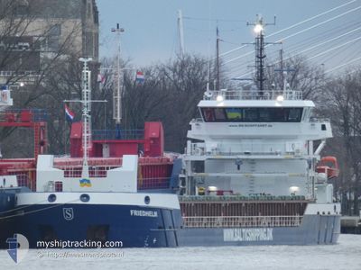
FRIEDHELM
Cargo
Current Trip
GN KMC
| Time Travelled | 11 days |
|---|---|
| Remaining Time | --- |
| Distance Travelled | 2512.50 nm |
| Remaining Distance | --- |
| AVG Speed | 9 Knots |
| MAX Speed | 10.7 Knots |
| AVG Wind | 6.6 knots |
| MAX Wind | 24 knots |
| MIN Temp | 5.5°C / 41.9°F |
| MAX Temp | 18.4°C / 65.12°F |
| Draught | 5.2 m |
| Position Received | 3 d ago |
Current Position
| Longitude | --- |
|---|---|
| Latitude | --- |
| Status | Under way using engine |
| Speed | 10 Knots |
| Course | 265.4° |
| Area | North Atlantic Ocean |
| Station | T-AIS |
| Position Received | 3 d ago |
Info
Information
The current position of FRIEDHELM is in North Atlantic Ocean with coordinates 35.95779° / -6.11538° as reported on 2025-02-28 11:24 by AIS to our vessel tracker app. The vessel's current speed is 10 Knots
The vessel FRIEDHELM (IMO: 9953951, MMSI: 255804550) is a Cargo It's sailing under the flag of [PT] Portugal.
In this page you can find informations about the vessels current position, last detected port calls, and current voyage information. If the vessels is not in coverage by AIS you will find the latest position.
The current position of FRIEDHELM is detected by our AIS receivers and we are not responsible for the reliability of the data. The last position was recorded while the vessel was in Coverage by the Ais receivers of our vessel tracking app.
The current draught of FRIEDHELM as reported by AIS is 5.2 meters
Weather
| Temperature | 18°C / 64.4°F |
|---|---|
| Wind Speed | 8 knots |
| Direction | 284° WNW |
| Pressure | 1011.2 hPa |
| Humidity | 67.6 % |
| Cloud Coverage | 2 % |
Featured Company
Last Trips
| Origin | Departure | Destination | Arrival | Distance | |
|---|---|---|---|---|---|
| 2025-02-08 14:48 | 2025-02-18 11:11 | 1138.59 nm | |||
| 2025-01-29 01:37 | 2025-02-05 13:16 | 1524.52 nm | |||
| 2025-01-22 18:00 | 2025-01-28 00:28 | 332.60 nm | |||
| 2025-01-19 08:02 | 2025-01-19 08:12 | 2.05 nm | |||
| 2024-12-13 17:24 | 2025-01-09 00:19 | 1485.50 nm |
Events
| Time | Event | Details | Position / Dest | Info |
|---|---|---|---|---|
| 2025-02-28 11:26 | Status Changed | Default Under way using engine |
35.95747 / -6.12355
GN KMC
|
Speed: 10 kn Course: 265.4° |
| 2025-02-28 11:24 | OUT of Coverage |
35.95779 / -6.11538
North Atlantic Ocean
GN KMC
|
Speed: 10 kn Course: 265.4° |
|
| 2025-02-28 11:19 | Status Changed | Under way using engine Default |
35.95864 / -6.09701
GN KMC
|
Speed: 9.9 kn Course: 266° |
| 2025-02-28 11:13 | Status Changed | Default Under way using engine |
35.95955 / -6.07959
GN KMC
|
Speed: 9.9 kn Course: 267.1° |
| 2025-02-28 10:43 | Change Sea Area | Spanish part of the North Atlantic Ocean Spanish part of the Strait of Gibraltar |
35.96257 / -5.97000
North Atlantic Ocean
GN KMC
|
Speed: 10.5 kn Course: 269.8° |
| 2025-02-28 10:00 | Status Changed | Under way using engine Default |
35.95812 / -5.82009
GN KMC
|
Speed: 10.3 kn Course: 274° |
| 2025-02-28 09:58 | Status Changed | Default Under way using engine |
35.95755 / -5.81356
GN KMC
|
Speed: 9.9 kn Course: 275.2° |
| 2025-02-28 09:52 | Status Changed | Under way using engine Default |
35.95657 / -5.79305
GN KMC
|
Speed: 10 kn Course: 274° |
| 2025-02-28 09:47 | Status Changed | Default Under way using engine |
35.95554 / -5.77570
GN KMC
|
Speed: 11 kn Course: 270.9° |
| 2025-02-28 06:26 | Change Sea Area | Spanish part of the Strait of Gibraltar Gibraltarian part of the Alboran Sea |
36.01105 / -5.33076
Strait of Gibraltar
GN KMC
|
Speed: 5.6 kn Course: 255.7° |