
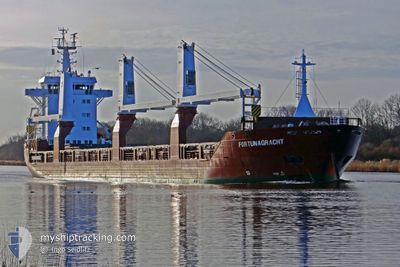
FORTUNAGRACHT
General Cargo
Current Trip
| Time Travelled | 19 h, 56 mins |
|---|---|
| Remaining Time | 4 days |
| Distance Travelled | 213.14 nm |
| Remaining Distance | 1211.12 nm |
| AVG Speed | 10 Knots |
| MAX Speed | 12.9 Knots |
| AVG Wind | 19.6 knots |
| MAX Wind | 23.2 knots |
| MIN Temp | 15.1°C / 59.18°F |
| MAX Temp | 17.2°C / 62.96°F |
| Draught | 5.8 m |
| Position Received | 17 h, 28 m ago |
Current Position
| Longitude | --- |
|---|---|
| Latitude | --- |
| Status | Under way using engine |
| Speed | 10.2 Knots |
| Course | 247.1° |
| Area | North Atlantic Ocean |
| Station | T-AIS |
| Position Received | 17 h, 28 m ago |
Info
Information
The current position of FORTUNAGRACHT is in North Atlantic Ocean with coordinates 36.43095° / -6.69970° as reported on 2026-01-03 12:46 by AIS to our vessel tracker app. The vessel's current speed is 10.2 Knots and is heading at the port of MARSAXLOKK. The estimated time of arrival as calculated by MyShipTracking vessel tracking app is 2026-01-08 08:22 LT
The vessel FORTUNAGRACHT (IMO: 9507609, MMSI: 246621000) is a General Cargo that was built in 2012 ( 14 years old ). It's sailing under the flag of [NL] Netherlands.
In this page you can find informations about the vessels current position, last detected port calls, and current voyage information. If the vessels is not in coverage by AIS you will find the latest position.
The current position of FORTUNAGRACHT is detected by our AIS receivers and we are not responsible for the reliability of the data. The last position was recorded while the vessel was in Coverage by the Ais receivers of our vessel tracking app.
The current draught of FORTUNAGRACHT as reported by AIS is 5.8 meters
Weather
| Temperature | 15.9°C / 60.62°F |
|---|---|
| Wind Speed | 12 knots |
| Direction | 1° N |
| Pressure | 998 hPa |
| Humidity | 83.2 % |
| Cloud Coverage | 25 % |
Featured Company
Last Port Calls
| Port | Arrival | Departure | Time In Port |
|---|---|---|---|
| 2026-01-02 20:15 | 2026-01-03 11:18 | 15 h | |
| 2025-12-31 07:22 | 2025-12-31 16:37 | 9 h | |
| 2025-12-26 10:11 | 2025-12-30 15:44 | 4 d | |
| 2025-12-18 12:42 | 2025-12-20 14:23 | 2 d | |
| 2025-12-08 14:47 | 2025-12-11 16:33 | 3 d | |
| 2025-11-16 10:12 | 2025-11-19 10:17 | 3 d | |
| 2025-11-14 20:50 | 2025-11-15 02:25 | 5 h |
Most Visited Ports (Last year)
| Port | Arrivals | |
|---|---|---|
| 5 | ||
| 4 | ||
| 2 | ||
| 2 | ||
| 2 | ||
| 1 |
Last Trips
| Origin | Departure | Destination | Arrival | Distance | |
|---|---|---|---|---|---|
| 2025-12-31 16:37 | 2026-01-02 20:15 | 690.47 nm | |||
| 2025-12-30 15:44 | 2025-12-31 07:22 | 6.22 nm | |||
| 2025-12-20 14:23 | 2025-12-26 10:11 | 1585.51 nm | |||
| 2025-12-11 16:33 | 2025-12-18 12:42 | 298.50 nm | |||
| 2025-11-19 10:17 | 2025-12-08 14:47 | 5659.04 nm | |||
| 2025-11-15 02:25 | 2025-11-16 10:12 | 420.96 nm | |||
| 2025-10-26 08:15 | 2025-11-14 20:50 | 5967.77 nm |
Events
| Time | Event | Details | Position / Dest | Info |
|---|---|---|---|---|
| 2026-01-03 12:54 | Status Changed | Default Under way using engine |
36.42333 / -6.72333
FREEPORT
|
Speed: 10.2 kn Course: 247.1° |
| 2026-01-03 12:46 | OUT of Coverage |
36.43095 / -6.69970
North Atlantic Ocean
FREEPORT
|
Speed: 10.2 kn Course: 247.1° |
|
| 2026-01-03 12:11 | Status Changed | Under way using engine Default |
36.46278 / -6.59425
FREEPORT
|
Speed: 9 kn Course: 249° |
| 2026-01-03 11:58 | Status Changed | Default Under way using engine |
36.47524 / -6.55454
FREEPORT
|
Speed: 10.2 kn Course: 242° |
| 2026-01-03 10:18 | PORT DEPARTURE |
|
36.53986 / -6.26771
FREEPORT
|
Speed: 8.8 kn Course: 330° |
| 2026-01-03 10:11 | START Moving |
36.52437 / -6.25969
[ES] CADIZ
|
Speed: 6.3 kn Course: 338° |
|
| 2026-01-03 10:06 | Status Changed | Under way using engine Moored |
36.52356 / -6.25746
[ES] CADIZ
|
Speed: Course: 160° |
| 2026-01-03 09:31 | Status Changed | Moored Default |
36.52357 / -6.25732
[ES] CADIZ
|
Speed: Course: 160° |
| 2026-01-03 09:28 | Status Changed | Default Moored |
36.52356 / -6.25735
[ES] CADIZ
|
Speed: Course: 160° |
| 2026-01-03 09:19 | Status Changed | Moored Default |
36.52356 / -6.25735
[ES] CADIZ
|
Speed: Course: -1° |