
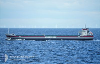
FLEVOBORG
General Cargo
Current Trip
| Trip Time | 17 days |
|---|---|
| Trip Distance | 3753.82 nm |
| AVG Speed | 10 Knots |
| MAX Speed | 14.1 Knots |
| Draught | 7.9 m |
| AVG Wind | 13.9 knots |
| MAX Wind | 30.2 knots |
| MIN Temp | 5.3°C / 41.54°F |
| MAX Temp | 27.2°C / 80.96°F |
| Position Received | 3 d ago |
Current Position
| Longitude | 35.85185° |
|---|---|
| Latitude | 36.49882° |
| Status | Under way using engine |
| Speed | 10.3 Knots |
| Course | 50.1° |
| Area | Mediterranean Sea - Eastern Basin |
| Station | T-AIS |
| Position Received | 3 d ago |
Info
Information
The current position of FLEVOBORG is in Mediterranean Sea - Eastern Basin with coordinates 36.49882° / 35.85185° as reported on 2024-05-09 07:28 by AIS to our vessel tracker app. The vessel's current speed is 10.3 Knots and is currently inside the port of ISKENDERUN.
The vessel FLEVOBORG (IMO: 9419292, MMSI: 245226000) is a General Cargo that was built in 2009 ( 15 years old ). It's sailing under the flag of [NL] Netherlands.
In this page you can find informations about the vessels current position, last detected port calls, and current voyage information. If the vessels is not in coverage by AIS you will find the latest position.
The current position of FLEVOBORG is detected by our AIS receivers and we are not responsible for the reliability of the data. The last position was recorded while the vessel was in Coverage by the Ais receivers of our vessel tracking app.
The current draught of FLEVOBORG as reported by AIS is 7.9 meters
Weather
| Temperature | 14.8°C / 58.64°F |
|---|---|
| Wind Speed | 1 knots |
| Direction | 247° WSW |
| Pressure | 1008 hPa |
| Humidity | 83.7 % |
| Cloud Coverage | 88 % |
Featured Company
Last Port Calls
| Port | Arrival | Departure | Time In Port |
|---|---|---|---|
| 2024-05-11 10:56 | |||
| 2024-04-17 11:00 | 2024-04-23 16:02 | 6 d | |
| 2024-04-17 10:16 | 2024-04-17 10:54 | 38 m | |
| 2024-04-12 23:41 | |||
| 2024-03-31 07:51 | 2024-04-02 15:05 | 2 d | |
| 2024-03-24 09:19 | 2024-03-26 14:43 | 2 d |
Most Visited Ports (Last year)
| Port | Arrivals | |
|---|---|---|
| 4 | ||
| 4 | ||
| 4 | ||
| 3 | ||
| 3 | ||
| 2 |
Last Trips
| Origin | Departure | Destination | Arrival | Distance | |
|---|---|---|---|---|---|
| 2024-04-23 16:02 | 2024-05-11 10:56 | 3753.82 nm | |||
| 2024-04-17 10:54 | 2024-04-17 11:00 | 0.39 nm | |||
| 2024-04-12 23:41 | 2024-04-17 10:16 | 870.64 nm | |||
| 2024-03-26 14:43 | 2024-03-31 07:51 | 423.70 nm |
Events
| Time | Event | Details | Position / Dest | Info |
|---|---|---|---|---|
| 2024-05-11 08:39 | STOP Moving |
36.70134 / 36.19114
[TR] ISKENDERUN
|
Speed: Course: 244° |
|
| 2024-05-11 07:56 | PORT ARRIVAL |
|
36.70243 / 36.17951
[TR] ISKENDERUN
|
Speed: 5.6 kn Course: 77° |
| 2024-05-11 07:42 | START Moving | 5.3 nm, North of ISKENDERUN |
36.69842 / 36.15828
TR ISK
|
Speed: 3.1 kn Course: 66° |
| 2024-05-09 09:44 | STOP Moving | 4.94 nm, North of ISKENDERUN |
36.69162 / 36.15358
TR ISK
|
Speed: 0.3 kn Course: 336° |
| 2024-05-09 07:34 | Status Changed | Default Under way using engine |
36.51075 / 35.86941
TR ISK
|
Speed: 10.3 kn Course: 50.1° |
| 2024-05-09 07:28 | OUT of Coverage |
36.49882 / 35.85185
Mediterranean Sea - Eastern Basin
TR ISK
|
Speed: 10.3 kn Course: 50.1° |
|
| 2024-05-09 04:28 | IN Coverage |
36.30679 / 35.30452
Mediterranean Sea - Eastern Basin
TR ISK
|
Speed: 9.8 kn Course: 75° |
|
| 2024-05-09 02:43 | OUT of Coverage |
36.20394 / 34.97860
Mediterranean Sea - Eastern Basin
TR ISK
|
Speed: 9.3 kn Course: 66.6° |
|
| 2024-05-09 02:35 | Change Sea Area | Turkish part of the Mediterranean Sea - Eastern Basin Cypriote part of the Mediterranean Sea - Eastern Basin |
36.19479 / 34.95518
Mediterranean Sea - Eastern Basin
TR ISK
|
Speed: 9.4 kn Course: 64.1° |
| 2024-05-09 02:35 | IN Coverage |
36.19479 / 34.95518
Mediterranean Sea - Eastern Basin
TR ISK
|
Speed: 9.4 kn Course: 64.1° |