
FINNTIDE
Ro-Ro Cargo
Current Trip
| Time Travelled | 23 h, 20 mins |
|---|---|
| Remaining Time | 9 h, 14 mins |
| Distance Travelled | 438.42 nm |
| Remaining Distance | 186.56 nm |
| AVG Speed | 18.7 Knots |
| MAX Speed | 19.7 Knots |
| AVG Wind | 7.1 knots |
| MAX Wind | 20.1 knots |
| MIN Temp | 2°C / 35.6°F |
| MAX Temp | 6.1°C / 42.98°F |
| Draught | 7.1 m |
| Position Received | 1 m ago |
Current Position
| Longitude | 15.06917° |
|---|---|
| Latitude | 55.58063° |
| Status | Under way using engine |
| Speed | 19.7 Knots |
| Course | 238.3° |
| Area | Baltic Sea |
| Station | T-AIS |
| Position Received | 1 m ago |
Info
Information
The current position of FINNTIDE is in Baltic Sea with coordinates 55.58063° / 15.06917° as reported on 2024-04-26 17:19 by AIS to our vessel tracker app. The vessel's current speed is 19.7 Knots and is heading at the port of TRAVEMUNDE. The estimated time of arrival as calculated by MyShipTracking vessel tracking app is 2024-04-27 02:34 LT
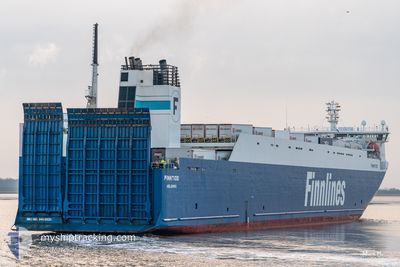
The vessel FINNTIDE (IMO: 9468920, MMSI: 230631000) is a Ro-Ro Cargo that was built in 2012 ( 12 years old ). It's sailing under the flag of [FI] Finland.
In this page you can find informations about the vessels current position, last detected port calls, and current voyage information. If the vessels is not in coverage by AIS you will find the latest position.
The current position of FINNTIDE is detected by our AIS receivers and we are not responsible for the reliability of the data. The last position was recorded while the vessel was in Coverage by the Ais receivers of our vessel tracking app.
The current draught of FINNTIDE as reported by AIS is 7.1 meters
Weather
| Temperature | 6°C / 42.8°F |
|---|---|
| Wind Speed | 21 knots |
| Direction | 115° ESE |
| Pressure | 1007.4 hPa |
| Humidity | 85.1 % |
| Cloud Coverage | 85 % |
Featured Company
Last Port Calls
| Port | Arrival | Departure | Time In Port |
|---|---|---|---|
| 2024-04-25 03:33 | 2024-04-25 18:00 | 14 h | |
| 2024-04-23 03:32 | 2024-04-23 13:44 | 10 h | |
| 2024-04-22 07:00 | 2024-04-22 17:39 | 10 h | |
| 2024-04-21 08:50 | 2024-04-21 22:50 | 13 h | |
| 2024-04-19 03:45 | 2024-04-19 17:48 | 14 h | |
| 2024-04-17 03:38 | 2024-04-17 15:55 | 12 h | |
| 2024-04-15 04:46 | 2024-04-16 16:50 | 1 d | |
| 2024-04-14 08:48 | 2024-04-14 19:25 | 10 h | |
| 2024-04-12 05:02 | 2024-04-12 19:32 | 14 h | |
| 2024-04-10 17:01 | 2024-04-10 23:31 | 6 h |
Last Trips
| Origin | Departure | Destination | Arrival | Distance | |
|---|---|---|---|---|---|
| 2024-04-23 15:44 | 2024-04-25 06:33 | 620.24 nm | |||
| 2024-04-22 19:39 | 2024-04-23 05:32 | 169.37 nm | |||
| 2024-04-22 00:50 | 2024-04-22 09:00 | 162.81 nm | |||
| 2024-04-19 20:48 | 2024-04-21 10:50 | 584.22 nm | |||
| 2024-04-17 17:55 | 2024-04-19 06:45 | 581.48 nm | |||
| 2024-04-16 18:50 | 2024-04-17 05:38 | 163.49 nm | |||
| 2024-04-14 21:25 | 2024-04-15 06:46 | 163.79 nm | |||
| 2024-04-12 22:32 | 2024-04-14 10:48 | 583.46 nm | |||
| 2024-04-11 01:31 | 2024-04-12 08:02 | 580.37 nm | |||
| 2024-04-10 16:19 | 2024-04-10 19:01 | 47.56 nm |
Events
| Time | Event | Details | Position / Dest | Info |
|---|---|---|---|---|
| 2024-04-26 16:59 | Change Sea Area | Danish part of the Kattegat Swedish part of the Baltic Sea |
55.63768 / 15.23381
Kattegat
DE TRV
|
Speed: 19.6 kn Course: 240° |
| 2024-04-26 13:20 | Status Changed | Under way using engine Default |
56.26362 / 17.00781
DE TRV
|
Speed: 19.3 kn Course: 235° |
| 2024-04-26 13:17 | Status Changed | Default Under way using engine |
56.27488 / 17.03719
DE TRV
|
Speed: 19.2 kn Course: 235.8° |
| 2024-04-26 12:59 | Change Sea Area | Swedish part of the Baltic Sea Estonian part of the Baltic Sea |
56.32890 / 17.17858
Baltic Sea
DE TRV
|
Speed: 19.1 kn Course: 235.7° |
| 2024-04-26 12:58 | Status Changed | Under way using engine Default |
56.33011 / 17.18173
DE TRV
|
Speed: 19.2 kn Course: 235° |
| 2024-04-26 12:48 | IN Coverage |
56.32890 / 17.17858
Baltic Sea
DE TRV
|
Speed: 19.1 kn Course: 235.7° |
|
| 2024-04-26 00:43 | Status Changed | Default Under way using engine |
59.24176 / 21.90935
DE TRV
|
Speed: 18.7 kn Course: 232.4° |
| 2024-04-26 00:35 | OUT of Coverage |
59.26729 / 21.97441
Baltic Sea
DE TRV
|
Speed: 18.7 kn Course: 232.4° |
|
| 2024-04-26 00:04 | Change Sea Area | Estonian part of the Baltic Sea Finnish part of the Baltic Sea |
59.36335 / 22.22459
Baltic Sea
DE TRV
|
Speed: 18.5 kn Course: 233° |
| 2024-04-25 22:28 | Change Sea Area | Finnish part of the Baltic Sea Finnish part of the Gulf of Finland |
59.57894 / 23.08229
Baltic Sea
DE TRV
|
Speed: 18.3 kn Course: 252.6° |