
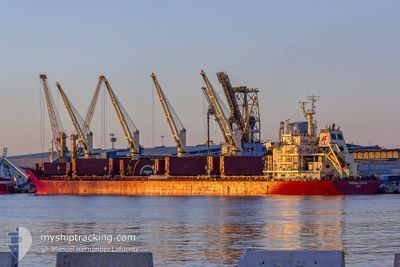
FEDERAL SUTTON
Bulk Carrier
Current Trip
| Time Travelled | 16 h, 56 mins |
|---|---|
| Remaining Time | --- |
| Distance Travelled | 104.97 nm |
| Remaining Distance | --- |
| AVG Speed | 8.8 Knots |
| MAX Speed | 12.1 Knots |
| AVG Wind | 11 knots |
| MAX Wind | 13.6 knots |
| MIN Temp | 27.8°C / 82.04°F |
| MAX Temp | 29.1°C / 84.38°F |
| Draught | 8.7 m |
| Position Received | 3 m ago |
Current Position
| Longitude | -75.06745° |
|---|---|
| Latitude | 11.28883° |
| Status | Under way using engine |
| Speed | 1.7 Knots |
| Course | 152° |
| Area | Caribbean Sea |
| Station | T-AIS |
| Position Received | 3 m ago |
Info
Information
The current position of FEDERAL SUTTON is in Caribbean Sea with coordinates 11.28883° / -75.06745° as reported on 2024-05-06 19:57 by AIS to our vessel tracker app. The vessel's current speed is 1.7 Knots
The vessel FEDERAL SUTTON (IMO: 9595917, MMSI: 538004383) is a Bulk Carrier that was built in 2012 ( 12 years old ). It's sailing under the flag of [MH] Marshall Is.
In this page you can find informations about the vessels current position, last detected port calls, and current voyage information. If the vessels is not in coverage by AIS you will find the latest position.
The current position of FEDERAL SUTTON is detected by our AIS receivers and we are not responsible for the reliability of the data. The last position was recorded while the vessel was in Coverage by the Ais receivers of our vessel tracking app.
The current draught of FEDERAL SUTTON as reported by AIS is 8.7 meters
Weather
| Temperature | 28.6°C / 83.48°F |
|---|---|
| Wind Speed | 13 knots |
| Direction | 46° NE |
| Pressure | 1007 hPa |
| Humidity | 83.3 % |
| Cloud Coverage | 100 % |
Featured Company
Most Visited Ports (Last year)
| Port | Arrivals | |
|---|---|---|
| 2 | ||
| 2 | ||
| 1 | ||
| 1 | ||
| 1 | ||
| 1 |
Last Trips
| Origin | Departure | Destination | Arrival | Distance | |
|---|---|---|---|---|---|
| 2024-04-19 18:30 | 2024-04-30 20:08 | 3136.45 nm | |||
| 2024-04-12 16:31 | 2024-04-12 20:53 | 38.81 nm | |||
| 2024-03-26 23:23 | 2024-04-09 11:24 | 3777.45 nm | |||
| 2024-03-08 18:35 | 2024-03-23 22:45 | 3064.12 nm |
Events
| Time | Event | Details | Position / Dest | Info |
|---|---|---|---|---|
| 2024-05-06 16:31 | Status Changed | Under way using engine Default |
11.29555 / -74.97015
CO BAQ
|
Speed: 1.7 kn Course: 154° |
| 2024-05-06 16:17 | Status Changed | Default Under way using engine |
11.29461 / -74.96313
CO BAQ
|
Speed: 1.6 kn Course: 147° |
| 2024-05-06 14:37 | STOP Moving | 20.19 nm, North West of BARRANQUILLA |
11.30842 / -74.93020
CO BAQ
|
Speed: 0.3 kn Course: 92° |
| 2024-05-06 13:03 | Status Changed | Under way using engine Default |
11.23249 / -74.91654
CO BAQ
|
Speed: 1 kn Course: 160° |
| 2024-05-06 12:52 | Status Changed | Default Under way using engine |
11.23357 / -74.91341
CO BAQ
|
Speed: 1 kn Course: 150° |
| 2024-05-06 12:06 | Status Changed | Under way using engine Default |
11.23973 / -74.89880
CO BAQ
|
Speed: 1.5 kn Course: 166° |
| 2024-05-06 12:02 | Status Changed | Default Under way using engine |
11.24088 / -74.89720
CO BAQ
|
Speed: 1.7 kn Course: 153° |
| 2024-05-06 11:51 | Status Changed | Under way using engine Default |
11.24335 / -74.89281
CO BAQ
|
Speed: 1.8 kn Course: 151° |
| 2024-05-06 11:49 | Status Changed | Default Under way using engine |
11.24388 / -74.89196
CO BAQ
|
Speed: 1.7 kn Course: 147° |
| 2024-05-06 11:41 | Status Changed | Under way using engine Default |
11.24624 / -74.88856
CO BAQ
|
Speed: 1.8 kn Course: 151° |