
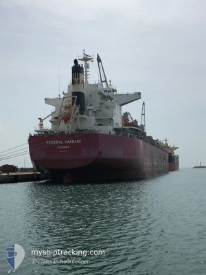
FEDERAL IMABARI
Cargo
Current Trip
| Time Travelled | --- |
|---|---|
| Remaining Time | 2 days |
| Distance Travelled | 8084.24 nm |
| Remaining Distance | 797.81 nm |
| AVG Speed | 10 Knots |
| MAX Speed | 13.8 Knots |
| AVG Wind | 13.1 knots |
| MAX Wind | 39 knots |
| MIN Temp | -2.2°C / 28.04°F |
| MAX Temp | 32°C / 89.6°F |
| Draught | 7 m |
| Position Received | 45 m ago |
Current Position
| Longitude | 115.32551° |
|---|---|
| Latitude | -7.60421° |
| Status | Under way using engine |
| Speed | 12.9 Knots |
| Course | 143.3° |
| Area | Bali Sea |
| Station | T-AIS |
| Position Received | 45 m ago |
Info
Information
The current position of FEDERAL IMABARI is in Bali Sea with coordinates -7.60421° / 115.32551° as reported on 2024-05-12 13:11 by AIS to our vessel tracker app. The vessel's current speed is 12.9 Knots and is heading at the port of DAMPIER. The estimated time of arrival as calculated by MyShipTracking vessel tracking app is 2024-05-15 02:53 LT
The vessel FEDERAL IMABARI (IMO: 9774331, MMSI: 372930000) is a Cargo It's sailing under the flag of [PA] Panama.
In this page you can find informations about the vessels current position, last detected port calls, and current voyage information. If the vessels is not in coverage by AIS you will find the latest position.
The current position of FEDERAL IMABARI is detected by our AIS receivers and we are not responsible for the reliability of the data. The last position was recorded while the vessel was in Coverage by the Ais receivers of our vessel tracking app.
The current draught of FEDERAL IMABARI as reported by AIS is 7 meters
Weather
| Temperature | 29°C / 84.2°F |
|---|---|
| Wind Speed | 8 knots |
| Direction | 88° E |
| Pressure | 1010.9 hPa |
| Humidity | 73.4 % |
| Cloud Coverage | 11 % |
Featured Company
Last Port Calls
Most Visited Ports (Last year)
| Port | Arrivals | |
|---|---|---|
| 2 | ||
| 1 | ||
| 1 | ||
| 1 | ||
| 1 |
Last Trips
| Origin | Departure | Destination | Arrival | Distance |
|---|
Events
| Time | Event | Details | Position / Dest | Info |
|---|---|---|---|---|
| 2024-05-12 13:12 | Status Changed | Default Under way using engine |
-7.60846 / 115.32869
AU DAM
|
Speed: 12.9 kn Course: 143.3° |
| 2024-05-12 13:04 | ETA Changed | 2024/05/15 02:00 2024/05/14 08:00 |
-7.58138 / 115.30838
AU DAM
|
Speed: 12.8 kn Course: 143.3° |
| 2024-05-12 12:56 | Change Sea Area | Indonesian part of the Bali Sea Malaysian part of the Singapore Strait |
-7.56241 / 115.29425
Bali Sea
AU DAM
|
Speed: 12.7 kn Course: 144.2° |
| 2024-05-12 12:56 | Status Changed | Under way using engine Default |
-7.56241 / 115.29425
AU DAM
|
Speed: 12.7 kn Course: 141° |
| 2024-05-12 12:42 | IN Coverage |
-7.56241 / 115.29425
Bali Sea
AU DAM
|
Speed: 12.7 kn Course: 144.2° |
|
| 2024-05-09 14:24 | Status Changed | Default Under way using engine |
1.29882 / 104.33965
AU DAM
|
Speed: 9.9 kn Course: 59.1° |
| 2024-05-09 14:20 | OUT of Coverage |
1.29107 / 104.33014
Singapore Strait
AU DAM
|
Speed: 9.9 kn Course: 59.1° |
|
| 2024-05-09 13:01 | Change Sea Area | Malaysian part of the Singapore Strait Indonesian part of the Singapore Strait |
1.26420 / 104.12310
Singapore Strait
AU DAM
|
Speed: 9.6 kn Course: 94° |
| 2024-05-09 12:16 | Change Sea Area | Indonesian part of the Singapore Strait Singaporean part of the Singapore Strait |
1.26632 / 104.03603
Singapore Strait
AU DAM
|
Speed: 4.2 kn Course: 152.4° |
| 2024-05-09 11:54 | START Moving | 1.61 nm, South of TANAH MERAH |
1.28657 / 104.02602
AU DAM
|
Speed: 3.1 kn Course: 123° |