
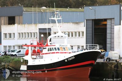
F/V.LAURA
Fishing
Current Trip
F/V.LAURA is out of coverage. Learn how you can join the community and extend the coverage to your area by clicking here!
LOCTUDY
Unknown Port
ETA*
2024-10-19 07:51 UTC
| Time Travelled | --- |
|---|---|
| Remaining Time | --- |
| Distance Travelled | 1536.54 nm |
| Remaining Distance | --- |
| AVG Speed | 4.8 Knots |
| MAX Speed | 9.7 Knots |
| AVG Wind | 25.6 knots |
| MAX Wind | 39.1 knots |
| MIN Temp | 9.1°C / 48.38°F |
| MAX Temp | 14.7°C / 58.46°F |
| Draught | 0 m |
| Position Received | 8 h, 7 m ago |
Current Position
| Longitude | -4.56325° |
|---|---|
| Latitude | 47.87756° |
| Status | Engaged in Fishing |
| Speed | 9.8 Knots |
| Course | 134.1° |
| Area | Celtic Sea |
| Station | T-AIS |
| Position Received | 8 h, 7 m ago |
Info
info
Information
The current position of F/V.LAURA is in Celtic Sea with coordinates 47.87756° / -4.56325° as reported on 2024-05-12 06:17 by AIS to our vessel tracker app. The vessel's current speed is 9.8 Knots
The vessel F/V.LAURA (MMSI: 227411000) is a Fishing It's sailing under the flag of [FR] France.
In this page you can find informations about the vessels current position, last detected port calls, and current voyage information. If the vessels is not in coverage by AIS you will find the latest position.
The current position of F/V.LAURA is detected by our AIS receivers and we are not responsible for the reliability of the data. The last position was recorded while the vessel was in Coverage by the Ais receivers of our vessel tracking app.
Weather
| Temperature | 14°C / 57.2°F |
|---|---|
| Wind Speed | 8 knots |
| Direction | 312° NW |
| Pressure | 1013.2 hPa |
| Humidity | 91.8 % |
| Cloud Coverage | 92 % |
Featured Company
Limited time offer - Install a base station receiver to your area and list your company on MyShipTracking Free forever!
Last Port Calls
Most Visited Ports (Last year)
| Port | Arrivals | |
|---|---|---|
| 1 |
Last Trips
| Origin | Departure | Destination | Arrival | Distance |
|---|
Events
| Time | Event | Details | Position / Dest | Info |
|---|---|---|---|---|
| 2024-05-12 06:17 | OUT of Coverage |
47.87756 / -4.56325
Celtic Sea
|
Speed: 9.8 kn Course: 134.1° |
|
| 2024-05-11 21:19 | Change Sea Area | French part of the Celtic Sea United Kingdom part of the Celtic Sea |
48.92614 / -5.99844
Celtic Sea
|
Speed: 10 kn Course: 144.7° |
| 2024-05-11 21:19 | IN Coverage |
48.92614 / -5.99844
Celtic Sea
|
Speed: 10 kn Course: 144.7° |
|
| 2024-05-11 17:13 | OUT of Coverage |
49.48679 / -6.53385
Celtic Sea
|
Speed: 9 kn Course: 149.1° |
|
| 2024-05-11 16:04 | Destination Changed | LOCTUDY FISHING |
49.62957 / -6.67560
LOCTUDY
|
Speed: 8.7 kn Course: 145.4° |
| 2024-05-11 15:16 | IN Coverage |
49.72666 / -6.77145
Celtic Sea
|
Speed: 8.6 kn Course: 148.2° |
|
| 2024-05-10 21:06 | OUT of Coverage |
50.62214 / -7.66937
Celtic Sea
|
Speed: 3 kn Course: 93.3° |
|
| 2024-05-10 20:34 | Change Sea Area | United Kingdom part of the Celtic Sea Irish part of the Celtic Sea |
50.62610 / -7.71181
Celtic Sea
|
Speed: 3.1 kn Course: 91.1° |
| 2024-05-10 20:14 | IN Coverage |
50.62957 / -7.74383
Celtic Sea
|
Speed: 3.6 kn Course: 114.7° |
|
| 2024-05-10 15:47 | OUT of Coverage |
50.75744 / -7.67334
Celtic Sea
|
Speed: 3.4 kn Course: 101.5° |