
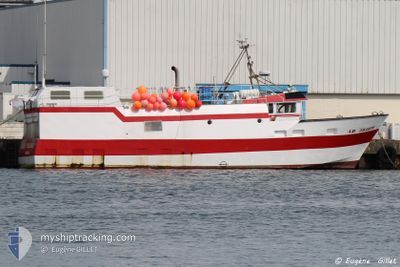
F/V L'ARCHE D'ALLIAN
Fishing
Current Trip
| Time Travelled | 30 days |
|---|---|
| Remaining Time | --- |
| Distance Travelled | 538.96 nm |
| Remaining Distance | --- |
| AVG Speed | 10.8 Knots |
| MAX Speed | 13.5 Knots |
| AVG Wind | 12 knots |
| MAX Wind | 24.9 knots |
| MIN Temp | 6°C / 42.8°F |
| MAX Temp | 14.5°C / 58.1°F |
| Draught | 0 m |
| Position Received | 9 h, 51 m ago |
Current Position
| Longitude | -4.63372° |
|---|---|
| Latitude | 47.98868° |
| Status | Engaged in Fishing |
| Speed | 11.9 Knots |
| Course | 79° |
| Area | Celtic Sea |
| Station | T-AIS |
| Position Received | 9 h, 51 m ago |
Info
Information
The current position of F/V L'ARCHE D'ALLIAN is in Celtic Sea with coordinates 47.98868° / -4.63372° as reported on 2024-05-12 08:34 by AIS to our vessel tracker app. The vessel's current speed is 11.9 Knots
The vessel F/V L'ARCHE D'ALLIAN (MMSI: 227311000) is a Fishing It's sailing under the flag of [FR] France.
In this page you can find informations about the vessels current position, last detected port calls, and current voyage information. If the vessels is not in coverage by AIS you will find the latest position.
The current position of F/V L'ARCHE D'ALLIAN is detected by our AIS receivers and we are not responsible for the reliability of the data. The last position was recorded while the vessel was in Coverage by the Ais receivers of our vessel tracking app.
Weather
| Temperature | 14.2°C / 57.56°F |
|---|---|
| Wind Speed | 10 knots |
| Direction | 294° WNW |
| Pressure | 1014 hPa |
| Humidity | 85.9 % |
| Cloud Coverage | 39 % |
Featured Company
Most Visited Ports (Last year)
| Port | Arrivals |
|---|
Last Trips
| Origin | Departure | Destination | Arrival | Distance |
|---|
Events
| Time | Event | Details | Position / Dest | Info |
|---|---|---|---|---|
| 2024-05-12 08:34 | OUT of Coverage |
47.98868 / -4.63372
Celtic Sea
|
Speed: 11.9 kn Course: 79° |
|
| 2024-05-12 06:31 | IN Coverage |
47.88845 / -5.14803
Celtic Sea
|
Speed: 10.5 kn Course: 2° |
|
| 2024-05-12 05:28 | OUT of Coverage |
47.95122 / -5.12782
Celtic Sea
|
Speed: 10.1 kn Course: 266° |
|
| 2024-05-12 03:17 | IN Coverage |
47.99498 / -4.56420
Celtic Sea
|
Speed: 11 kn Course: 256° |
|
| 2024-05-10 04:42 | OUT of Coverage |
48.01902 / -4.53298
Celtic Sea
|
Speed: Course: 135° |
|
| 2024-05-10 02:58 | IN Coverage |
48.01900 / -4.53300
Celtic Sea
|
Speed: Course: 135° |
|
| 2024-05-03 11:03 | OUT of Coverage |
47.98173 / -4.63710
Celtic Sea
|
Speed: 10.7 kn Course: 74° |
|
| 2024-05-03 10:05 | IN Coverage |
47.94412 / -4.88172
Celtic Sea
|
Speed: 10 kn Course: 77° |
|
| 2024-05-03 02:58 | OUT of Coverage |
47.96830 / -4.89935
Celtic Sea
|
Speed: 10.9 kn Course: 262° |
|
| 2024-05-03 01:41 | IN Coverage |
47.99303 / -4.57280
Celtic Sea
|
Speed: 10.9 kn Course: 259° |