
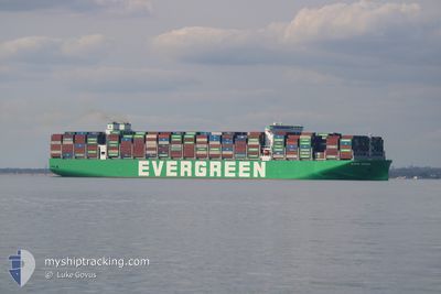
EVER MEGA
Cargo D
Current Trip
| Time Travelled | 20 h, 27 mins |
|---|---|
| Remaining Time | --- |
| Distance Travelled | 280.57 nm |
| Remaining Distance | 906.20 nm |
| AVG Speed | 14 Knots |
| MAX Speed | 15.9 Knots |
| AVG Wind | 6.3 knots |
| MAX Wind | 11 knots |
| MIN Temp | 12.6°C / 54.68°F |
| MAX Temp | 19.8°C / 67.64°F |
| Draught | 11.5 m |
| Position Received | 13 d ago |
Current Position
| Longitude | --- |
|---|---|
| Latitude | --- |
| Status | Under way using engine |
| Speed | 18.1 Knots |
| Course | 10.3° |
| Area | Eastern China Sea |
| Station | T-AIS |
| Position Received | 13 d ago |
Info
Information
The current position of EVER MEGA is in Eastern China Sea with coordinates 25.06176° / 122.30412° as reported on 2025-11-23 05:51 by AIS to our vessel tracker app. The vessel's current speed is 18.1 Knots and is heading at the port of TIANJIN.
The vessel EVER MEGA (IMO: 9935260, MMSI: 563229400) is a Cargo D It's sailing under the flag of [SG] Singapore.
In this page you can find informations about the vessels current position, last detected port calls, and current voyage information. If the vessels is not in coverage by AIS you will find the latest position.
The current position of EVER MEGA is detected by our AIS receivers and we are not responsible for the reliability of the data. The last position was recorded while the vessel was in Coverage by the Ais receivers of our vessel tracking app.
The current draught of EVER MEGA as reported by AIS is 11.5 meters
Weather
| Temperature | 20.1°C / 68.18°F |
|---|---|
| Wind Speed | 11 knots |
| Direction | 74° ENE |
| Pressure | 1021.8 hPa |
| Humidity | 59.1 % |
| Cloud Coverage | 77 % |
Featured Company
Last Port Calls
| Port | Arrival | Departure | Time In Port |
|---|---|---|---|
| 2025-12-05 01:06 | 2025-12-06 02:17 | 1 d | |
| 2025-11-26 06:29 | 2025-11-27 16:29 | 1 d | |
| 2025-11-16 19:16 | 2025-11-17 17:56 | 22 h | |
| 2025-10-15 02:32 | 2025-10-18 19:17 | 3 d | |
| 2025-10-06 14:51 | 2025-10-08 05:44 | 1 d | |
| 2025-10-02 08:59 |
Last Trips
| Origin | Departure | Destination | Arrival | Distance | |
|---|---|---|---|---|---|
| 2025-11-28 00:29 | 2025-12-05 09:06 | 987.55 nm | |||
| 2025-11-18 01:56 | 2025-11-26 14:29 | 3205.96 nm | |||
| 2025-10-18 21:17 | 2025-11-17 03:16 | 11735.46 nm | |||
| 2025-10-08 07:44 | 2025-10-15 04:32 | 338.83 nm | |||
| 2025-10-02 10:59 | 2025-10-06 16:51 | 591.52 nm |
Events
| Time | Event | Details | Position / Dest | Info |
|---|---|---|---|---|
| 2025-12-06 02:21 | START Moving | 3.98 nm, West of YANGSHAN |
30.61924 / 122.05886
MY PKG>CN TXG
|
Speed: 5.1 kn Course: 139° |
| 2025-12-06 02:17 | PORT DEPARTURE |
|
30.62268 / 122.05580
MY PKG>CN TXG
|
Speed: 0.6 kn Course: 134° |
| 2025-12-05 01:06 | PORT ARRIVAL |
|
30.62579 / 122.05610
[CN] YANGSHAN
|
Speed: 7.6 kn Course: 303° |
| 2025-12-04 22:17 | START Moving | 16.91 nm, South of SHENGSI |
30.47445 / 122.53315
MY PKG>CN TXG
|
Speed: 5 kn Course: 339° |
| 2025-12-04 08:37 | STOP Moving | 17.14 nm, South of SHENGSI |
30.47210 / 122.53837
MY PKG>CN TXG
|
Speed: 0.2 kn Course: 330° |
| 2025-12-03 23:01 | START Moving | 13.47 nm, South East of NINGBO |
29.78046 / 122.02365
MY PKG>CN TXG
|
Speed: 3.1 kn Course: 79° |
| 2025-12-02 17:21 | STOP Moving | 13.38 nm, South East of NINGBO |
29.77975 / 122.02021
MY PKG>CN TXG
|
Speed: 0.3 kn Course: 30° |
| 2025-12-02 10:49 | START Moving |
29.78615 / 122.97907
MY PKG>CN TXG
|
Speed: 4.4 kn Course: 307° |
|
| 2025-11-30 00:48 | STOP Moving |
29.78333 / 122.97833
MY PKG>CN TXG
|
Speed: Course: -1° |
|
| 2025-11-27 16:29 | PORT DEPARTURE |
|
38.95465 / 117.89071
MY PKG>CN TXG
|
Speed: 12.1 kn Course: 103° |