
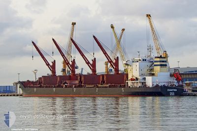
EVANTHIA
Bulk Carrier
Current Trip
BHAVNAGAR
| Time Travelled | 2 days |
|---|---|
| Remaining Time | --- |
| Distance Travelled | 438.57 nm |
| Remaining Distance | --- |
| AVG Speed | 9.2 Knots |
| MAX Speed | 13 Knots |
| AVG Wind | 5.5 knots |
| MAX Wind | 10.7 knots |
| MIN Temp | 23.3°C / 73.94°F |
| MAX Temp | 25.4°C / 77.72°F |
| Draught | 12 m |
| Position Received | 1 d ago |
Current Position
| Longitude | --- |
|---|---|
| Latitude | --- |
| Status | Under way using engine |
| Speed | 12.1 Knots |
| Course | 107.4° |
| Area | Gulf of Oman |
| Station | T-AIS |
| Position Received | 1 d ago |
Info
Information
The current position of EVANTHIA is in Gulf of Oman with coordinates 25.09738° / 56.98155° as reported on 2025-12-12 04:46 by AIS to our vessel tracker app. The vessel's current speed is 12.1 Knots
The vessel EVANTHIA (IMO: 9308106, MMSI: 352027000) is a Bulk Carrier that was built in 2005 ( 20 years old ). It's sailing under the flag of [PA] Panama.
In this page you can find informations about the vessels current position, last detected port calls, and current voyage information. If the vessels is not in coverage by AIS you will find the latest position.
The current position of EVANTHIA is detected by our AIS receivers and we are not responsible for the reliability of the data. The last position was recorded while the vessel was in Coverage by the Ais receivers of our vessel tracking app.
The current draught of EVANTHIA as reported by AIS is 12 meters
Weather
| Temperature | 23.3°C / 73.94°F |
|---|---|
| Wind Speed | 4 knots |
| Direction | 234° SW |
| Pressure | 1017 hPa |
| Humidity | 49.2 % |
| Cloud Coverage | --- |
Featured Company
Last Trips
| Origin | Departure | Destination | Arrival | Distance |
|---|
Events
| Time | Event | Details | Position / Dest | Info |
|---|---|---|---|---|
| 2025-12-12 05:15 | Status Changed | Default Under way using engine |
25.06667 / 57.08167
BHAVNAGAR
|
Speed: 12.1 kn Course: 107.4° |
| 2025-12-12 04:46 | Status Changed | Under way using engine Default |
25.09738 / 56.98155
BHAVNAGAR
|
Speed: 12 kn Course: 107° |
| 2025-12-12 04:46 | OUT of Coverage |
25.09738 / 56.98155
Gulf of Oman
BHAVNAGAR
|
Speed: 12.1 kn Course: 107.4° |
|
| 2025-12-12 04:39 | Status Changed | Default Under way using engine |
25.10333 / 56.95667
BHAVNAGAR
|
Speed: 12 kn Course: 107.6° |
| 2025-12-12 01:21 | START Moving | 8.24 nm, South East of KHORFAKKAN |
25.25605 / 56.46390
BHAVNAGAR
|
Speed: 3.1 kn Course: 114° |
| 2025-12-12 01:14 | ETA Changed | 2025/12/15 13:00 2025/12/15 15:00 |
25.25818 / 56.46073
BHAVNAGAR
|
Speed: 0.6 kn Course: 129° |
| 2025-12-12 01:12 | ETA Changed | 2025/12/15 15:00 2025/12/11 16:00 |
25.25829 / 56.46034
BHAVNAGAR
|
Speed: 0.6 kn Course: 123° |
| 2025-12-12 01:08 | Destination Changed | BHAVNAGAR FUJAIRAH |
25.25863 / 56.45964
BHAVNAGAR
|
Speed: 0.5 kn Course: 126° |
| 2025-12-12 01:06 | Status Changed | Under way using engine At anchor |
25.25874 / 56.45952
FUJAIRAH
|
Speed: 0.2 kn Course: 134° |
| 2025-12-11 17:50 | STOP Moving | 7.99 nm, South East of KHORFAKKAN |
25.25839 / 56.46008
FUJAIRAH
|
Speed: 0.3 kn Course: 118° |