
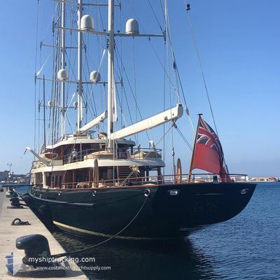
EOS
Sailing Vessel
Current Trip
QALITM WEST PALM
| Time Travelled | --- |
|---|---|
| Remaining Time | --- |
| Distance Travelled | 658.51 nm |
| Remaining Distance | --- |
| AVG Speed | 10.2 Knots |
| MAX Speed | 15 Knots |
| AVG Wind | 12.4 knots |
| MAX Wind | 19 knots |
| MIN Temp | 22.5°C / 72.5°F |
| MAX Temp | 32°C / 89.6°F |
| Draught | 0 m |
| Position Received | 2 m ago |
Current Position
| Longitude | --- |
|---|---|
| Latitude | --- |
| Status | At anchor |
| Speed | |
| Course | 41° |
| Area | South Pacific Ocean |
| Station | T-AIS |
| Position Received | 2 m ago |
Info
Information
The current position of EOS is in South Pacific Ocean with coordinates -17.73946° / 177.38620° as reported on 2026-01-05 13:50 by AIS to our vessel tracker app. The vessel's current speed is 0 Knots
The vessel EOS (IMO: 9377456, MMSI: 319087000) is a Sailing Vessel that was built in 2006 ( 20 years old ). It's sailing under the flag of [KY] Cayman Is.
In this page you can find informations about the vessels current position, last detected port calls, and current voyage information. If the vessels is not in coverage by AIS you will find the latest position.
The current position of EOS is detected by our AIS receivers and we are not responsible for the reliability of the data. The last position was recorded while the vessel was in Coverage by the Ais receivers of our vessel tracking app.
Weather
| Temperature | 23.1°C / 73.58°F |
|---|---|
| Wind Speed | 3 knots |
| Direction | 57° ENE |
| Pressure | 1008.4 hPa |
| Humidity | 95.3 % |
| Cloud Coverage | 49 % |
Featured Company
Last Port Calls
Last Trips
| Origin | Departure | Destination | Arrival | Distance |
|---|
Events
| Time | Event | Details | Position / Dest | Info |
|---|---|---|---|---|
| 2026-01-05 05:53 | IN Coverage |
-17.73963 / 177.38649
South Pacific Ocean
|
Speed: 0.1 kn Course: 21° |
|
| 2026-01-05 00:50 | OUT of Coverage |
-17.73938 / 177.38636
South Pacific Ocean
|
Speed: 0.1 kn Course: 27° |
|
| 2026-01-05 00:14 | IN Coverage |
-17.73939 / 177.38643
South Pacific Ocean
|
Speed: 0.1 kn Course: 19° |
|
| 2026-01-04 22:47 | OUT of Coverage |
-17.73930 / 177.38636
South Pacific Ocean
|
Speed: Course: 21° |
|
| 2026-01-03 08:11 | STOP Moving | 1.97 nm, North of DENARAU |
-17.73806 / 177.38633
QALITM WEST PALM
|
Speed: 0.3 kn Course: 151° |
| 2026-01-03 08:06 | Status Changed | At anchor Under way using engine |
-17.73887 / 177.38685
QALITM WEST PALM
|
Speed: 1.2 kn Course: 155° |
| 2026-01-03 06:27 | START Moving | 3.27 nm, South East of MANA ISLAND |
-17.72672 / 177.12949
QALITM WEST PALM
|
Speed: 6.3 kn Course: 273.1° |
| 2026-01-03 06:09 | Status Changed | Under way using engine At anchor |
-17.72781 / 177.13005
QALITM WEST PALM
|
Speed: 0.1 kn Course: 90° |
| 2026-01-03 00:59 | Draught Changed | 0 5.5 |
-17.72700 / 177.13087
QALITM WEST PALM
|
Speed: 0.2 kn Course: 166° |
| 2026-01-03 00:59 | Destination Changed | QALITM WEST PALM MALOLLT |
-17.72700 / 177.13087
QALITM WEST PALM
|
Speed: 0.2 kn Course: 166° |