
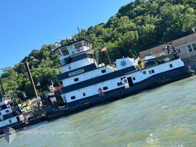
ENTERPRISE
Towing
Current Trip
USCVG>USCIR>USCVG
| Time Travelled | 13 days |
|---|---|
| Remaining Time | --- |
| Distance Travelled | 80.93 nm |
| Remaining Distance | --- |
| AVG Speed | 5.6 Knots |
| MAX Speed | 10.5 Knots |
| AVG Wind | 9.3 knots |
| MAX Wind | 19.3 knots |
| MIN Temp | -2.2°C / 28.04°F |
| MAX Temp | 23.3°C / 73.94°F |
| Draught | 3 m |
| Position Received | 23 d ago |
Current Position
| Longitude | --- |
|---|---|
| Latitude | --- |
| Status | Under way using engine |
| Speed | |
| Course | --- |
| Area | --- |
| Station | T-AIS |
| Position Received | 23 d ago |
Info
Information
The current position of ENTERPRISE is in --- with coordinates 37.21352° / -88.88142° as reported on 2025-02-18 06:58 by AIS to our vessel tracker app. The vessel's current speed is 0 Knots
The vessel ENTERPRISE (IMO: 101249518, MMSI: 367615260) is a Towing It's sailing under the flag of [US] USA.
In this page you can find informations about the vessels current position, last detected port calls, and current voyage information. If the vessels is not in coverage by AIS you will find the latest position.
The current position of ENTERPRISE is detected by our AIS receivers and we are not responsible for the reliability of the data. The last position was recorded while the vessel was in Coverage by the Ais receivers of our vessel tracking app.
The current draught of ENTERPRISE as reported by AIS is 3 meters
Weather
| Temperature | 15.1°C / 59.18°F |
|---|---|
| Wind Speed | 6 knots |
| Direction | 158° SSE |
| Pressure | 1008.7 hPa |
| Humidity | 81.5 % |
| Cloud Coverage | --- |
Featured Company
Last Port Calls
| Port | Arrival | Departure | Time In Port |
|---|---|---|---|
| 2025-02-28 07:27 | 2025-02-28 10:07 | 2 h | |
| 2025-02-23 11:23 | 2025-02-23 13:59 | 2 h |
Most Visited Ports (Last year)
| Port | Arrivals | |
|---|---|---|
| 5 | ||
| 3 | ||
| 2 | ||
| 1 | ||
| 1 |
Last Trips
| Origin | Departure | Destination | Arrival | Distance | |
|---|---|---|---|---|---|
| 2025-02-23 13:59 | 2025-02-28 07:27 | 46.25 nm |
Events
| Time | Event | Details | Position / Dest | Info |
|---|---|---|---|---|
| 2025-03-13 20:48 | STOP Moving | 8.15 nm, North West of METROPOLIS |
37.21312 / -88.88111
USCVG>USCIR>USCVG
|
Speed: Course: -1° |
| 2025-03-13 20:32 | START Moving | 6.84 nm, North West of METROPOLIS |
37.20375 / -88.85605
USCVG>USCIR>USCVG
|
Speed: 9.9 kn Course: 293° |
| 2025-03-13 19:24 | STOP Moving | 6.3 nm, North West of METROPOLIS |
37.20092 / -88.84508
USCVG>USCIR>USCVG
|
Speed: Course: -1° |
| 2025-03-13 18:56 | START Moving | 8.02 nm, North West of METROPOLIS |
37.21171 / -88.87895
USCVG>USCIR>USCVG
|
Speed: 4.6 kn Course: -1° |
| 2025-03-12 23:28 | STOP Moving | 8.16 nm, North West of METROPOLIS |
37.21316 / -88.88123
USCVG>USCIR>USCVG
|
Speed: Course: -1° |
| 2025-03-12 23:07 | START Moving | 6.84 nm, North West of METROPOLIS |
37.20349 / -88.85635
USCVG>USCIR>USCVG
|
Speed: 7.9 kn Course: 290° |
| 2025-03-12 22:59 | STOP Moving | 6.31 nm, North West of METROPOLIS |
37.20094 / -88.84518
USCVG>USCIR>USCVG
|
Speed: 0.1 kn Course: -1° |
| 2025-03-12 22:50 | START Moving | 6.72 nm, North West of METROPOLIS |
37.20313 / -88.85358
USCVG>USCIR>USCVG
|
Speed: 3.9 kn Course: -1° |
| 2025-03-12 20:24 | STOP Moving | 6.83 nm, North West of METROPOLIS |
37.20423 / -88.85552
USCVG>USCIR>USCVG
|
Speed: 0.1 kn Course: -1° |
| 2025-03-12 20:08 | START Moving | 7.81 nm, North West of METROPOLIS |
37.21043 / -88.87478
USCVG>USCIR>USCVG
|
Speed: 5 kn Course: 111° |