
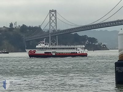
ENHYDRA
Passenger
Current Trip
| Time Travelled | 1 day |
|---|---|
| Remaining Time | 38 mins |
| Distance Travelled | 60.98 nm |
| Remaining Distance | --- |
| AVG Speed | 9.1 Knots |
| MAX Speed | 15.5 Knots |
| AVG Wind | 11 knots |
| MAX Wind | 12.1 knots |
| MIN Temp | 13.4°C / 56.12°F |
| MAX Temp | 17.4°C / 63.32°F |
| Draught | 2 m |
| Position Received | 1 m ago |
Current Position
| Longitude | -122.47079° |
|---|---|
| Latitude | 37.82427° |
| Status | Under way using engine |
| Speed | 13.3 Knots |
| Course | 77.8° |
| Area | North Pacific Ocean |
| Station | T-AIS |
| Position Received | 1 m ago |
Info
Information
The current position of ENHYDRA is in North Pacific Ocean with coordinates 37.82427° / -122.47079° as reported on 2024-05-12 23:15 by AIS to our vessel tracker app. The vessel's current speed is 13.3 Knots and is heading at the port of SAN FRANCISCO. The estimated time of arrival as calculated by MyShipTracking vessel tracking app is 2024-05-12 16:54 LT
The vessel ENHYDRA (MMSI: 368052630) is a Passenger It's sailing under the flag of [US] USA.
In this page you can find informations about the vessels current position, last detected port calls, and current voyage information. If the vessels is not in coverage by AIS you will find the latest position.
The current position of ENHYDRA is detected by our AIS receivers and we are not responsible for the reliability of the data. The last position was recorded while the vessel was in Coverage by the Ais receivers of our vessel tracking app.
The current draught of ENHYDRA as reported by AIS is 2 meters
Weather
| Temperature | 13.4°C / 56.12°F |
|---|---|
| Wind Speed | 12 knots |
| Direction | 253° WSW |
| Pressure | 1014 hPa |
| Humidity | 79.8 % |
| Cloud Coverage | 63 % |
Featured Company
Last Port Calls
| Port | Arrival | Departure | Time In Port |
|---|---|---|---|
| 2024-05-11 13:00 | 2024-05-11 13:02 | 1 m | |
| 2024-05-05 20:52 | 2024-05-05 20:53 | 1 m | |
| 2024-05-05 17:02 | 2024-05-05 17:04 | 2 m | |
| 2024-05-04 16:57 | 2024-05-04 17:06 | 8 m | |
| 2024-05-03 16:54 | 2024-05-03 17:05 | 11 m | |
| 2024-04-28 20:50 | 2024-04-28 20:52 | 1 m | |
| 2024-04-27 20:45 | 2024-04-27 20:53 | 8 m | |
| 2024-04-27 17:01 | 2024-04-27 17:04 | 2 m | |
| 2024-04-26 20:51 | 2024-04-26 20:54 | 3 m | |
| 2024-04-26 16:56 | 2024-04-26 17:04 | 7 m |
Most Visited Ports (Last year)
| Port | Arrivals | |
|---|---|---|
| 294 | ||
| 4 |
Last Trips
| Origin | Departure | Destination | Arrival | Distance | |
|---|---|---|---|---|---|
| 2024-05-05 20:53 | 2024-05-11 13:00 | 28.70 nm | |||
| 2024-05-05 17:04 | 2024-05-05 20:52 | 24.82 nm | |||
| 2024-05-04 17:06 | 2024-05-05 17:02 | 59.58 nm | |||
| 2024-05-03 17:05 | 2024-05-04 16:57 | 49.95 nm | |||
| 2024-04-28 20:52 | 2024-05-03 16:54 | 43.53 nm | |||
| 2024-04-27 20:53 | 2024-04-28 20:50 | 61.07 nm | |||
| 2024-04-27 17:04 | 2024-04-27 20:45 | 23.13 nm | |||
| 2024-04-26 20:54 | 2024-04-27 17:01 | 36.73 nm | |||
| 2024-04-26 17:04 | 2024-04-26 20:51 | 22.49 nm | |||
| 2024-04-23 20:51 | 2024-04-26 16:56 | 35.79 nm |
Events
| Time | Event | Details | Position / Dest | Info |
|---|---|---|---|---|
| 2024-05-12 22:51 | START Moving | 2.42 nm, West of TREASURE ISLAND |
37.81124 / -122.41635
USSEA>USSFO43.5
|
Speed: 10.4 kn Course: 322.7° |
| 2024-05-12 22:16 | STOP Moving | 2.38 nm, West of TREASURE ISLAND |
37.80936 / -122.41519
USSEA>USSFO43.5
|
Speed: 0.2 kn Course: 132° |
| 2024-05-12 21:23 | START Moving | 2.41 nm, West of TREASURE ISLAND |
37.81124 / -122.41616
USSEA>USSFO43.5
|
Speed: 9 kn Course: 315.3° |
| 2024-05-12 20:59 | STOP Moving | 2.38 nm, West of TREASURE ISLAND |
37.80936 / -122.41520
USSEA>USSFO43.5
|
Speed: 0.3 kn Course: 131° |
| 2024-05-12 20:06 | START Moving | 2.42 nm, West of TREASURE ISLAND |
37.81108 / -122.41623
USSEA>USSFO43.5
|
Speed: 9.3 kn Course: 322.2° |
| 2024-05-12 19:02 | STOP Moving | 2.38 nm, West of TREASURE ISLAND |
37.80935 / -122.41520
USSEA>USSFO43.5
|
Speed: 0.3 kn Course: 132° |
| 2024-05-12 18:08 | START Moving | 2.42 nm, West of TREASURE ISLAND |
37.81092 / -122.41632
USSEA>USSFO43.5
|
Speed: 6.1 kn Course: 325.9° |
| 2024-05-12 17:43 | IN Coverage |
37.80935 / -122.41519
North Pacific Ocean
|
Speed: Course: 216° |
|
| 2024-05-12 02:36 | OUT of Coverage |
37.80933 / -122.41520
North Pacific Ocean
|
Speed: Course: 187.1° |
|
| 2024-05-12 02:28 | STOP Moving | 2.39 nm, West of TREASURE ISLAND |
37.80943 / -122.41530
USSEA>USSFO43.5
|
Speed: 0.2 kn Course: 127° |