
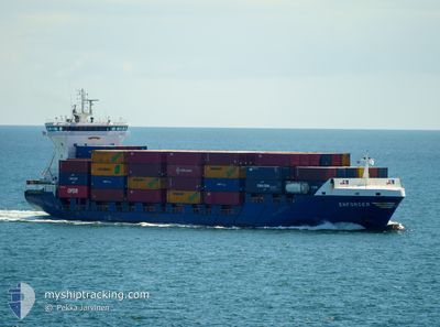
ENFORCER
Container Ship
Current Trip
| Time Travelled | 8 h, 2 mins |
|---|---|
| Remaining Time | 2 h, 47 mins |
| Distance Travelled | 109.33 nm |
| Remaining Distance | 43.09 nm |
| AVG Speed | 13.3 Knots |
| MAX Speed | 15.8 Knots |
| AVG Wind | 18.4 knots |
| MAX Wind | 24 knots |
| MIN Temp | 9°C / 48.2°F |
| MAX Temp | 11.2°C / 52.16°F |
| Draught | 5.9 m |
| Position Received | 1 m ago |
Current Position
| Longitude | --- |
|---|---|
| Latitude | --- |
| Status | Under way using engine |
| Speed | 14.5 Knots |
| Course | 74.1° |
| Area | North Sea |
| Station | T-AIS |
| Position Received | 1 m ago |
Info
Information
The current position of ENFORCER is in North Sea with coordinates 51.85941° / 3.06478° as reported on 2025-12-14 20:22 by AIS to our vessel tracker app. The vessel's current speed is 14.5 Knots and is heading at the port of ROTTERDAM. The estimated time of arrival as calculated by MyShipTracking vessel tracking app is 2025-12-15 00:10 LT
The vessel ENFORCER (IMO: 9255737, MMSI: 244597000) is a Container Ship that was built in 2004 ( 21 years old ). It's sailing under the flag of [NL] Netherlands.
In this page you can find informations about the vessels current position, last detected port calls, and current voyage information. If the vessels is not in coverage by AIS you will find the latest position.
The current position of ENFORCER is detected by our AIS receivers and we are not responsible for the reliability of the data. The last position was recorded while the vessel was in Coverage by the Ais receivers of our vessel tracking app.
The current draught of ENFORCER as reported by AIS is 5.9 meters
Weather
| Temperature | 9°C / 48.2°F |
|---|---|
| Wind Speed | 23 knots |
| Direction | 199° SSW |
| Pressure | 1016.6 hPa |
| Humidity | 87.9 % |
| Cloud Coverage | 44 % |
Featured Company
Last Port Calls
| Port | Arrival | Departure | Time In Port |
|---|---|---|---|
| 2025-12-13 16:55 | 2025-12-14 12:21 | 19 h | |
| 2025-12-09 01:51 | 2025-12-10 21:03 | 1 d | |
| 2025-12-04 16:05 | 2025-12-06 22:22 | 2 d | |
| 2025-12-02 17:14 | 2025-12-03 12:22 | 19 h | |
| 2025-12-01 22:20 | 2025-12-02 06:27 | 8 h | |
| 2025-11-28 19:57 | 2025-11-30 00:59 | 1 d | |
| 2025-11-26 11:12 | 2025-11-27 01:49 | 14 h | |
| 2025-11-22 04:45 | 2025-11-23 03:25 | 22 h | |
| 2025-11-20 18:36 | 2025-11-21 17:19 | 22 h | |
| 2025-11-16 21:19 | 2025-11-17 12:34 | 15 h |
Most Visited Ports (Last year)
| Port | Arrivals | |
|---|---|---|
| 13 | ||
| 11 | ||
| 11 | ||
| 11 | ||
| 8 | ||
| 8 |
Last Trips
| Origin | Departure | Destination | Arrival | Distance | |
|---|---|---|---|---|---|
| 2025-12-10 21:03 | 2025-12-13 16:55 | 735.57 nm | |||
| 2025-12-06 22:22 | 2025-12-09 01:51 | 613.29 nm | |||
| 2025-12-03 12:22 | 2025-12-04 16:05 | 286.09 nm | |||
| 2025-12-02 06:27 | 2025-12-02 17:14 | 118.05 nm | |||
| 2025-11-30 00:59 | 2025-12-01 22:20 | 630.40 nm | |||
| 2025-11-27 01:49 | 2025-11-28 19:57 | 628.98 nm | |||
| 2025-11-23 03:25 | 2025-11-26 11:12 | 535.82 nm | |||
| 2025-11-21 17:19 | 2025-11-22 04:45 | 140.26 nm | |||
| 2025-11-17 12:34 | 2025-11-20 18:36 | 684.32 nm | |||
| 2025-11-16 05:47 | 2025-11-16 21:19 | 200.16 nm |
Events
| Time | Event | Details | Position / Dest | Info |
|---|---|---|---|---|
| 2025-12-14 19:22 | Change Sea Area | Dutch part of the North Sea Belgian part of the North Sea |
51.79365 / 2.67940
North Sea
ROTTERDAM
|
Speed: 15.2 kn Course: 78.5° |
| 2025-12-14 18:56 | Change Sea Area | Belgian part of the North Sea United Kingdom part of the North Sea |
51.82255 / 2.52452
North Sea
ROTTERDAM
|
Speed: 14.2 kn Course: 115.9° |
| 2025-12-14 17:51 | Status Changed | Under way using engine Default |
51.71476 / 2.18151
ROTTERDAM
|
Speed: 14.4 kn Course: 52° |
| 2025-12-14 17:50 | Status Changed | Default Under way using engine |
51.71230 / 2.17643
ROTTERDAM
|
Speed: 14.5 kn Course: 52° |
| 2025-12-14 17:41 | Status Changed | Under way using engine Default |
51.69142 / 2.13297
ROTTERDAM
|
Speed: 14.3 kn Course: 52° |
| 2025-12-14 17:22 | Status Changed | Default Under way using engine |
51.64424 / 2.03470
ROTTERDAM
|
Speed: 14.2 kn Course: 52.3° |
| 2025-12-14 15:52 | ETA Changed | 2025/12/14 22:30 2025/12/14 23:30 |
51.48510 / 1.54082
ROTTERDAM
|
Speed: 14.1 kn Course: 70.9° |
| 2025-12-14 12:21 | PORT DEPARTURE |
|
51.44900 / .34507
ROTTERDAM
|
Speed: 8.3 kn Course: 99° |
| 2025-12-14 12:16 | START Moving |
51.45622 / .33384
[GB] TILBURY
|
Speed: 5 kn Course: 172° |
|
| 2025-12-14 10:04 | Status Changed | Under way using engine Moored |
51.45832 / .33381
[GB] TILBURY
|
Speed: Course: 163° |