
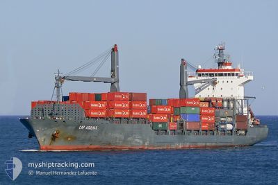
EM HYDRA
Container Ship
Current Trip
| Time Travelled | 5 days |
|---|---|
| Remaining Time | 3 h, 53 mins |
| Distance Travelled | 1307.94 nm |
| Remaining Distance | 34.32 nm |
| AVG Speed | 11.1 Knots |
| MAX Speed | 16.3 Knots |
| AVG Wind | 15.3 knots |
| MAX Wind | 25 knots |
| MIN Temp | 18.2°C / 64.76°F |
| MAX Temp | 22.3°C / 72.14°F |
| Draught | 8.4 m |
| Position Received | 2 h, 9 m ago |
Current Position
| Longitude | -6.25081° |
|---|---|
| Latitude | 35.82173° |
| Status | Under way using engine |
| Speed | 2.2 Knots |
| Course | 205° |
| Area | North Atlantic Ocean |
| Station | T-AIS |
| Position Received | 2 h, 9 m ago |
Info
Information
The current position of EM HYDRA is in North Atlantic Ocean with coordinates 35.82173° / -6.25081° as reported on 2024-05-13 15:24 by AIS to our vessel tracker app. The vessel's current speed is 2.2 Knots and is heading at the port of TANGER MED. The estimated time of arrival as calculated by MyShipTracking vessel tracking app is 2024-05-13 22:27 LT
The vessel EM HYDRA (IMO: 9338967, MMSI: 636014956) is a Container Ship that was built in 2005 ( 19 years old ). It's sailing under the flag of [LR] Liberia.
In this page you can find informations about the vessels current position, last detected port calls, and current voyage information. If the vessels is not in coverage by AIS you will find the latest position.
The current position of EM HYDRA is detected by our AIS receivers and we are not responsible for the reliability of the data. The last position was recorded while the vessel was in Coverage by the Ais receivers of our vessel tracking app.
The current draught of EM HYDRA as reported by AIS is 8.4 meters
Weather
| Temperature | 19°C / 66.2°F |
|---|---|
| Wind Speed | 6 knots |
| Direction | 277° W |
| Pressure | 1013 hPa |
| Humidity | 71.4 % |
| Cloud Coverage | 100 % |
Featured Company
Last Port Calls
| Port | Arrival | Departure | Time In Port |
|---|---|---|---|
| 2024-05-06 18:34 | 2024-05-08 16:18 | 1 d | |
| 2024-05-02 04:14 | 2024-05-03 11:15 | 1 d | |
| 2024-04-21 21:13 | 2024-04-27 20:21 | 5 d | |
| 2024-04-16 06:59 | 2024-04-17 22:02 | 1 d | |
| 2024-04-04 06:35 | 2024-04-05 12:15 | 1 d | |
| 2024-03-30 20:03 | 2024-03-31 17:23 | 20 h | |
| 2024-03-19 14:39 | 2024-03-19 19:45 | 5 h | |
| 2024-03-12 13:53 | |||
| 2024-03-10 17:29 | 2024-03-11 11:16 | 17 h |
Most Visited Ports (Last year)
| Port | Arrivals | |
|---|---|---|
| 6 | ||
| 5 | ||
| 5 | ||
| 4 | ||
| 4 | ||
| 2 |
Last Trips
| Origin | Departure | Destination | Arrival | Distance | |
|---|---|---|---|---|---|
| 2024-05-03 11:15 | 2024-05-06 18:34 | 690.91 nm | |||
| 2024-04-27 20:21 | 2024-05-02 04:14 | 1028.12 nm | |||
| 2024-04-17 22:02 | 2024-04-21 21:13 | 340.05 nm | |||
| 2024-04-05 12:15 | 2024-04-16 06:59 | 1401.67 nm | |||
| 2024-03-31 17:23 | 2024-04-04 06:35 | 205.78 nm | |||
| 2024-03-19 19:45 | 2024-03-30 20:03 | 1396.86 nm | |||
| 2024-03-11 11:16 | 2024-03-12 13:53 | 17.36 nm | |||
| 2024-02-28 19:32 | 2024-03-10 17:29 | 1724.23 nm |
Events
| Time | Event | Details | Position / Dest | Info |
|---|---|---|---|---|
| 2024-05-13 16:38 | START Moving |
35.80651 / -6.24768
MAPTM
|
Speed: 6.6 kn Course: 3° |
|
| 2024-05-13 15:38 | Status Changed | Default Under way using engine |
35.81833 / -6.24833
MAPTM
|
Speed: 2.2 kn Course: 205° |
| 2024-05-13 15:24 | Status Changed | Under way using engine Default |
35.82173 / -6.25081
MAPTM
|
Speed: 1.1 kn Course: 207° |
| 2024-05-13 15:24 | OUT of Coverage |
35.82173 / -6.25081
North Atlantic Ocean
MAPTM
|
Speed: 2.2 kn Course: 135° |
|
| 2024-05-13 15:12 | IN Coverage |
35.82173 / -6.25081
North Atlantic Ocean
MAPTM
|
Speed: 2.2 kn Course: 135° |
|
| 2024-05-13 14:44 | STOP Moving |
35.82834 / -6.25333
MAPTM
|
Speed: Course: -1° |
|
| 2024-05-13 14:06 | START Moving | 19.67 nm, West of TANGIER |
35.80576 / -6.19846
MAPTM
|
Speed: 3.7 kn Course: 290° |
| 2024-05-13 11:53 | STOP Moving | 21.21 nm, West of TANGIER |
35.82500 / -6.22833
MAPTM
|
Speed: Course: -1° |
| 2024-05-13 05:05 | Status Changed | Default Under way using engine |
35.29021 / -6.87021
MAPTM
|
Speed: 12 kn Course: 52.7° |
| 2024-05-13 05:03 | OUT of Coverage |
35.28732 / -6.87522
North Atlantic Ocean
MAPTM
|
Speed: 12 kn Course: 52.7° |