
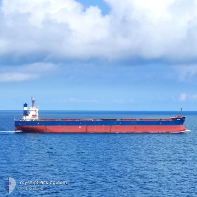
ELLINA
Bulk Carrier
Current Trip
| Time Travelled | 5 days |
|---|---|
| Remaining Time | --- |
| Distance Travelled | 1324.78 nm |
| Remaining Distance | --- |
| AVG Speed | 11.3 Knots |
| MAX Speed | 12.3 Knots |
| AVG Wind | 11.8 knots |
| MAX Wind | 29 knots |
| MIN Temp | 18.8°C / 65.84°F |
| MAX Temp | 28.6°C / 83.48°F |
| Draught | 13.1 m |
| Position Received | 4 d ago |
Current Position
| Longitude | --- |
|---|---|
| Latitude | --- |
| Status | Under way using engine |
| Speed | 11.6 Knots |
| Course | 131.7° |
| Area | Gulf of Oman |
| Station | T-AIS |
| Position Received | 4 d ago |
Info
Information
The current position of ELLINA is in Gulf of Oman with coordinates 25.40805° / 57.02628° as reported on 2025-02-28 07:23 by AIS to our vessel tracker app. The vessel's current speed is 11.6 Knots and is heading at the port of KARAIKAL. The estimated time of arrival as calculated by MyShipTracking vessel tracking app is 2025-03-08 18:00 LT
The vessel ELLINA (IMO: 9398668, MMSI: 249469000) is a Bulk Carrier that was built in 2008 ( 17 years old ). It's sailing under the flag of [MT] Malta.
In this page you can find informations about the vessels current position, last detected port calls, and current voyage information. If the vessels is not in coverage by AIS you will find the latest position.
The current position of ELLINA is detected by our AIS receivers and we are not responsible for the reliability of the data. The last position was recorded while the vessel was in Coverage by the Ais receivers of our vessel tracking app.
The current draught of ELLINA as reported by AIS is 13.1 meters
Weather
| Temperature | 28.5°C / 83.3°F |
|---|---|
| Wind Speed | 6 knots |
| Direction | 314° NW |
| Pressure | 1010.1 hPa |
| Humidity | 75.5 % |
| Cloud Coverage | 100 % |
Featured Company
Last Port Calls
| Port | Arrival | Departure | Time In Port |
|---|---|---|---|
| 2025-02-25 09:52 | 2025-02-28 00:30 | 2 d | |
| 2025-02-10 12:21 | 2025-02-20 08:45 | 9 d |
Last Trips
| Origin | Departure | Destination | Arrival | Distance | |
|---|---|---|---|---|---|
| 2025-02-20 08:45 | 2025-02-25 09:52 | 788.18 nm | |||
| 2024-12-19 23:16 | 2025-02-10 12:21 | 10035.09 nm |
Events
| Time | Event | Details | Position / Dest | Info |
|---|---|---|---|---|
| 2025-02-28 07:27 | Status Changed | Default Under way using engine |
25.39865 / 57.03763
IN KRK
|
Speed: 11.6 kn Course: 131.7° |
| 2025-02-28 07:23 | Status Changed | Under way using engine Default |
25.40805 / 57.02628
IN KRK
|
Speed: 11.5 kn Course: 132° |
| 2025-02-28 07:23 | OUT of Coverage |
25.40805 / 57.02628
Gulf of Oman
IN KRK
|
Speed: 11.6 kn Course: 131.7° |
|
| 2025-02-28 06:55 | Status Changed | Default Under way using engine |
25.46673 / 56.95298
IN KRK
|
Speed: 11.5 kn Course: 157.2° |
| 2025-02-28 05:22 | Change Sea Area | Iranian part of the Gulf of Oman Omani part of the Gulf of Oman |
25.74834 / 56.85488
Gulf of Oman
IN KRK
|
Speed: 11.2 kn Course: 162.9° |
| 2025-02-28 04:31 | ETA Changed | 2025/03/08 12:30 2025/03/08 17:30 |
25.89530 / 56.79898
IN KRK
|
Speed: 10.4 kn Course: 157.7° |
| 2025-02-28 04:29 | Change Sea Area | Omani part of the Gulf of Oman Omani part of the Persian Gulf |
25.89980 / 56.79696
Gulf of Oman
IN KRK
|
Speed: 10.4 kn Course: 158.5° |
| 2025-02-28 04:27 | Status Changed | Under way using engine Default |
25.90576 / 56.79438
IN KRK
|
Speed: 10.5 kn Course: 160° |
| 2025-02-28 04:12 | IN Coverage |
25.89980 / 56.79696
Gulf of Oman
IN KRK
|
Speed: 10.4 kn Course: 158.5° |
|
| 2025-02-27 21:17 | OUT of Coverage |
26.11164 / 56.05091
Persian Gulf
IN KRK
|
Speed: 11 kn Course: 25.8° |