
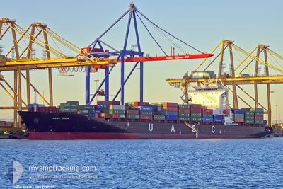
ELENI T
Container Ship
Current Trip
| Time Travelled | 21 h, 8 mins |
|---|---|
| Remaining Time | --- |
| Distance Travelled | 56.55 nm |
| Remaining Distance | 850.46 nm |
| AVG Speed | 11.6 Knots |
| MAX Speed | 15.8 Knots |
| AVG Wind | 8.5 knots |
| MAX Wind | 10 knots |
| MIN Temp | 22.8°C / 73.04°F |
| MAX Temp | 24.5°C / 76.1°F |
| Draught | 12.1 m |
| Position Received | 9 d ago |
Current Position
| Longitude | --- |
|---|---|
| Latitude | --- |
| Status | Under way using engine |
| Speed | 14.1 Knots |
| Course | 140.9° |
| Area | Gulf of Oman |
| Station | T-AIS |
| Position Received | 9 d ago |
Info
Information
The current position of ELENI T is in Gulf of Oman with coordinates 24.94017° / 57.30509° as reported on 2025-02-23 16:33 by AIS to our vessel tracker app. The vessel's current speed is 14.1 Knots and is heading at the port of SALALAH. The estimated time of arrival as calculated by MyShipTracking vessel tracking app is 2025-02-26 00:30 LT
The vessel ELENI T (IMO: 9397585, MMSI: 538007684) is a Container Ship that was built in 2009 ( 16 years old ). It's sailing under the flag of [MH] Marshall Is.
In this page you can find informations about the vessels current position, last detected port calls, and current voyage information. If the vessels is not in coverage by AIS you will find the latest position.
The current position of ELENI T is detected by our AIS receivers and we are not responsible for the reliability of the data. The last position was recorded while the vessel was in Coverage by the Ais receivers of our vessel tracking app.
The current draught of ELENI T as reported by AIS is 12.1 meters
Weather
| Temperature | 24.5°C / 76.1°F |
|---|---|
| Wind Speed | 11 knots |
| Direction | 34° NE |
| Pressure | 1017.3 hPa |
| Humidity | 48.9 % |
| Cloud Coverage | --- |
Featured Company
Last Port Calls
| Port | Arrival | Departure | Time In Port |
|---|---|---|---|
| 2025-03-03 13:55 | 2025-03-04 20:38 | 1 d | |
| 2025-02-26 01:06 | 2025-02-26 18:27 | 17 h | |
| 2025-02-22 17:10 | 2025-02-23 02:34 | 9 h | |
| 2025-02-21 14:58 | 2025-02-22 10:45 | 19 h | |
| 2025-02-20 10:53 | 2025-02-20 23:26 | 12 h | |
| 2025-02-15 09:58 | 2025-02-16 06:50 | 20 h | |
| 2025-02-10 16:14 | 2025-02-11 19:15 | 1 d | |
| 2025-02-05 01:10 | 2025-02-05 19:12 | 18 h | |
| 2025-01-30 14:31 | 2025-01-31 10:55 | 20 h | |
| 2025-01-27 14:15 | 2025-01-29 03:15 | 1 d |
Last Trips
| Origin | Departure | Destination | Arrival | Distance | |
|---|---|---|---|---|---|
| 2025-02-26 18:27 | 2025-03-03 13:55 | 973.42 nm | |||
| 2025-02-23 02:34 | 2025-02-26 01:06 | 983.13 nm | |||
| 2025-02-22 10:45 | 2025-02-22 17:10 | 42.97 nm | |||
| 2025-02-20 23:26 | 2025-02-21 14:58 | 67.60 nm | |||
| 2025-02-16 06:50 | 2025-02-20 10:53 | 1006.49 nm | |||
| 2025-02-11 19:15 | 2025-02-15 09:58 | 930.62 nm | |||
| 2025-02-05 19:12 | 2025-02-10 16:14 | 940.41 nm | |||
| 2025-01-31 10:55 | 2025-02-05 01:10 | 1632.46 nm | |||
| 2025-01-29 03:15 | 2025-01-30 14:31 | 616.12 nm | |||
| 2025-01-23 14:51 | 2025-01-27 14:15 | 723.50 nm |
Events
| Time | Event | Details | Position / Dest | Info |
|---|---|---|---|---|
| 2025-03-04 15:38 | PORT DEPARTURE |
|
24.78439 / 67.28239
OMSLL
|
Speed: 7.5 kn Course: 308° |
| 2025-03-04 15:28 | START Moving |
24.76228 / 67.32710
[PK] PORT QASIM
|
Speed: 4.2 kn Course: 249° |
|
| 2025-03-03 08:55 | STOP Moving |
24.76537 / 67.33019
[PK] PORT QASIM
|
Speed: 0.3 kn Course: 229° |
|
| 2025-03-03 08:55 | PORT ARRIVAL |
|
24.76537 / 67.33019
[PK] PORT QASIM
|
Speed: 2.2 kn Course: 307° |
| 2025-03-03 04:38 | START Moving | 13.99 nm, South of SALEHAABAD ISLAND |
24.57645 / 66.91541
OMSLL
|
Speed: 5.9 kn Course: 196° |
| 2025-03-03 02:34 | STOP Moving | 16.12 nm, South of SALEHAABAD ISLAND |
24.55290 / 66.86536
OMSLL
|
Speed: 0.2 kn Course: 272° |
| 2025-03-03 00:23 | START Moving | 1.24 nm, East of SALEHAABAD ISLAND |
24.79894 / 66.99139
OMSLL
|
Speed: 4.5 kn Course: 154° |
| 2025-03-02 08:24 | STOP Moving | 1.06 nm, East of SALEHAABAD ISLAND |
24.80070 / 66.98853
OMSLL
|
Speed: 0.2 kn Course: 333° |
| 2025-03-01 04:02 | STOP Moving |
23.11701 / 64.62565
OMSLL
|
Speed: 0.2 kn Course: 324° |
|
| 2025-02-26 14:27 | PORT DEPARTURE |
|
16.95318 / 54.03504
OMSLL
|
Speed: 6.7 kn Course: 77° |