
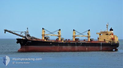
ELANORA
Bulk Carrier
Current Trip
| Time Travelled | 4 days |
|---|---|
| Remaining Time | --- |
| Distance Travelled | 1336.19 nm |
| Remaining Distance | --- |
| AVG Speed | 13.4 Knots |
| MAX Speed | 16.4 Knots |
| AVG Wind | 14.6 knots |
| MAX Wind | 28.9 knots |
| MIN Temp | 15.5°C / 59.9°F |
| MAX Temp | 23.9°C / 75.02°F |
| Draught | 6.5 m |
| Position Received | 2 d ago |
Current Position
| Longitude | 119.05768° |
|---|---|
| Latitude | -35.21392° |
| Status | Under way using engine |
| Speed | 13.5 Knots |
| Course | 80° |
| Area | Great Australian Bight |
| Station | T-AIS |
| Position Received | 2 d ago |
Info
Information
The current position of ELANORA is in Great Australian Bight with coordinates -35.21392° / 119.05768° as reported on 2024-05-11 02:00 by AIS to our vessel tracker app. The vessel's current speed is 13.5 Knots
The vessel ELANORA (IMO: 9263241, MMSI: 311000890) is a Bulk Carrier that was built in 2003 ( 21 years old ). It's sailing under the flag of [BS] Bahamas.
In this page you can find informations about the vessels current position, last detected port calls, and current voyage information. If the vessels is not in coverage by AIS you will find the latest position.
The current position of ELANORA is detected by our AIS receivers and we are not responsible for the reliability of the data. The last position was recorded while the vessel was in Coverage by the Ais receivers of our vessel tracking app.
The current draught of ELANORA as reported by AIS is 6.5 meters
Weather
| Temperature | 15.5°C / 59.9°F |
|---|---|
| Wind Speed | 9 knots |
| Direction | 109° ESE |
| Pressure | 1025.9 hPa |
| Humidity | 62.3 % |
| Cloud Coverage | 100 % |
Featured Company
Last Port Calls
| Port | Arrival | Departure | Time In Port |
|---|---|---|---|
| 2024-05-05 06:33 | 2024-05-09 08:23 | 4 d | |
| 2024-04-19 22:38 | 2024-04-22 02:10 | 2 d | |
| 2024-04-11 00:28 | 2024-04-15 10:02 | 4 d | |
| 2024-04-04 21:33 | 2024-04-06 13:43 | 1 d | |
| 2024-03-28 09:39 | 2024-03-31 22:35 | 3 d | |
| 2024-03-19 22:02 | 2024-03-25 14:34 | 5 d | |
| 2024-03-08 20:25 | 2024-03-11 01:42 | 2 d | |
| 2024-02-29 23:50 | 2024-03-04 06:05 | 3 d |
Last Trips
| Origin | Departure | Destination | Arrival | Distance | |
|---|---|---|---|---|---|
| 2024-04-22 11:40 | 2024-05-05 14:33 | 1361.87 nm | |||
| 2024-04-15 20:02 | 2024-04-20 08:08 | 1230.89 nm | |||
| 2024-04-07 00:13 | 2024-04-11 10:28 | 1284.31 nm | |||
| 2024-04-01 09:35 | 2024-04-05 08:03 | 821.44 nm | |||
| 2024-03-26 01:04 | 2024-03-28 20:39 | 792.48 nm | |||
| 2024-03-11 12:42 | 2024-03-20 08:32 | 1306.30 nm | |||
| 2024-03-04 16:35 | 2024-03-09 07:25 | 1260.16 nm | |||
| 2024-02-27 06:47 | 2024-03-01 10:20 | 794.34 nm |
Events
| Time | Event | Details | Position / Dest | Info |
|---|---|---|---|---|
| 2024-05-13 09:07 | STOP Moving | 9.86 nm, South West of THEVENARD |
-32.25555 / 133.49422
AU THE
|
Speed: Course: 134° |
| 2024-05-11 02:06 | Status Changed | Default Under way using engine |
-35.20987 / 119.08493
AU THE
|
Speed: 13.5 kn Course: 80° |
| 2024-05-11 02:00 | OUT of Coverage |
-35.21392 / 119.05768
Great Australian Bight
AU THE
|
Speed: 13.5 kn Course: 80° |
|
| 2024-05-11 01:00 | Status Changed | Under way using engine Default |
-35.25138 / 118.78035
AU THE
|
Speed: 14.3 kn Course: 79° |
| 2024-05-11 00:55 | Status Changed | Default Under way using engine |
-35.25540 / 118.75412
AU THE
|
Speed: 14.4 kn Course: 79° |
| 2024-05-10 23:14 | Change Sea Area | Australian part of the Great Australian Bight Australian part of the Indian Ocean |
-35.32440 / 118.24522
Great Australian Bight
AU THE
|
Speed: 14.4 kn Course: 80° |
| 2024-05-10 17:47 | Status Changed | Under way using engine Default |
-35.54100 / 116.66728
AU THE
|
Speed: 15.1 kn Course: 79° |
| 2024-05-10 17:43 | IN Coverage |
-35.54100 / 116.66728
Indian Ocean
AU THE
|
Speed: 15.3 kn Course: 80° |
|
| 2024-05-09 10:35 | Status Changed | Default Under way using engine |
-29.12895 / 114.50678
AU THE
|
Speed: 13.8 kn Course: 177° |
| 2024-05-09 10:30 | OUT of Coverage |
-29.10900 / 114.50607
Indian Ocean
AU THE
|
Speed: 13.8 kn Course: 177° |