
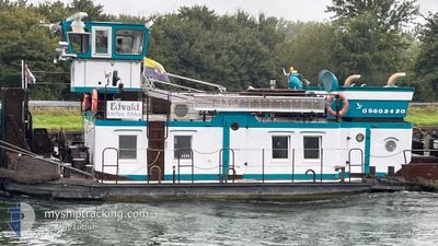
EDWALD
Wing in ground
Current Trip
KWH
| Time Travelled | 7 days |
|---|---|
| Remaining Time | --- |
| Distance Travelled | 65.73 nm |
| Remaining Distance | --- |
| AVG Speed | 5.3 Knots |
| MAX Speed | 7.3 Knots |
| AVG Wind | 5.8 knots |
| MAX Wind | 9 knots |
| MIN Temp | 0.1°C / 32.18°F |
| MAX Temp | 9.7°C / 49.46°F |
| Draught | 2.2 m |
| Position Received | Now |
Current Position
| Longitude | --- |
|---|---|
| Latitude | --- |
| Status | Under way using engine |
| Speed | |
| Course | --- |
| Area | --- |
| Station | T-AIS |
| Position Received | Now |
Info
Information
The current position of EDWALD is in --- with coordinates 52.30776° / 13.64305° as reported on 2025-12-21 04:55 by AIS to our vessel tracker app. The vessel's current speed is 0 Knots
The vessel EDWALD (MMSI: 211522420) is a Wing in ground It's sailing under the flag of [DE] Germany.
In this page you can find informations about the vessels current position, last detected port calls, and current voyage information. If the vessels is not in coverage by AIS you will find the latest position.
The current position of EDWALD is detected by our AIS receivers and we are not responsible for the reliability of the data. The last position was recorded while the vessel was in Coverage by the Ais receivers of our vessel tracking app.
The current draught of EDWALD as reported by AIS is 2.2 meters
Weather
| Temperature | 6.1°C / 42.98°F |
|---|---|
| Wind Speed | 6 knots |
| Direction | 95° E |
| Pressure | 1017.8 hPa |
| Humidity | 93.5 % |
| Cloud Coverage | 98 % |
Featured Company
Last Port Calls
| Port | Arrival | Departure | Time In Port |
|---|---|---|---|
| 2025-12-13 10:27 | 2025-12-13 10:53 | 25 m | |
| 2025-11-18 17:22 | 2025-11-21 13:50 | 2 d | |
| 2025-11-08 07:56 | 2025-11-08 08:44 | 47 m | |
| 2025-11-03 14:20 | 2025-11-03 14:41 | 20 m | |
| 2025-11-02 16:20 | 2025-11-02 17:07 | 47 m | |
| 2025-10-31 13:19 | 2025-10-31 13:58 | 38 m | |
| 2025-10-02 12:10 | 2025-10-02 12:36 | 26 m |
Last Trips
| Origin | Departure | Destination | Arrival | Distance | |
|---|---|---|---|---|---|
| 2025-11-21 13:50 | 2025-12-13 10:27 | 404.00 nm | |||
| 2025-11-08 08:44 | 2025-11-18 17:22 | 321.77 nm | |||
| 2025-11-03 14:41 | 2025-11-08 07:56 | 63.59 nm | |||
| 2025-11-02 17:07 | 2025-11-03 14:20 | 5.74 nm | |||
| 2025-10-31 13:58 | 2025-11-02 16:20 | 17.78 nm | |||
| 2025-10-02 12:36 | 2025-10-31 13:19 | 483.05 nm | |||
| 2025-09-05 10:41 | 2025-10-02 12:10 | 480.45 nm |
Events
| Time | Event | Details | Position / Dest | Info |
|---|---|---|---|---|
| 2025-12-19 16:06 | STOP Moving | 15.31 nm, South East of BERLIN |
52.30775 / 13.64308
KWH
|
Speed: Course: 511° |
| 2025-12-19 13:56 | START Moving | 6.96 nm, South East of BERLIN |
52.42627 / 13.52308
KWH
|
Speed: 4.2 kn Course: 95.7° |
| 2025-12-17 15:36 | STOP Moving | 6.82 nm, South East of BERLIN |
52.42648 / 13.51708
KWH
|
Speed: 0.2 kn Course: 511° |
| 2025-12-17 15:31 | START Moving | 6.69 nm, South East of BERLIN |
52.42717 / 13.51275
KWH
|
Speed: 3.8 kn Course: 107.3° |
| 2025-12-17 15:21 | STOP Moving | 6.57 nm, South East of BERLIN |
52.42810 / 13.50911
KWH
|
Speed: 0.2 kn Course: 511° |
| 2025-12-17 13:01 | START Moving | 15.33 nm, South East of BERLIN |
52.30761 / 13.64331
KWH
|
Speed: 4 kn Course: 21.6° |
| 2025-12-16 12:47 | STOP Moving | 15.38 nm, South East of BERLIN |
52.30580 / 13.64137
KWH
|
Speed: 0.3 kn Course: 511° |
| 2025-12-16 10:32 | START Moving | 6.82 nm, South East of BERLIN |
52.42659 / 13.51720
KWH
|
Speed: 4 kn Course: 93.2° |
| 2025-12-15 16:00 | STOP Moving | 6.74 nm, South East of BERLIN |
52.42670 / 13.51425
KWH
|
Speed: 0.2 kn Course: 511° |
| 2025-12-15 15:55 | START Moving | 6.61 nm, South East of BERLIN |
52.42770 / 13.51038
KWH
|
Speed: 3.3 kn Course: 113.1° |