
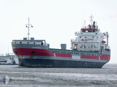
EDENBORG
General Cargo
Current Trip
| Time Travelled | 18 h, 33 mins |
|---|---|
| Remaining Time | 1 day |
| Distance Travelled | 205.82 nm |
| Remaining Distance | 526.98 nm |
| AVG Speed | 10.5 Knots |
| MAX Speed | 12.8 Knots |
| AVG Wind | 16.9 knots |
| MAX Wind | 28 knots |
| MIN Temp | 7.3°C / 45.14°F |
| MAX Temp | 8.4°C / 47.12°F |
| Draught | 5.1 m |
| Position Received | 8 h, 12 m ago |
Current Position
| Longitude | --- |
|---|---|
| Latitude | --- |
| Status | Under way using engine |
| Speed | 11.3 Knots |
| Course | 63.4° |
| Area | Kattegat |
| Station | T-AIS |
| Position Received | 8 h, 12 m ago |
Info
Information
The current position of EDENBORG is in Kattegat with coordinates 55.50628° / 15.02366° as reported on 2025-12-08 05:43 by AIS to our vessel tracker app. The vessel's current speed is 11.3 Knots and is heading at the port of PIETARSAARI. The estimated time of arrival as calculated by MyShipTracking vessel tracking app is 2025-12-10 12:55 LT
The vessel EDENBORG (IMO: 9463449, MMSI: 246716000) is a General Cargo that was built in 2010 ( 15 years old ). It's sailing under the flag of [NL] Netherlands.
In this page you can find informations about the vessels current position, last detected port calls, and current voyage information. If the vessels is not in coverage by AIS you will find the latest position.
The current position of EDENBORG is detected by our AIS receivers and we are not responsible for the reliability of the data. The last position was recorded while the vessel was in Coverage by the Ais receivers of our vessel tracking app.
The current draught of EDENBORG as reported by AIS is 5.1 meters
Weather
| Temperature | 7.8°C / 46.04°F |
|---|---|
| Wind Speed | 26 knots |
| Direction | 223° SW |
| Pressure | 1004.3 hPa |
| Humidity | 87.1 % |
| Cloud Coverage | 100 % |
Featured Company
Last Port Calls
| Port | Arrival | Departure | Time In Port |
|---|---|---|---|
| 2025-12-05 17:11 | 2025-12-07 20:23 | 2 d | |
| 2025-11-25 07:05 | 2025-11-29 15:37 | 4 d | |
| 2025-11-13 20:18 | 2025-11-16 22:45 | 3 d | |
| 2025-11-04 14:12 | 2025-11-07 06:59 | 2 d | |
| 2025-11-03 02:04 | 2025-11-03 04:19 | 2 h | |
| 2025-10-28 11:51 | 2025-10-29 21:44 | 1 d |
Most Visited Ports (Last year)
| Port | Arrivals | |
|---|---|---|
| 3 | ||
| 3 | ||
| 2 | ||
| 2 | ||
| 2 | ||
| 1 |
Last Trips
| Origin | Departure | Destination | Arrival | Distance | |
|---|---|---|---|---|---|
| 2025-11-29 15:37 | 2025-12-05 17:11 | 899.96 nm | |||
| 2025-11-16 22:45 | 2025-11-25 07:05 | 1885.71 nm | |||
| 2025-11-07 06:59 | 2025-11-13 20:18 | 782.45 nm | |||
| 2025-11-03 04:19 | 2025-11-04 14:12 | 307.43 nm | |||
| 2025-10-29 21:44 | 2025-11-03 02:04 | 952.45 nm | |||
| 2025-09-30 01:48 | 2025-10-28 11:51 | 4776.73 nm |
Events
| Time | Event | Details | Position / Dest | Info |
|---|---|---|---|---|
| 2025-12-08 05:49 | Status Changed | Default Under way using engine |
55.51469 / 15.05426
FIPRS
|
Speed: 11.3 kn Course: 63.4° |
| 2025-12-08 05:43 | OUT of Coverage |
55.50628 / 15.02366
Kattegat
FIPRS
|
Speed: 11.3 kn Course: 63.4° |
|
| 2025-12-08 05:41 | Status Changed | Under way using engine Default |
55.50344 / 15.01381
FIPRS
|
Speed: 11.3 kn Course: 62° |
| 2025-12-08 05:37 | Status Changed | Default Under way using engine |
55.49822 / 14.99588
FIPRS
|
Speed: 11.3 kn Course: 62.4° |
| 2025-12-08 05:19 | Status Changed | Under way using engine Default |
55.47243 / 14.90803
FIPRS
|
Speed: 11.1 kn Course: 64° |
| 2025-12-08 05:17 | Status Changed | Default Under way using engine |
55.46938 / 14.89754
FIPRS
|
Speed: 11 kn Course: 62.3° |
| 2025-12-08 04:55 | Status Changed | Under way using engine Default |
55.43817 / 14.79146
FIPRS
|
Speed: 11 kn Course: 62° |
| 2025-12-08 04:05 | Status Changed | Default Under way using engine |
55.34743 / 14.57436
FIPRS
|
Speed: 11.3 kn Course: 41.2° |
| 2025-12-08 03:52 | Status Changed | Under way using engine Default |
55.31642 / 14.52718
FIPRS
|
Speed: 11.3 kn Course: 42° |
| 2025-12-08 03:49 | Status Changed | Default Under way using engine |
55.30923 / 14.51620
FIPRS
|
Speed: 11.3 kn Course: 42.5° |