
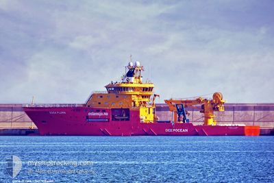
EDDA FLORA
Research/Survey Vessel
Current Trip
SURVEY LOC
| Time Travelled | 4 h, 48 mins |
|---|---|
| Remaining Time | --- |
| Distance Travelled | 39.19 nm |
| Remaining Distance | --- |
| AVG Speed | 9.3 Knots |
| MAX Speed | 11.4 Knots |
| AVG Wind | 27 knots |
| MAX Wind | 29 knots |
| MIN Temp | 13.4°C / 56.12°F |
| MAX Temp | 14.3°C / 57.74°F |
| Draught | 7.1 m |
| Position Received | 3 h, 14 m ago |
Current Position
| Longitude | --- |
|---|---|
| Latitude | --- |
| Status | Moored |
| Speed | 8.4 Knots |
| Course | 242.9° |
| Area | Mediterranean Sea - Eastern Basin |
| Station | T-AIS |
| Position Received | 3 h, 14 m ago |
Info
Information
The current position of EDDA FLORA is in Mediterranean Sea - Eastern Basin with coordinates 35.73800° / 14.53967° as reported on 2026-01-07 19:18 by AIS to our vessel tracker app. The vessel's current speed is 8.4 Knots
The vessel EDDA FLORA (IMO: 9386380, MMSI: 258245000) is a Research/Survey Vessel that was built in 2008 ( 18 years old ). It's sailing under the flag of [NO] Norway.
In this page you can find informations about the vessels current position, last detected port calls, and current voyage information. If the vessels is not in coverage by AIS you will find the latest position.
The current position of EDDA FLORA is detected by our AIS receivers and we are not responsible for the reliability of the data. The last position was recorded while the vessel was in Coverage by the Ais receivers of our vessel tracking app.
The current draught of EDDA FLORA as reported by AIS is 7.1 meters
Weather
| Temperature | 14.3°C / 57.74°F |
|---|---|
| Wind Speed | 28 knots |
| Direction | 294° WNW |
| Pressure | 1016.8 hPa |
| Humidity | 52.8 % |
| Cloud Coverage | 87 % |
Featured Company
Last Port Calls
| Port | Arrival | Departure | Time In Port |
|---|---|---|---|
| 2026-01-07 07:08 | 2026-01-07 18:45 | 11 h | |
| 2025-12-23 00:55 | 2025-12-23 15:58 | 15 h | |
| 2025-12-17 12:50 | 2025-12-18 09:14 | 20 h | |
| 2025-12-09 16:13 | 2025-12-10 13:58 | 21 h | |
| 2025-12-04 21:35 | 2025-12-04 22:44 | 1 h | |
| 2025-11-28 16:12 | 2025-11-28 21:58 | 5 h | |
| 2025-11-23 19:48 | 2025-11-28 15:14 | 4 d | |
| 2025-11-14 11:41 | 2025-11-14 17:08 | 5 h | |
| 2025-11-12 09:37 | 2025-11-12 13:28 | 3 h | |
| 2025-11-04 18:58 | 2025-11-05 00:28 | 5 h |
Last Trips
| Origin | Departure | Destination | Arrival | Distance | |
|---|---|---|---|---|---|
| 2025-12-23 15:58 | 2026-01-07 07:08 | 795.31 nm | |||
| 2025-12-18 09:14 | 2025-12-23 00:55 | 218.85 nm | |||
| 2025-12-10 13:58 | 2025-12-17 12:50 | 1689.60 nm | |||
| 2025-12-04 22:44 | 2025-12-09 16:13 | 951.12 nm | |||
| 2025-11-28 21:58 | 2025-12-04 21:35 | 574.30 nm | |||
| 2025-11-28 15:14 | 2025-11-28 16:12 | 2.97 nm | |||
| 2025-11-14 17:08 | 2025-11-23 19:48 | 612.77 nm | |||
| 2025-11-12 13:28 | 2025-11-14 11:41 | 511.40 nm | |||
| 2025-11-05 00:28 | 2025-11-12 09:37 | 583.83 nm | |||
| 2025-10-28 18:34 | 2025-11-04 18:58 | 433.43 nm |
Events
| Time | Event | Details | Position / Dest | Info |
|---|---|---|---|---|
| 2026-01-07 19:24 | Status Changed | Default Moored |
35.73123 / 14.52517
SURVEY LOC
|
Speed: 8.4 kn Course: 242.9° |
| 2026-01-07 19:18 | OUT of Coverage |
35.73800 / 14.53967
Mediterranean Sea - Eastern Basin
SURVEY LOC
|
Speed: 8.4 kn Course: 242.9° |
|
| 2026-01-07 17:58 | Destination Changed | SURVEY LOC VALETTA |
35.90536 / 14.57038
SURVEY LOC
|
Speed: 11.1 kn Course: 127.3° |
| 2026-01-07 17:58 | ETA Changed | 2026/01/08 02:00 2026/01/07 08:00 |
35.90536 / 14.57038
SURVEY LOC
|
Speed: 11.1 kn Course: 127.3° |
| 2026-01-07 17:54 | Status Changed | Moored Default |
35.91368 / 14.55682
VALETTA
|
Speed: 9.9 kn Course: 66° |
| 2026-01-07 17:45 | PORT DEPARTURE |
|
35.90319 / 14.53056
VALETTA
|
Speed: 5.4 kn Course: 48° |
| 2026-01-07 17:37 | IN Coverage |
35.91121 / 14.56161
Mediterranean Sea - Eastern Basin
|
Speed: 10.6 kn Course: 128.1° |
|
| 2026-01-07 17:29 | START Moving |
35.88657 / 14.50651
[MT] VALLETTA
|
Speed: 5.1 kn Course: 54° |
|
| 2026-01-07 06:08 | OUT of Coverage |
35.89928 / 14.52166
Mediterranean Sea - Eastern Basin
[MT] VALLETTA
|
Speed: 6 kn Course: 213.9° |
|
| 2026-01-07 06:08 | PORT ARRIVAL |
|
35.89928 / 14.52166
[MT] VALLETTA
|
Speed: 7 kn Course: 238° |