
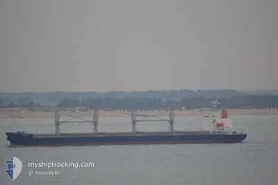
EASTGATE
General Cargo
Current Trip
| Time Travelled | 17 days |
|---|---|
| Remaining Time | 1 day |
| Distance Travelled | 4322.26 nm |
| Remaining Distance | 519.61 nm |
| AVG Speed | 9.7 Knots |
| MAX Speed | 12.6 Knots |
| AVG Wind | 11.7 knots |
| MAX Wind | 26.9 knots |
| MIN Temp | 16.9°C / 62.42°F |
| MAX Temp | 30.3°C / 86.54°F |
| Draught | 11 m |
| Position Received | 7 h, 41 m ago |
Current Position
| Longitude | 104.19551° |
|---|---|
| Latitude | 1.25869° |
| Status | Under way using engine |
| Speed | 11.3 Knots |
| Course | 83.2° |
| Area | Singapore Strait |
| Station | T-AIS |
| Position Received | 7 h, 41 m ago |
Info
Information
The current position of EASTGATE is in Singapore Strait with coordinates 1.25869° / 104.19551° as reported on 2024-06-16 17:55 by AIS to our vessel tracker app. The vessel's current speed is 11.3 Knots and is heading at the port of PHU MY. The estimated time of arrival as calculated by MyShipTracking vessel tracking app is 2024-06-18 22:26 LT
The vessel EASTGATE (IMO: 9478468, MMSI: 636017271) is a General Cargo that was built in 2010 ( 14 years old ). It's sailing under the flag of [LR] Liberia.
In this page you can find informations about the vessels current position, last detected port calls, and current voyage information. If the vessels is not in coverage by AIS you will find the latest position.
The current position of EASTGATE is detected by our AIS receivers and we are not responsible for the reliability of the data. The last position was recorded while the vessel was in Coverage by the Ais receivers of our vessel tracking app.
The current draught of EASTGATE as reported by AIS is 11 meters
Weather
| Temperature | 29.3°C / 84.74°F |
|---|---|
| Wind Speed | 10 knots |
| Direction | 203° SSW |
| Pressure | 1010.3 hPa |
| Humidity | 73.8 % |
| Cloud Coverage | 98 % |
Featured Company
Last Port Calls
| Port | Arrival | Departure | Time In Port |
|---|---|---|---|
| 2024-05-28 23:06 | 2024-05-30 08:43 | 1 d | |
| 2024-05-24 17:55 | 2024-05-26 18:08 | 2 d | |
| 2024-05-19 16:59 | 2024-05-23 06:47 | 3 d | |
| 2024-05-12 20:45 | 2024-05-15 15:19 | 2 d | |
| 2024-05-06 18:19 | 2024-05-09 03:56 | 2 d | |
| 2024-04-30 02:11 | 2024-05-03 03:20 | 3 d | |
| 2024-04-02 23:40 | 2024-04-06 22:56 | 3 d |
Last Trips
| Origin | Departure | Destination | Arrival | Distance | |
|---|---|---|---|---|---|
| 2024-05-27 04:08 | 2024-05-29 09:06 | 254.87 nm | |||
| 2024-05-23 16:47 | 2024-05-25 03:55 | 137.11 nm | |||
| 2024-05-16 01:19 | 2024-05-20 02:59 | 790.67 nm | |||
| 2024-05-09 13:56 | 2024-05-13 06:45 | 700.54 nm | |||
| 2024-05-03 13:20 | 2024-05-07 04:19 | 766.56 nm | |||
| 2024-04-07 05:56 | 2024-04-30 12:11 | 3154.31 nm | |||
| 2024-02-22 22:04 | 2024-04-03 06:40 | 8606.43 nm |
Events
| Time | Event | Details | Position / Dest | Info |
|---|---|---|---|---|
| 2024-06-16 18:01 | Status Changed | Default Under way using engine |
1.26061 / 104.21401
VNPHU
|
Speed: 11.3 kn Course: 83.2° |
| 2024-06-16 17:55 | OUT of Coverage |
1.25869 / 104.19551
Singapore Strait
VNPHU
|
Speed: 11.3 kn Course: 83.2° |
|
| 2024-06-16 17:51 | Change Sea Area | Malaysian part of the Singapore Strait Indonesian part of the Singapore Strait |
1.25694 / 104.18236
Singapore Strait
VNPHU
|
Speed: 11.4 kn Course: 81.8° |
| 2024-06-16 16:58 | ETA Changed | 2024/06/19 01:00 2024/06/19 04:00 |
1.24072 / 104.01533
VNPHU
|
Speed: 11 kn Course: 85.6° |
| 2024-06-16 16:44 | Change Sea Area | Indonesian part of the Singapore Strait Singaporean part of the Singapore Strait |
1.24265 / 103.97904
Singapore Strait
VNPHU
|
Speed: 7.2 kn Course: 159.8° |
| 2024-06-16 15:55 | START Moving | 4.26 nm, West of TANAH MERAH |
1.28544 / 103.95207
VNPHU
|
Speed: 3.1 kn Course: 200° |
| 2024-06-16 15:52 | Draught Changed | 11 10.9 |
1.28743 / 103.95282
VNPHU
|
Speed: 2.1 kn Course: 210° |
| 2024-06-16 15:46 | Status Changed | Under way using engine At anchor |
1.28935 / 103.95403
VNPHU
|
Speed: 0.5 kn Course: 229° |
| 2024-06-16 15:46 | ETA Changed | 2024/06/19 04:00 2024/06/18 19:00 |
1.28943 / 103.95413
VNPHU
|
Speed: 0.5 kn Course: 229° |
| 2024-06-16 02:56 | ETA Changed | 2024/06/18 19:00 2024/06/16 01:30 |
1.29025 / 103.95493
VNPHU
|
Speed: 0.2 kn Course: 220° |