
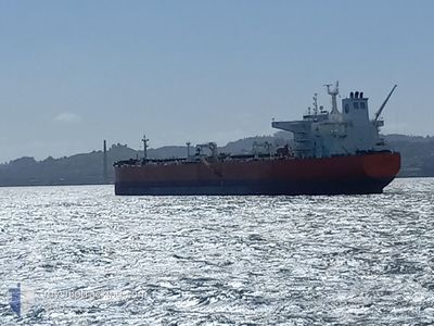
EAGLE HATTERAS
Crude Oil Tanker
Current Trip
| Time Travelled | 52 days |
|---|---|
| Remaining Time | --- |
| Distance Travelled | 9290.30 nm |
| Remaining Distance | --- |
| AVG Speed | 10.6 Knots |
| MAX Speed | 14.8 Knots |
| AVG Wind | 14 knots |
| MAX Wind | 33 knots |
| MIN Temp | 5.8°C / 42.44°F |
| MAX Temp | 26.4°C / 79.52°F |
| Draught | 13.3 m |
| Position Received | 29 d ago |
Current Position
| Longitude | --- |
|---|---|
| Latitude | --- |
| Status | Under way using engine |
| Speed | 11.6 Knots |
| Course | 251.6° |
| Area | North Pacific Ocean |
| Station | T-AIS |
| Position Received | 29 d ago |
Info
Information
The current position of EAGLE HATTERAS is in North Pacific Ocean with coordinates 48.25062° / -126.38101° as reported on 2025-11-13 15:29 by AIS to our vessel tracker app. The vessel's current speed is 11.6 Knots and is heading at the port of NINGBO. The estimated time of arrival as calculated by MyShipTracking vessel tracking app is 2026-01-13 00:00 LT
The vessel EAGLE HATTERAS (IMO: 9453975, MMSI: 235076276) is a Crude Oil Tanker that was built in 2010 ( 15 years old ). It's sailing under the flag of [GB] United Kingdom.
In this page you can find informations about the vessels current position, last detected port calls, and current voyage information. If the vessels is not in coverage by AIS you will find the latest position.
The current position of EAGLE HATTERAS is detected by our AIS receivers and we are not responsible for the reliability of the data. The last position was recorded while the vessel was in Coverage by the Ais receivers of our vessel tracking app.
The current draught of EAGLE HATTERAS as reported by AIS is 13.3 meters
Weather
| Temperature | 25.1°C / 77.18°F |
|---|---|
| Wind Speed | 14 knots |
| Direction | 62° ENE |
| Pressure | 1014.7 hPa |
| Humidity | 69.8 % |
| Cloud Coverage | --- |
Featured Company
Most Visited Ports (Last year)
| Port | Arrivals | |
|---|---|---|
| 22 | ||
| 10 | ||
| 1 | ||
| 1 |
Events
| Time | Event | Details | Position / Dest | Info |
|---|---|---|---|---|
| 2025-12-10 05:17 | START Moving | 5.22 nm, South of JINHAI HEAVY INDUSTR |
30.16822 / 122.24850
NINGBO,CHINA
|
Speed: 4.4 kn Course: 115° |
| 2025-12-10 04:44 | STOP Moving | 5.07 nm, South of JINHAI HEAVY INDUSTR |
30.17096 / 122.24439
NINGBO,CHINA
|
Speed: 0.2 kn Course: 135° |
| 2025-12-10 04:21 | START Moving | 5.08 nm, South of JINHAI HEAVY INDUSTR |
30.17080 / 122.24423
NINGBO,CHINA
|
Speed: 4.1 kn Course: 134° |
| 2025-12-10 00:13 | STOP Moving | 5.25 nm, South of JINHAI HEAVY INDUSTR |
30.16777 / 122.24787
NINGBO,CHINA
|
Speed: Course: 331° |
| 2025-12-10 00:09 | START Moving | 5.25 nm, South of JINHAI HEAVY INDUSTR |
30.16779 / 122.24789
NINGBO,CHINA
|
Speed: 3.3 kn Course: 330° |
| 2025-12-09 01:32 | STOP Moving | 5.06 nm, South of JINHAI HEAVY INDUSTR |
30.17110 / 122.24463
NINGBO,CHINA
|
Speed: 0.2 kn Course: 142° |
| 2025-12-08 22:49 | START Moving | 14.77 nm, North of JINTANG |
30.30118 / 121.92025
NINGBO,CHINA
|
Speed: 6.8 kn Course: 193° |
| 2025-12-07 06:05 | STOP Moving | 15.17 nm, North of JINTANG |
30.30757 / 121.92288
NINGBO,CHINA
|
Speed: 0.1 kn Course: 301° |
| 2025-12-06 07:49 | START Moving |
29.79088 / 123.77748
NINGBO,CHINA
|
Speed: 3.1 kn Course: 7° |
|
| 2025-12-06 05:12 | STOP Moving |
29.80519 / 123.75572
NINGBO,CHINA
|
Speed: 0.2 kn Course: 304° |