
DORUS
Cargo
Current Trip
| Time Travelled | 4 days |
|---|---|
| Remaining Time | --- |
| Distance Travelled | 5.18 nm |
| Remaining Distance | --- |
| AVG Speed | 6.3 Knots |
| MAX Speed | 7 Knots |
| AVG Wind | 7.8 knots |
| MAX Wind | 11 knots |
| MIN Temp | 5°C / 41°F |
| MAX Temp | 9.6°C / 49.28°F |
| Draught | 2 m |
| Position Received | 4 m ago |
Current Position
| Longitude | --- |
|---|---|
| Latitude | --- |
| Status | Under way using engine |
| Speed | |
| Course | --- |
| Area | North Sea |
| Station | T-AIS |
| Position Received | 4 m ago |
Info
Information
The current position of DORUS is in North Sea with coordinates 51.91047° / 5.43755° as reported on 2025-03-04 19:57 by AIS to our vessel tracker app. The vessel's current speed is 0 Knots
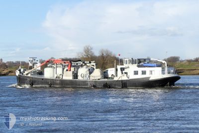
The vessel DORUS (MMSI: 244670399) is a Cargo It's sailing under the flag of [NL] Netherlands.
In this page you can find informations about the vessels current position, last detected port calls, and current voyage information. If the vessels is not in coverage by AIS you will find the latest position.
The current position of DORUS is detected by our AIS receivers and we are not responsible for the reliability of the data. The last position was recorded while the vessel was in Coverage by the Ais receivers of our vessel tracking app.
The current draught of DORUS as reported by AIS is 2 meters
Weather
| Temperature | 5.8°C / 42.44°F |
|---|---|
| Wind Speed | 5 knots |
| Direction | 191° S |
| Pressure | 1024.9 hPa |
| Humidity | 72.3 % |
| Cloud Coverage | --- |
Featured Company
Last Port Calls
| Port | Arrival | Departure | Time In Port |
|---|---|---|---|
| 2025-02-28 13:34 | 2025-02-28 14:10 | 36 m | |
| 2025-02-28 07:56 | 2025-02-28 09:03 | 1 h | |
| 2025-02-26 10:35 | 2025-02-26 11:48 | 1 h | |
| 2025-02-26 05:48 | 2025-02-26 06:12 | 23 m |
Most Visited Ports (Last year)
| Port | Arrivals | |
|---|---|---|
| 11 | ||
| 8 | ||
| 2 | ||
| 1 | ||
| 1 | ||
| 1 |
Last Trips
| Origin | Departure | Destination | Arrival | Distance | |
|---|---|---|---|---|---|
| 2025-02-28 10:03 | 2025-02-28 14:34 | 31.21 nm | |||
| 2025-02-26 12:48 | 2025-02-28 08:56 | 1.78 nm | |||
| 2025-02-26 07:12 | 2025-02-26 11:35 | 31.41 nm | |||
| 2025-02-26 07:12 | 2025-02-26 06:48 | 31.41 nm |
Events
| Time | Event | Details | Position / Dest | Info |
|---|---|---|---|---|
| 2025-03-04 15:54 | Status Changed | Under way using engine Default |
51.91047 / 5.43755
TIEL INDUSTRIEHAVEN
|
Speed: Course: -1° |
| 2025-03-04 15:49 | Status Changed | Default Under way using engine |
51.91047 / 5.43755
TIEL INDUSTRIEHAVEN
|
Speed: Course: 511° |
| 2025-03-04 12:47 | Status Changed | Under way using engine Default |
51.91045 / 5.43754
TIEL INDUSTRIEHAVEN
|
Speed: Course: -1° |
| 2025-03-04 12:42 | Status Changed | Default Under way using engine |
51.91045 / 5.43754
TIEL INDUSTRIEHAVEN
|
Speed: Course: 511° |
| 2025-03-03 11:44 | STOP Moving | 1.37 nm, North of TIEL |
51.90955 / 5.43962
TIEL INDUSTRIEHAVEN
|
Speed: 0.3 kn Course: 511° |
| 2025-03-03 11:42 | START Moving | 1.41 nm, North of TIEL |
51.91022 / 5.43807
TIEL INDUSTRIEHAVEN
|
Speed: 4.3 kn Course: 133.3° |
| 2025-03-03 11:26 | Status Changed | Under way using engine Default |
51.91049 / 5.43753
TIEL INDUSTRIEHAVEN
|
Speed: Course: -1° |
| 2025-03-03 11:25 | Status Changed | Default Under way using engine |
51.91050 / 5.43753
TIEL INDUSTRIEHAVEN
|
Speed: Course: 511° |
| 2025-03-01 00:04 | ETA Changed | 2026/02/28 11:00 2025/02/28 11:00 |
51.91167 / 5.43595
TIEL INDUSTRIEHAVEN
|
Speed: Course: 511° |
| 2025-02-28 14:55 | STOP Moving | 1.51 nm, North of TIEL |
51.91172 / 5.43596
TIEL INDUSTRIEHAVEN
|
Speed: Course: 511° |