
DOROTHEA SCHULTE
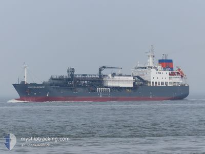
Lpg Tanker
Current Trip
| Time Travelled | 18 h, 7 mins |
|---|---|
| Remaining Time | --- |
| Distance Travelled | 144.82 nm |
| Remaining Distance | 217.68 nm |
| AVG Speed | 7.9 Knots |
| MAX Speed | 10 Knots |
| AVG Wind | 19.5 knots |
| MAX Wind | 25 knots |
| MIN Temp | 6.3°C / 43.34°F |
| MAX Temp | 8°C / 46.4°F |
| Draught | 7 m |
| Position Received | 14 h, 39 m ago |
Current Position
| Longitude | --- |
|---|---|
| Latitude | --- |
| Status | Under way using engine |
| Speed | 8.8 Knots |
| Course | 109.9° |
| Area | North Sea |
| Station | T-AIS |
| Position Received | 14 h, 39 m ago |
Info
Information
The current position of DOROTHEA SCHULTE is in North Sea with coordinates 54.57651° / -0.26660° as reported on 2025-12-23 17:24 by AIS to our vessel tracker app. The vessel's current speed is 8.8 Knots and is heading at the port of ANTWERP. The estimated time of arrival as calculated by MyShipTracking vessel tracking app is 2025-12-24 14:00 LT
The vessel DOROTHEA SCHULTE (IMO: 9618862, MMSI: 235093299) is a Lpg Tanker that was built in 2013 ( 12 years old ). It's sailing under the flag of [GB] United Kingdom.
In this page you can find informations about the vessels current position, last detected port calls, and current voyage information. If the vessels is not in coverage by AIS you will find the latest position.
The current position of DOROTHEA SCHULTE is detected by our AIS receivers and we are not responsible for the reliability of the data. The last position was recorded while the vessel was in Coverage by the Ais receivers of our vessel tracking app.
The current draught of DOROTHEA SCHULTE as reported by AIS is 7 meters
Weather
| Temperature | 6.6°C / 43.88°F |
|---|---|
| Wind Speed | 23 knots |
| Direction | 85° E |
| Pressure | 1035.4 hPa |
| Humidity | 65.3 % |
| Cloud Coverage | 10 % |
Featured Company
Last Port Calls
| Port | Arrival | Departure | Time In Port |
|---|---|---|---|
| 2025-12-22 12:30 | 2025-12-23 13:57 | 1 d | |
| 2025-12-18 18:22 | 2025-12-21 03:23 | 2 d | |
| 2025-12-15 18:34 | 2025-12-17 09:46 | 1 d | |
| 2025-12-09 07:29 | 2025-12-10 22:53 | 1 d | |
| 2025-12-04 09:08 | 2025-12-07 20:37 | 3 d | |
| 2025-12-01 22:56 | 2025-12-02 23:26 | 1 d | |
| 2025-11-21 18:05 | 2025-11-24 03:31 | 2 d | |
| 2025-11-15 20:22 | 2025-11-18 01:55 | 2 d | |
| 2025-11-02 18:01 | 2025-11-04 04:57 | 1 d | |
| 2025-10-29 14:26 | 2025-11-01 00:43 | 2 d |
Most Visited Ports (Last year)
| Port | Arrivals | |
|---|---|---|
| 17 | ||
| 13 | ||
| 13 | ||
| 11 | ||
| 2 | ||
| 2 |
Last Trips
| Origin | Departure | Destination | Arrival | Distance | |
|---|---|---|---|---|---|
| 2025-12-21 03:23 | 2025-12-22 12:30 | 400.60 nm | |||
| 2025-12-17 09:46 | 2025-12-18 18:22 | 357.72 nm | |||
| 2025-12-10 22:53 | 2025-12-15 18:34 | 376.60 nm | |||
| 2025-12-07 20:37 | 2025-12-09 07:29 | 384.14 nm | |||
| 2025-12-02 23:26 | 2025-12-04 09:08 | 346.57 nm | |||
| 2025-11-24 03:31 | 2025-12-01 22:56 | 483.91 nm | |||
| 2025-11-18 01:55 | 2025-11-21 18:05 | 401.03 nm | |||
| 2025-11-04 04:57 | 2025-11-15 20:22 | 409.63 nm | |||
| 2025-11-01 00:43 | 2025-11-02 18:01 | 418.21 nm | |||
| 2025-10-27 00:05 | 2025-10-29 14:26 | 200.78 nm |
Events
| Time | Event | Details | Position / Dest | Info |
|---|---|---|---|---|
| 2025-12-23 17:30 | Status Changed | Default Under way using engine |
54.56925 / -.24407
BEZWL
|
Speed: 8.8 kn Course: 109.9° |
| 2025-12-23 17:24 | OUT of Coverage |
54.57651 / -.26660
North Sea
BEZWL
|
Speed: 8.8 kn Course: 109.9° |
|
| 2025-12-23 17:24 | Status Changed | Under way using engine Default |
54.57695 / -.26856
BEZWL
|
Speed: 9.3 kn Course: 113° |
| 2025-12-23 17:20 | IN Coverage |
54.57651 / -.26660
North Sea
BEZWL
|
Speed: 8.8 kn Course: 109.9° |
|
| 2025-12-23 15:32 | Status Changed | Default Under way using engine |
54.65143 / -.75433
BEZWL
|
Speed: 9.5 kn Course: 89.5° |
| 2025-12-23 15:27 | OUT of Coverage |
54.65165 / -.77629
North Sea
BEZWL
|
Speed: 9.5 kn Course: 89.5° |
|
| 2025-12-23 13:57 | PORT DEPARTURE |
|
54.64869 / -1.14099
BEZWL
|
Speed: 12.1 kn Course: 30° |
| 2025-12-23 13:39 | Draught Changed | 7 6.5 |
54.60212 / -1.16799
[GB] TEES
|
Speed: 8.4 kn Course: 44° |
| 2025-12-23 13:39 | Destination Changed | BEZWL GBTEE |
54.60212 / -1.16799
[GB] TEES
|
Speed: 8.4 kn Course: 44° |
| 2025-12-23 13:39 | ETA Changed | 2025/12/24 13:00 2025/12/22 12:00 |
54.60212 / -1.16799
[GB] TEES
|
Speed: 8.4 kn Course: 44° |