
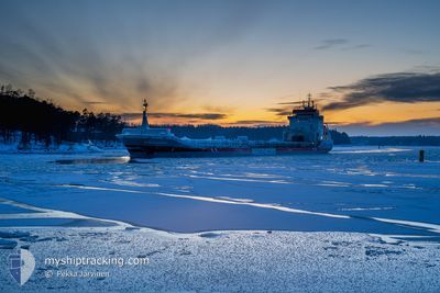
DIEZEBORG
General Cargo
Current Trip
| Time Travelled | 1 day |
|---|---|
| Remaining Time | 23 h, 6 mins |
| Distance Travelled | 447.12 nm |
| Remaining Distance | 265.05 nm |
| AVG Speed | 11.1 Knots |
| MAX Speed | 12.7 Knots |
| AVG Wind | 6.6 knots |
| MAX Wind | 14 knots |
| MIN Temp | 5.5°C / 41.9°F |
| MAX Temp | 15.9°C / 60.62°F |
| Draught | 4.8 m |
| Position Received | 1 m ago |
Current Position
| Longitude | 19.70278° |
|---|---|
| Latitude | 59.10357° |
| Status | Under way using engine |
| Speed | 10.9 Knots |
| Course | 28.1° |
| Area | Baltic Sea |
| Station | T-AIS |
| Position Received | 1 m ago |
Info
Information
The current position of DIEZEBORG is in Baltic Sea with coordinates 59.10357° / 19.70278° as reported on 2024-05-05 06:32 by AIS to our vessel tracker app. The vessel's current speed is 10.9 Knots and is heading at the port of ORNSKOLDSVIK. The estimated time of arrival as calculated by MyShipTracking vessel tracking app is 2024-05-06 05:40 LT
The vessel DIEZEBORG (IMO: 9225586, MMSI: 245250000) is a General Cargo that was built in 2000 ( 24 years old ). It's sailing under the flag of [NL] Netherlands.
In this page you can find informations about the vessels current position, last detected port calls, and current voyage information. If the vessels is not in coverage by AIS you will find the latest position.
The current position of DIEZEBORG is detected by our AIS receivers and we are not responsible for the reliability of the data. The last position was recorded while the vessel was in Coverage by the Ais receivers of our vessel tracking app.
The current draught of DIEZEBORG as reported by AIS is 4.8 meters
Weather
| Temperature | 5.7°C / 42.26°F |
|---|---|
| Wind Speed | 7 knots |
| Direction | 127° SE |
| Pressure | 1011.3 hPa |
| Humidity | 85.2 % |
| Cloud Coverage | 90 % |
Featured Company
Last Port Calls
| Port | Arrival | Departure | Time In Port |
|---|---|---|---|
| 2024-05-01 05:15 | 2024-05-03 15:41 | 2 d | |
| 2024-04-28 13:44 | 2024-04-29 16:00 | 1 d | |
| 2024-04-16 10:59 | 2024-04-17 19:57 | 1 d | |
| 2024-04-13 17:35 | 2024-04-16 04:49 | 2 d | |
| 2024-04-01 02:01 | 2024-04-03 22:32 | 2 d | |
| 2024-03-28 11:16 | 2024-03-31 10:55 | 2 d | |
| 2024-03-27 14:26 | 2024-03-27 14:44 | 17 m | |
| 2024-03-24 14:21 | 2024-03-26 00:12 | 1 d | |
| 2024-03-14 09:15 | 2024-03-18 05:20 | 3 d |
Last Trips
| Origin | Departure | Destination | Arrival | Distance | |
|---|---|---|---|---|---|
| 2024-04-29 18:00 | 2024-05-01 07:15 | 372.51 nm | |||
| 2024-04-17 20:57 | 2024-04-28 15:44 | 2362.06 nm | |||
| 2024-04-16 05:49 | 2024-04-16 11:59 | 68.67 nm | |||
| 2024-04-04 00:32 | 2024-04-13 17:35 | 1525.87 nm | |||
| 2024-03-31 12:55 | 2024-04-01 04:01 | 132.31 nm | |||
| 2024-03-27 15:44 | 2024-03-28 12:16 | 7.54 nm | |||
| 2024-03-26 01:12 | 2024-03-27 15:26 | 114.34 nm | |||
| 2024-03-18 06:20 | 2024-03-24 15:21 | 724.73 nm | |||
| 2024-02-25 21:19 | 2024-03-14 10:15 | 3012.09 nm |
Events
| Time | Event | Details | Position / Dest | Info |
|---|---|---|---|---|
| 2024-05-05 06:19 | Status Changed | Under way using engine Default |
59.06701 / 19.66157
DOMSJO
|
Speed: 11 kn Course: 32° |
| 2024-05-05 06:17 | Status Changed | Default Under way using engine |
59.06186 / 19.65519
DOMSJO
|
Speed: 11.1 kn Course: 34.6° |
| 2024-05-05 05:57 | Status Changed | Under way using engine Default |
59.01212 / 19.58937
DOMSJO
|
Speed: 11.5 kn Course: 35° |
| 2024-05-05 05:56 | Status Changed | Default Under way using engine |
59.00950 / 19.58583
DOMSJO
|
Speed: 11.5 kn Course: 33° |
| 2024-05-05 05:48 | Status Changed | Under way using engine Default |
58.98828 / 19.55848
DOMSJO
|
Speed: 11.6 kn Course: 32° |
| 2024-05-05 05:45 | Status Changed | Default Under way using engine |
58.97790 / 19.54573
DOMSJO
|
Speed: 11.6 kn Course: 31.4° |
| 2024-05-05 05:00 | Status Changed | Under way using engine Default |
58.85471 / 19.40638
DOMSJO
|
Speed: 11.1 kn Course: 33° |
| 2024-05-05 04:32 | Status Changed | Default Under way using engine |
58.78550 / 19.31677
DOMSJO
|
Speed: 10.9 kn Course: 33.8° |
| 2024-05-05 04:27 | Status Changed | Under way using engine Default |
58.77297 / 19.30020
DOMSJO
|
Speed: 10.9 kn Course: 36° |
| 2024-05-05 04:25 | Status Changed | Default Under way using engine |
58.76581 / 19.29079
DOMSJO
|
Speed: 11 kn Course: 35° |