
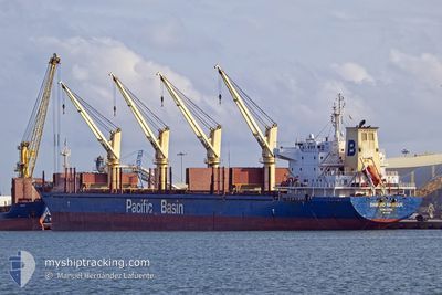
DIAMOND HARBOUR
Bulk Carrier
Current Trip
IN LUBUK GAUNG
| Time Travelled | 7 days |
|---|---|
| Remaining Time | --- |
| Distance Travelled | 390.54 nm |
| Remaining Distance | --- |
| AVG Speed | 12.2 Knots |
| MAX Speed | 15.8 Knots |
| AVG Wind | 8.5 knots |
| MAX Wind | 15 knots |
| MIN Temp | 22.9°C / 73.22°F |
| MAX Temp | 29.9°C / 85.82°F |
| Draught | 8.1 m |
| Position Received | 7 d ago |
Current Position
| Longitude | --- |
|---|---|
| Latitude | --- |
| Status | Under way using engine |
| Speed | 14.4 Knots |
| Course | 316.3° |
| Area | Malacca Strait |
| Station | T-AIS |
| Position Received | 7 d ago |
Info
Information
The current position of DIAMOND HARBOUR is in Malacca Strait with coordinates 1.29234° / 103.35418° as reported on 2025-02-24 20:08 by AIS to our vessel tracker app. The vessel's current speed is 14.4 Knots
The vessel DIAMOND HARBOUR (IMO: 9377987, MMSI: 477114300) is a Bulk Carrier that was built in 2008 ( 17 years old ). It's sailing under the flag of [HK] Hong Kong.
In this page you can find informations about the vessels current position, last detected port calls, and current voyage information. If the vessels is not in coverage by AIS you will find the latest position.
The current position of DIAMOND HARBOUR is detected by our AIS receivers and we are not responsible for the reliability of the data. The last position was recorded while the vessel was in Coverage by the Ais receivers of our vessel tracking app.
The current draught of DIAMOND HARBOUR as reported by AIS is 8.1 meters
Weather
| Temperature | 26.1°C / 78.98°F |
|---|---|
| Wind Speed | 6 knots |
| Direction | 30° NNE |
| Pressure | 1009.6 hPa |
| Humidity | 82 % |
| Cloud Coverage | 100 % |
Featured Company
Last Port Calls
| Port | Arrival | Departure | Time In Port |
|---|---|---|---|
| 2025-02-20 08:13 | 2025-02-24 14:57 | 4 d |
Last Trips
| Origin | Departure | Destination | Arrival | Distance | |
|---|---|---|---|---|---|
| 2024-12-25 02:57 | 2025-02-20 16:13 | 5476.43 nm |
Events
| Time | Event | Details | Position / Dest | Info |
|---|---|---|---|---|
| 2025-03-03 11:57 | START Moving | 6.87 nm, North West of DUMAI |
1.76118 / 101.36833
IN LUBUK GAUNG
|
Speed: 3.5 kn Course: 82° |
| 2025-02-25 22:05 | STOP Moving | 6.83 nm, North West of DUMAI |
1.75834 / 101.36687
IN LUBUK GAUNG
|
Speed: Course: 330° |
| 2025-02-25 20:57 | START Moving | 3.46 nm, North West of DUMAI |
1.73605 / 101.42410
IN LUBUK GAUNG
|
Speed: 5.8 kn Course: 286° |
| 2025-02-25 10:51 | STOP Moving | 3.15 nm, North West of DUMAI |
1.73283 / 101.42853
IN LUBUK GAUNG
|
Speed: 0.3 kn Course: 344° |
| 2025-02-24 20:13 | Status Changed | Default Under way using engine |
1.30760 / 103.33992
IN LUBUK GAUNG
|
Speed: 14.4 kn Course: 316.3° |
| 2025-02-24 20:08 | Status Changed | Under way using engine Default |
1.29234 / 103.35418
IN LUBUK GAUNG
|
Speed: 14.4 kn Course: 316° |
| 2025-02-24 20:08 | OUT of Coverage |
1.29234 / 103.35418
Malacca Strait
IN LUBUK GAUNG
|
Speed: 14.4 kn Course: 316.3° |
|
| 2025-02-24 20:01 | Status Changed | Default Under way using engine |
1.27261 / 103.37296
IN LUBUK GAUNG
|
Speed: 14.2 kn Course: 309.8° |
| 2025-02-24 19:53 | Change Sea Area | Malaysian part of the Malacca Strait Indonesian part of the Singapore Strait |
1.24887 / 103.39660
Malacca Strait
IN LUBUK GAUNG
|
Speed: 14.2 kn Course: 308.1° |
| 2025-02-24 19:53 | Status Changed | Under way using engine Default |
1.24814 / 103.39753
IN LUBUK GAUNG
|
Speed: 14.5 kn Course: 290° |