
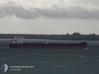
DENSA FLAMINGO
Bulk Carrier
Current Trip
| Time Travelled | 31 days |
|---|---|
| Remaining Time | 6 days |
| Distance Travelled | 7017.53 nm |
| Remaining Distance | 1549.97 nm |
| AVG Speed | 9 Knots |
| MAX Speed | 13.3 Knots |
| AVG Wind | 14 knots |
| MAX Wind | 34 knots |
| MIN Temp | 4.8°C / 40.64°F |
| MAX Temp | 26.5°C / 79.7°F |
| Draught | 14.7 m |
| Position Received | 4 d ago |
Current Position
| Longitude | --- |
|---|---|
| Latitude | --- |
| Status | Under way using engine |
| Speed | 9.8 Knots |
| Course | 153.2° |
| Area | Red Sea |
| Station | T-AIS |
| Position Received | 4 d ago |
Info
Information
The current position of DENSA FLAMINGO is in Red Sea with coordinates 22.25609° / 37.18126° as reported on 2025-02-28 22:33 by AIS to our vessel tracker app. The vessel's current speed is 9.8 Knots and is heading at the port of PORT SAID. The estimated time of arrival as calculated by MyShipTracking vessel tracking app is 2025-03-12 07:21 LT
The vessel DENSA FLAMINGO (IMO: 9603283, MMSI: 215284000) is a Bulk Carrier that was built in 2012 ( 13 years old ). It's sailing under the flag of [MT] Malta.
In this page you can find informations about the vessels current position, last detected port calls, and current voyage information. If the vessels is not in coverage by AIS you will find the latest position.
The current position of DENSA FLAMINGO is detected by our AIS receivers and we are not responsible for the reliability of the data. The last position was recorded while the vessel was in Coverage by the Ais receivers of our vessel tracking app.
The current draught of DENSA FLAMINGO as reported by AIS is 14.7 meters
Weather
| Temperature | 25.3°C / 77.54°F |
|---|---|
| Wind Speed | 18 knots |
| Direction | 71° ENE |
| Pressure | 1013.1 hPa |
| Humidity | 81.1 % |
| Cloud Coverage | 68 % |
Featured Company
Last Port Calls
| Port | Arrival | Departure | Time In Port |
|---|---|---|---|
| 2025-02-26 09:49 | 2025-02-26 18:56 | 9 h | |
| 2025-01-27 17:10 | 2025-02-01 08:04 | 4 d |
Most Visited Ports (Last year)
| Port | Arrivals | |
|---|---|---|
| 3 | ||
| 2 | ||
| 1 | ||
| 1 | ||
| 1 | ||
| 1 |
Last Trips
| Origin | Departure | Destination | Arrival | Distance | |
|---|---|---|---|---|---|
| 2025-02-01 08:04 | 2025-02-26 09:49 | 5456.15 nm | |||
| 2024-12-29 12:28 | 2025-01-27 17:10 | 5647.95 nm |
Events
| Time | Event | Details | Position / Dest | Info |
|---|---|---|---|---|
| 2025-02-28 22:37 | Status Changed | Default Under way using engine |
22.24502 / 37.18732
PORT SAID
|
Speed: 9.8 kn Course: 153.2° |
| 2025-02-28 22:33 | Change Sea Area | Disputed Sudan-Egypt part of the Red Sea Egyptian part of the Gulf of Suez |
22.25609 / 37.18126
Red Sea
|
Speed: 9.8 kn Course: 153.2° |
| 2025-02-28 22:33 | Status Changed | Under way using engine Default |
22.25609 / 37.18126
PORT SAID
|
Speed: 9.8 kn Course: 153° |
| 2025-02-28 22:33 | IN Coverage |
22.25609 / 37.18126
Red Sea
|
Speed: 9.8 kn Course: 153.2° |
|
| 2025-02-28 22:33 | OUT of Coverage |
22.25609 / 37.18126
Red Sea
|
Speed: 9.8 kn Course: 153.2° |
|
| 2025-02-26 17:49 | Status Changed | Default Under way using engine |
29.85518 / 32.55347
PORT SAID
|
Speed: 7.3 kn Course: 172.4° |
| 2025-02-26 17:42 | OUT of Coverage |
29.86946 / 32.55119
Gulf of Suez
|
Speed: 7.3 kn Course: 172.4° |
|
| 2025-02-26 16:58 | Change Sea Area | Egyptian part of the Gulf of Suez Egyptian part of the Mediterranean Sea - Eastern Basin |
29.94360 / 32.57586
Gulf of Suez
|
Speed: 6.8 kn Course: 219.4° |
| 2025-02-26 16:56 | PORT DEPARTURE |
|
29.94564 / 32.57758
PORT SAID
|
Speed: 7 kn Course: 215° |
| 2025-02-26 15:29 | Status Changed | Under way using engine Default |
30.20784 / 32.55778
[EG] SUEZ CANAL
|
Speed: 10.7 kn Course: 150° |