
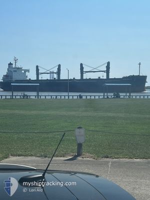
DENSA DOLPHIN
Bulk Carrier
Current Trip
| Time Travelled | 9 days |
|---|---|
| Remaining Time | --- |
| Distance Travelled | 1326.63 nm |
| Remaining Distance | --- |
| AVG Speed | 11.5 Knots |
| MAX Speed | 13.7 Knots |
| AVG Wind | 7.4 knots |
| MAX Wind | 19 knots |
| MIN Temp | 23.3°C / 73.94°F |
| MAX Temp | 29°C / 84.2°F |
| Draught | 12 m |
| Position Received | 2024-10-23 03:06 |
Current Position
| Longitude | --- |
|---|---|
| Latitude | --- |
| Status | Under way using engine |
| Speed | 6.7 Knots |
| Course | 141.5° |
| Area | North Pacific Ocean |
| Station | T-AIS |
| Position Received | 2024-10-23 03:06 |
Info
Information
The current position of DENSA DOLPHIN is in North Pacific Ocean with coordinates 8.88201° / -79.51710° as reported on 2024-10-23 03:06 by AIS to our vessel tracker app. The vessel's current speed is 6.7 Knots and is heading at the port of BALBOA.
The vessel DENSA DOLPHIN (IMO: 9403190, MMSI: 249883000) is a Bulk Carrier that was built in 2010 ( 14 years old ). It's sailing under the flag of [MT] Malta.
In this page you can find informations about the vessels current position, last detected port calls, and current voyage information. If the vessels is not in coverage by AIS you will find the latest position.
The current position of DENSA DOLPHIN is detected by our AIS receivers and we are not responsible for the reliability of the data. The last position was recorded while the vessel was in Coverage by the Ais receivers of our vessel tracking app.
The current draught of DENSA DOLPHIN as reported by AIS is 12 meters
Weather
| Temperature | 27.9°C / 82.22°F |
|---|---|
| Wind Speed | 13 knots |
| Direction | 76° ENE |
| Pressure | 1008.9 hPa |
| Humidity | 80 % |
| Cloud Coverage | 70 % |
Featured Company
Last Port Calls
| Port | Arrival | Departure | Time In Port |
|---|---|---|---|
| 2024-12-01 20:04 | 2024-12-05 01:56 | 3 d | |
| 2024-10-09 16:37 | 2024-10-15 03:31 | 5 d | |
| 2024-10-09 14:24 | 2024-10-09 15:39 | 1 h | |
| 2024-10-02 17:11 |
Most Visited Ports (Last year)
| Port | Arrivals | |
|---|---|---|
| 4 | ||
| 2 | ||
| 2 | ||
| 2 | ||
| 1 | ||
| 1 |
Last Trips
| Origin | Departure | Destination | Arrival | Distance | |
|---|---|---|---|---|---|
| 2024-10-15 03:31 | 2024-12-01 20:04 | 7428.14 nm | |||
| 2024-10-09 15:39 | 2024-10-09 16:37 | 4.75 nm | |||
| 2024-10-02 17:11 | 2024-10-09 14:24 | 421.59 nm |
Events
| Time | Event | Details | Position / Dest | Info |
|---|---|---|---|---|
| 2024-12-12 09:41 | START Moving | 3.83 nm, North of DAVAO |
7.17807 / 125.66775
PA BLB
|
Speed: 5.2 kn Course: 37° |
| 2024-12-08 02:29 | STOP Moving | 3.8 nm, North of DAVAO |
7.17784 / 125.65820
PA BLB
|
Speed: 0.3 kn Course: 239° |
| 2024-12-04 17:57 | START Moving | 2.4 nm, South of LIMAY |
14.46732 / 120.61525
PA BLB
|
Speed: 3.1 kn Course: 113° |
| 2024-12-04 17:56 | PORT DEPARTURE |
|
14.46732 / 120.61525
PA BLB
|
Speed: 2.3 kn Course: 111° |