
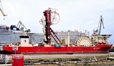
DEEP BLUE
Pipelay Crane Vessel
Current Trip
| Time Travelled | --- |
|---|---|
| Remaining Time | --- |
| Distance Travelled | 1182.33 nm |
| Remaining Distance | --- |
| AVG Speed | 7 Knots |
| MAX Speed | 10.8 Knots |
| AVG Wind | 12.1 knots |
| MAX Wind | 33 knots |
| MIN Temp | 17.4°C / 63.32°F |
| MAX Temp | 36.2°C / 97.16°F |
| Draught | 8.6 m |
| Position Received | 2 d ago |
Current Position
| Longitude | --- |
|---|---|
| Latitude | --- |
| Status | Under way using engine |
| Speed | 7 Knots |
| Course | 160.5° |
| Area | South Atlantic Ocean |
| Station | T-AIS |
| Position Received | 2 d ago |
Info
Information
The current position of DEEP BLUE is in South Atlantic Ocean with coordinates -23.26006° / -42.94260° as reported on 2026-01-05 23:08 by AIS to our vessel tracker app. The vessel's current speed is 7 Knots and is heading at the port of BUZIOS. The estimated time of arrival as calculated by MyShipTracking vessel tracking app is 2026-01-06 05:00 LT
The vessel DEEP BLUE (IMO: 9215359, MMSI: 311105000) is a Pipelay Crane Vessel that was built in 2001 ( 25 years old ). It's sailing under the flag of [BS] Bahamas.
In this page you can find informations about the vessels current position, last detected port calls, and current voyage information. If the vessels is not in coverage by AIS you will find the latest position.
The current position of DEEP BLUE is detected by our AIS receivers and we are not responsible for the reliability of the data. The last position was recorded while the vessel was in Coverage by the Ais receivers of our vessel tracking app.
The current draught of DEEP BLUE as reported by AIS is 8.6 meters
Weather
| Temperature | 25.2°C / 77.36°F |
|---|---|
| Wind Speed | 21 knots |
| Direction | 33° NNE |
| Pressure | 1014.7 hPa |
| Humidity | 87.4 % |
| Cloud Coverage | 100 % |
Featured Company
Last Port Calls
Most Visited Ports (Last year)
| Port | Arrivals | |
|---|---|---|
| 3 | ||
| 1 | ||
| 1 |
Last Trips
| Origin | Departure | Destination | Arrival | Distance |
|---|
Events
| Time | Event | Details | Position / Dest | Info |
|---|---|---|---|---|
| 2026-01-06 11:05 | STOP Moving |
-24.66167 / -42.40500
BUZIOS 6 FIELD
|
Speed: Course: -1° |
|
| 2026-01-05 23:14 | Status Changed | Default Under way using engine |
-23.27144 / -42.94035
BUZIOS 6 FIELD
|
Speed: 7 kn Course: 160.5° |
| 2026-01-05 23:08 | Status Changed | Under way using engine Default |
-23.26006 / -42.94260
BUZIOS 6 FIELD
|
Speed: 6 kn Course: 155° |
| 2026-01-05 23:08 | OUT of Coverage |
-23.26006 / -42.94260
South Atlantic Ocean
BUZIOS 6 FIELD
|
Speed: 7 kn Course: 160.5° |
|
| 2026-01-05 22:33 | Status Changed | Default Under way using engine |
-23.20347 / -42.99039
BUZIOS 6 FIELD
|
Speed: 7.3 kn Course: 161.5° |
| 2026-01-05 19:23 | START Moving | 3.24 nm, North West of NITEROI |
-22.83384 / -43.14744
BUZIOS 6 FIELD
|
Speed: 3.2 kn Course: 269° |
| 2026-01-05 18:49 | Status Changed | Under way using engine At anchor |
-22.83304 / -43.14507
BUZIOS 6 FIELD
|
Speed: Course: 261° |
| 2026-01-05 18:49 | Draught Changed | 8.6 8.9 |
-22.83285 / -43.14501
BUZIOS 6 FIELD
|
Speed: Course: 261° |
| 2026-01-05 18:49 | Destination Changed | BUZIOS 6 FIELD BR RIO |
-22.83285 / -43.14501
BUZIOS 6 FIELD
|
Speed: Course: 261° |
| 2026-01-05 18:49 | ETA Changed | 2026/01/06 08:00 2026/01/03 15:00 |
-22.83285 / -43.14501
BUZIOS 6 FIELD
|
Speed: Course: 261° |