
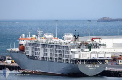
DAREEN
Livestock Carrier
Current Trip
| Time Travelled | 14 h, 43 mins |
|---|---|
| Remaining Time | 3 days |
| Distance Travelled | 177.76 nm |
| Remaining Distance | 1158.92 nm |
| AVG Speed | 12.9 Knots |
| MAX Speed | 14.9 Knots |
| AVG Wind | 5.6 knots |
| MAX Wind | 10 knots |
| MIN Temp | 11.4°C / 52.52°F |
| MAX Temp | 20.5°C / 68.9°F |
| Draught | 6.1 m |
| Position Received | 12 h, 4 m ago |
Current Position
| Longitude | --- |
|---|---|
| Latitude | --- |
| Status | Under way using engine |
| Speed | 14.5 Knots |
| Course | 200° |
| Area | South China Sea |
| Station | T-AIS |
| Position Received | 12 h, 4 m ago |
Info
Information
The current position of DAREEN is in South China Sea with coordinates 20.54112° / 107.23087° as reported on 2026-01-10 02:21 by AIS to our vessel tracker app. The vessel's current speed is 14.5 Knots and is heading at the port of SINGAPORE. The estimated time of arrival as calculated by MyShipTracking vessel tracking app is 2026-01-14 06:04 LT
The vessel DAREEN (IMO: 9074913, MMSI: 353518000) is a Livestock Carrier that was built in 1994 ( 32 years old ). It's sailing under the flag of [PA] Panama.
In this page you can find informations about the vessels current position, last detected port calls, and current voyage information. If the vessels is not in coverage by AIS you will find the latest position.
The current position of DAREEN is detected by our AIS receivers and we are not responsible for the reliability of the data. The last position was recorded while the vessel was in Coverage by the Ais receivers of our vessel tracking app.
The current draught of DAREEN as reported by AIS is 6.1 meters
Weather
| Temperature | 20.8°C / 69.44°F |
|---|---|
| Wind Speed | 5 knots |
| Direction | 10° N |
| Pressure | 1021.1 hPa |
| Humidity | 58.6 % |
| Cloud Coverage | 6 % |
Featured Company
Last Port Calls
| Port | Arrival | Departure | Time In Port |
|---|---|---|---|
| 2026-01-08 17:12 | 2026-01-10 06:43 | 1 d | |
| 2025-12-26 13:05 | 2025-12-27 18:18 | 1 d | |
| 2025-12-17 21:53 | 2025-12-24 17:00 | 6 d | |
| 2025-12-17 12:13 | 2025-12-17 18:20 | 6 h | |
| 2025-11-19 18:22 | 2025-11-20 16:21 | 21 h | |
| 2025-11-13 18:53 | 2025-11-15 01:19 | 1 d |
Most Visited Ports (Last year)
| Port | Arrivals | |
|---|---|---|
| 7 | ||
| 5 | ||
| 3 | ||
| 2 | ||
| 2 | ||
| 2 |
Last Trips
| Origin | Departure | Destination | Arrival | Distance | |
|---|---|---|---|---|---|
| 2025-12-27 18:18 | 2026-01-08 17:12 | 3473.55 nm | |||
| 2025-12-24 17:00 | 2025-12-26 13:05 | 25.42 nm | |||
| 2025-12-17 18:20 | 2025-12-17 21:53 | 28.90 nm | |||
| 2025-11-20 16:21 | 2025-12-17 12:13 | 8729.23 nm | |||
| 2025-11-15 01:19 | 2025-11-19 18:22 | 1341.62 nm | |||
| 2025-10-22 23:23 | 2025-11-13 18:53 | 7356.48 nm |
Events
| Time | Event | Details | Position / Dest | Info |
|---|---|---|---|---|
| 2026-01-10 02:27 | Status Changed | Default Under way using engine |
20.51902 / 107.22546
PEBGA SG
|
Speed: 14.5 kn Course: 200° |
| 2026-01-10 02:21 | OUT of Coverage |
20.54112 / 107.23087
South China Sea
PEBGA SG
|
Speed: 14.5 kn Course: 200° |
|
| 2026-01-10 01:28 | Status Changed | Under way using engine Default |
20.71905 / 107.17709
PEBGA SG
|
Speed: 9.8 kn Course: 167° |
| 2026-01-10 00:57 | Status Changed | Default Under way using engine |
20.80040 / 107.14834
PEBGA SG
|
Speed: 6.1 kn Course: 156.1° |
| 2026-01-10 00:45 | Status Changed | Under way using engine Default |
20.82379 / 107.13736
PEBGA SG
|
Speed: 9.9 kn Course: 157° |
| 2026-01-10 00:40 | Status Changed | Default Under way using engine |
20.83580 / 107.13201
PEBGA SG
|
Speed: 8.5 kn Course: 147.8° |
| 2026-01-09 23:52 | Draught Changed | 6.1 7.1 |
20.93123 / 107.07066
PEBGA SG
|
Speed: 8.4 kn Course: 159° |
| 2026-01-09 23:52 | Destination Changed | PEBGA SG CAILAN VIETNAM |
20.93123 / 107.07066
PEBGA SG
|
Speed: 8.4 kn Course: 159° |
| 2026-01-09 23:52 | ETA Changed | 2026/01/14 03:00 2026/01/08 03:00 |
20.93123 / 107.07066
PEBGA SG
|
Speed: 8.4 kn Course: 159° |
| 2026-01-09 23:43 | PORT DEPARTURE |
|
20.94975 / 107.06504
CAILAN VIETNAM
|
Speed: 6.6 kn Course: 170° |