
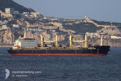
DARANEE NAREE
Bulk Carrier
Current Trip
| Trip Time | 3 days |
|---|---|
| Trip Distance | 836.41 nm |
| AVG Speed | 11.5 Knots |
| MAX Speed | 13.6 Knots |
| Draught | 7.3 m |
| AVG Wind | 14.9 knots |
| MAX Wind | 28 knots |
| MIN Temp | -1.2°C / 29.84°F |
| MAX Temp | 7.8°C / 46.04°F |
| Position Received | 8 d ago |
Current Position
| Longitude | --- |
|---|---|
| Latitude | --- |
| Status | Under way using engine |
| Speed | 12.9 Knots |
| Course | 213.3° |
| Area | Japan Sea |
| Station | T-AIS |
| Position Received | 8 d ago |
Info
Information
The current position of DARANEE NAREE is in Japan Sea with coordinates 34.82964° / 129.26870° as reported on 2025-02-22 21:09 by AIS to our vessel tracker app. The vessel's current speed is 12.9 Knots and is currently inside the port of SHANHAIGUAN.
The vessel DARANEE NAREE (IMO: 9613446, MMSI: 566707000) is a Bulk Carrier that was built in 2012 ( 13 years old ). It's sailing under the flag of [SG] Singapore.
In this page you can find informations about the vessels current position, last detected port calls, and current voyage information. If the vessels is not in coverage by AIS you will find the latest position.
The current position of DARANEE NAREE is detected by our AIS receivers and we are not responsible for the reliability of the data. The last position was recorded while the vessel was in Coverage by the Ais receivers of our vessel tracking app.
The current draught of DARANEE NAREE as reported by AIS is 7.3 meters
Weather
| Temperature | 5.6°C / 42.08°F |
|---|---|
| Wind Speed | 13 knots |
| Direction | 42° NE |
| Pressure | 1028.9 hPa |
| Humidity | 14.4 % |
| Cloud Coverage | 86 % |
Featured Company
Last Port Calls
| Port | Arrival | Departure | Time In Port |
|---|---|---|---|
| 2025-02-26 05:53 | |||
| 2025-02-18 07:45 | 2025-02-22 13:26 | 4 d | |
| 2025-02-13 04:05 | 2025-02-15 01:05 | 1 d | |
| 2025-01-04 03:24 |
Events
| Time | Event | Details | Position / Dest | Info |
|---|---|---|---|---|
| 2025-02-26 05:53 | PORT ARRIVAL |
|
39.95327 / 119.83067
[CN] SHANHAIGUAN
|
Speed: 5.1 kn Course: 347° |
| 2025-02-26 03:53 | START Moving | 7.27 nm, South of SHANHAIGUAN |
39.84480 / 119.82391
CN SHP
|
Speed: 5 kn Course: 55° |
| 2025-02-25 12:25 | STOP Moving | 7.3 nm, South of SHANHAIGUAN |
39.84470 / 119.81523
CN SHP
|
Speed: 0.3 kn Course: 110° |
| 2025-02-22 21:09 | Status Changed | Default Under way using engine |
34.82869 / 129.26794
CN SHP
|
Speed: 12.9 kn Course: 213.3° |
| 2025-02-22 21:09 | Status Changed | Under way using engine Default |
34.82964 / 129.26870
CN SHP
|
Speed: 12.8 kn Course: 215° |
| 2025-02-22 21:09 | OUT of Coverage |
34.82964 / 129.26870
Japan Sea
CN SHP
|
Speed: 12.9 kn Course: 213.3° |
|
| 2025-02-22 21:09 | Change Sea Area | Japanese part of the Japan Sea South Korean part of the Japan Sea |
34.82964 / 129.26870
Japan Sea
CN SHP
|
Speed: 12.9 kn Course: 213.3° |
| 2025-02-22 20:57 | IN Coverage |
34.82964 / 129.26870
Japan Sea
CN SHP
|
Speed: 12.9 kn Course: 213.3° |
|
| 2025-02-22 15:21 | Status Changed | Default Under way using engine |
35.96965 / 129.69582
CN SHP
|
Speed: 12.6 kn Course: 180.6° |
| 2025-02-22 15:15 | OUT of Coverage |
35.99066 / 129.69660
Japan Sea
CN SHP
|
Speed: 12.6 kn Course: 180.6° |