
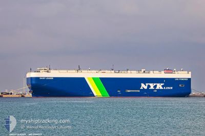
DAISY LEADER
Cargo
Current Trip
| Time Travelled | 1 day |
|---|---|
| Remaining Time | --- |
| Distance Travelled | 268.56 nm |
| Remaining Distance | --- |
| AVG Speed | 9.2 Knots |
| MAX Speed | 15.9 Knots |
| AVG Wind | 16.4 knots |
| MAX Wind | 21.8 knots |
| MIN Temp | 12.9°C / 55.22°F |
| MAX Temp | 20.4°C / 68.72°F |
| Draught | 8.3 m |
| Position Received | 1 m ago |
Current Position
| Longitude | --- |
|---|---|
| Latitude | --- |
| Status | Under way using engine |
| Speed | 8.4 Knots |
| Course | 15.7° |
| Area | North Pacific Ocean |
| Station | T-AIS |
| Position Received | 1 m ago |
Info
Information
The current position of DAISY LEADER is in North Pacific Ocean with coordinates 36.91645° / -122.82964° as reported on 2025-12-10 02:58 by AIS to our vessel tracker app. The vessel's current speed is 8.4 Knots and is heading at the port of BENICIA. The estimated time of arrival as calculated by MyShipTracking vessel tracking app is 2025-12-10 02:00 LT
The vessel DAISY LEADER (IMO: 9960227, MMSI: 431193000) is a Cargo It's sailing under the flag of [JP] Japan.
In this page you can find informations about the vessels current position, last detected port calls, and current voyage information. If the vessels is not in coverage by AIS you will find the latest position.
The current position of DAISY LEADER is detected by our AIS receivers and we are not responsible for the reliability of the data. The last position was recorded while the vessel was in Coverage by the Ais receivers of our vessel tracking app.
The current draught of DAISY LEADER as reported by AIS is 8.3 meters
Weather
| Temperature | 13.1°C / 55.58°F |
|---|---|
| Wind Speed | 18 knots |
| Direction | 344° NNW |
| Pressure | 1020 hPa |
| Humidity | 78.7 % |
| Cloud Coverage | 5 % |
Featured Company
Last Port Calls
| Port | Arrival | Departure | Time In Port |
|---|---|---|---|
| 2025-12-08 06:20 | 2025-12-08 14:27 | 8 h | |
| 2025-12-06 02:44 | 2025-12-06 17:07 | 14 h | |
| 2025-11-22 02:43 | 2025-11-22 17:45 | 15 h | |
| 2025-11-21 07:42 | 2025-11-21 15:54 | 8 h | |
| 2025-11-01 15:51 | 2025-11-04 20:44 | 3 d | |
| 2025-10-29 15:33 | 2025-10-29 22:33 | 7 h | |
| 2025-10-26 02:27 | 2025-10-29 02:34 | 3 d | |
| 2025-10-15 09:16 | 2025-10-15 18:28 | 9 h | |
| 2025-10-13 07:34 | 2025-10-13 22:11 | 14 h | |
| 2025-10-11 06:05 | 2025-10-11 23:24 | 17 h |
Last Trips
| Origin | Departure | Destination | Arrival | Distance | |
|---|---|---|---|---|---|
| 2025-12-06 17:07 | 2025-12-08 06:20 | 169.24 nm | |||
| 2025-11-22 17:45 | 2025-12-06 02:44 | 4506.65 nm | |||
| 2025-11-21 15:54 | 2025-11-22 02:43 | 106.45 nm | |||
| 2025-11-04 20:44 | 2025-11-21 07:42 | 5914.78 nm | |||
| 2025-10-29 22:33 | 2025-11-01 15:51 | 559.83 nm | |||
| 2025-10-29 02:34 | 2025-10-29 15:33 | 204.96 nm | |||
| 2025-10-15 18:28 | 2025-10-26 02:27 | 3333.12 nm | |||
| 2025-10-13 22:11 | 2025-10-15 09:16 | 564.98 nm | |||
| 2025-10-11 23:24 | 2025-10-13 07:34 | 409.10 nm | |||
| 2025-10-08 13:19 | 2025-10-11 06:05 | 890.31 nm |
Events
| Time | Event | Details | Position / Dest | Info |
|---|---|---|---|---|
| 2025-12-09 16:38 | Draught Changed | 8.3 8.8 |
35.42439 / -122.00878
US BNC
|
Speed: 15.4 kn Course: 320° |
| 2025-12-09 16:36 | Status Changed | Under way using engine Default |
35.42040 / -122.00472
US BNC
|
Speed: 15.8 kn Course: 323° |
| 2025-12-09 16:18 | Status Changed | Default Under way using engine |
35.35514 / -121.94476
US BNC
|
Speed: 13.2 kn Course: 321.7° |
| 2025-12-09 16:03 | Status Changed | Under way using engine Default |
35.31033 / -121.90193
US BNC
|
Speed: 11.4 kn Course: 321° |
| 2025-12-09 15:47 | IN Coverage |
35.31291 / -121.90444
North Pacific Ocean
US BNC
|
Speed: 12.2 kn Course: 321.5° |
|
| 2025-12-09 10:51 | Status Changed | Default Under way using engine |
34.62653 / -121.24277
US BNC
|
Speed: 9 kn Course: 323.9° |
| 2025-12-09 10:43 | OUT of Coverage |
34.61063 / -121.22790
North Pacific Ocean
US BNC
|
Speed: 9 kn Course: 323.9° |
|
| 2025-12-09 07:56 | Status Changed | Under way using engine Default |
34.42278 / -120.80174
US BNC
|
Speed: 9.4 kn Course: 286° |
| 2025-12-09 07:51 | Status Changed | Default Under way using engine |
34.41926 / -120.78713
US BNC
|
Speed: 9.4 kn Course: 285.2° |
| 2025-12-09 07:45 | Status Changed | Under way using engine Default |
34.41517 / -120.76936
US BNC
|
Speed: 9.3 kn Course: 286° |