
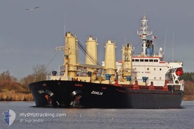
DAHLIA
Bulk Carrier
Current Trip
BR REC
| Time Travelled | 6 days |
|---|---|
| Remaining Time | --- |
| Distance Travelled | 1020.37 nm |
| Remaining Distance | --- |
| AVG Speed | 6.7 Knots |
| MAX Speed | 8.5 Knots |
| AVG Wind | 11.1 knots |
| MAX Wind | 18 knots |
| MIN Temp | 24.7°C / 76.46°F |
| MAX Temp | 29.4°C / 84.92°F |
| Draught | 8.2 m |
| Position Received | 8 h, 58 m ago |
Current Position
| Longitude | -41.08949° |
|---|---|
| Latitude | -22.35160° |
| Status | Under way using engine |
| Speed | 7.5 Knots |
| Course | 226.2° |
| Area | South Atlantic Ocean |
| Station | T-AIS |
| Position Received | 8 h, 58 m ago |
Info
Information
The current position of DAHLIA is in South Atlantic Ocean with coordinates -22.35160° / -41.08949° as reported on 2024-05-01 12:30 by AIS to our vessel tracker app. The vessel's current speed is 7.5 Knots
The vessel DAHLIA (IMO: 9127071, MMSI: 352515000) is a Bulk Carrier that was built in 1997 ( 27 years old ). It's sailing under the flag of [PA] Panama.
In this page you can find informations about the vessels current position, last detected port calls, and current voyage information. If the vessels is not in coverage by AIS you will find the latest position.
The current position of DAHLIA is detected by our AIS receivers and we are not responsible for the reliability of the data. The last position was recorded while the vessel was in Coverage by the Ais receivers of our vessel tracking app.
The current draught of DAHLIA as reported by AIS is 8.2 meters
Weather
| Temperature | 24.8°C / 76.64°F |
|---|---|
| Wind Speed | 16 knots |
| Direction | 50° NE |
| Pressure | 1012 hPa |
| Humidity | 89.1 % |
| Cloud Coverage | --- |
Featured Company
Last Port Calls
| Port | Arrival | Departure | Time In Port |
|---|---|---|---|
| 2024-04-21 20:23 | 2024-04-25 17:37 | 3 d | |
| 2024-04-13 04:10 | 2024-04-19 18:33 | 6 d | |
| 2024-04-01 03:09 | 2024-04-04 03:12 | 3 d | |
| 2024-03-13 09:40 | 2024-03-15 15:42 | 2 d | |
| 2024-03-07 22:32 |
Most Visited Ports (Last year)
| Port | Arrivals | |
|---|---|---|
| 11 | ||
| 7 | ||
| 6 | ||
| 3 | ||
| 2 | ||
| 2 |
Last Trips
| Origin | Departure | Destination | Arrival | Distance | |
|---|---|---|---|---|---|
| 2024-04-19 15:33 | 2024-04-21 17:23 | 410.59 nm | |||
| 2024-04-04 00:12 | 2024-04-13 01:10 | 1800.94 nm | |||
| 2024-03-15 12:42 | 2024-04-01 00:09 | 1427.51 nm | |||
| 2024-03-07 19:32 | 2024-03-13 06:40 | 1272.25 nm |
Events
| Time | Event | Details | Position / Dest | Info |
|---|---|---|---|---|
| 2024-05-01 12:34 | Status Changed | Default Under way using engine |
-22.35681 / -41.09557
BR REC
|
Speed: 7.5 kn Course: 226.2° |
| 2024-05-01 12:30 | OUT of Coverage |
-22.35160 / -41.08949
South Atlantic Ocean
|
Speed: 7.5 kn Course: 226.2° |
|
| 2024-05-01 12:22 | Status Changed | Under way using engine Default |
-22.33917 / -41.07547
BR REC
|
Speed: 7 kn Course: 227° |
| 2024-05-01 12:12 | Status Changed | Default Under way using engine |
-22.32500 / -41.05833
BR REC
|
Speed: 7.7 kn Course: 226.5° |
| 2024-05-01 12:05 | Status Changed | Under way using engine Default |
-22.31408 / -41.04669
BR REC
|
Speed: 7 kn Course: 223° |
| 2024-05-01 11:53 | IN Coverage |
-22.31408 / -41.04669
South Atlantic Ocean
|
Speed: 7.7 kn Course: 226.8° |
|
| 2024-05-01 04:59 | Status Changed | Default Under way using engine |
-21.91205 / -40.68137
BR REC
|
Speed: 7.4 kn Course: 199° |
| 2024-05-01 04:56 | OUT of Coverage |
-21.90714 / -40.67935
South Atlantic Ocean
|
Speed: 7.4 kn Course: 199° |
|
| 2024-05-01 04:24 | Status Changed | Under way using engine Default |
-21.84508 / -40.65316
BR REC
|
Speed: 7.5 kn Course: 202° |
| 2024-05-01 04:21 | Status Changed | Default Under way using engine |
-21.83827 / -40.65019
BR REC
|
Speed: 7.3 kn Course: 203.1° |