
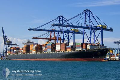
CYPRESS
Container Ship
Current Trip
| Time Travelled | 8 days |
|---|---|
| Remaining Time | --- |
| Distance Travelled | 1320.21 nm |
| Remaining Distance | --- |
| AVG Speed | 11.8 Knots |
| MAX Speed | 17.9 Knots |
| AVG Wind | 17.1 knots |
| MAX Wind | 25 knots |
| MIN Temp | 21°C / 69.8°F |
| MAX Temp | 28°C / 82.4°F |
| Draught | 12.7 m |
| Position Received | 33 m ago |
Current Position
| Longitude | --- |
|---|---|
| Latitude | --- |
| Status | At anchor |
| Speed | 0.4 Knots |
| Course | 339° |
| Area | Laccadive Sea |
| Station | T-AIS |
| Position Received | 33 m ago |
Info
Information
The current position of CYPRESS is in Laccadive Sea with coordinates 6.94874° / 79.77658° as reported on 2026-01-08 09:12 by AIS to our vessel tracker app. The vessel's current speed is 0.4 Knots
The vessel CYPRESS (IMO: 9461477, MMSI: 636018058) is a Container Ship that was built in 2011 ( 15 years old ). It's sailing under the flag of [LR] Liberia.
In this page you can find informations about the vessels current position, last detected port calls, and current voyage information. If the vessels is not in coverage by AIS you will find the latest position.
The current position of CYPRESS is detected by our AIS receivers and we are not responsible for the reliability of the data. The last position was recorded while the vessel was in Coverage by the Ais receivers of our vessel tracking app.
The current draught of CYPRESS as reported by AIS is 12.7 meters
Weather
| Temperature | 25.6°C / 78.08°F |
|---|---|
| Wind Speed | 22 knots |
| Direction | 19° NNE |
| Pressure | 1010.7 hPa |
| Humidity | 75 % |
| Cloud Coverage | 100 % |
Featured Company
Last Port Calls
| Port | Arrival | Departure | Time In Port |
|---|---|---|---|
| 2025-12-29 22:54 | 2025-12-31 05:31 | 1 d | |
| 2025-12-27 04:39 | 2025-12-28 04:50 | 1 d | |
| 2025-12-24 14:50 | 2025-12-25 07:08 | 16 h | |
| 2025-11-19 20:16 | 2025-11-20 19:49 | 23 h | |
| 2025-11-18 03:45 | 2025-11-19 09:27 | 1 d | |
| 2025-11-13 05:26 | 2025-11-14 14:15 | 1 d | |
| 2025-11-10 17:39 | 2025-11-10 19:48 | 2 h |
Most Visited Ports (Last year)
| Port | Arrivals | |
|---|---|---|
| 5 | ||
| 4 | ||
| 3 | ||
| 3 | ||
| 3 | ||
| 2 |
Last Trips
| Origin | Departure | Destination | Arrival | Distance | |
|---|---|---|---|---|---|
| 2025-12-28 04:50 | 2025-12-29 22:54 | 452.10 nm | |||
| 2025-12-25 07:08 | 2025-12-27 04:39 | 570.37 nm | |||
| 2025-11-20 19:49 | 2025-12-24 14:50 | 11651.03 nm | |||
| 2025-11-19 09:27 | 2025-11-19 20:16 | 126.82 nm | |||
| 2025-11-14 14:15 | 2025-11-18 03:45 | 610.21 nm | |||
| 2025-11-10 19:48 | 2025-11-13 05:26 | 350.63 nm | |||
| 2025-10-08 23:20 | 2025-11-10 17:39 | 12140.78 nm |
Events
| Time | Event | Details | Position / Dest | Info |
|---|---|---|---|---|
| 2026-01-08 09:21 | Status Changed | Default At anchor |
6.94872 / 79.77535
LKCMB
|
Speed: 0.4 kn Course: 339° |
| 2026-01-08 09:12 | Status Changed | At anchor Default |
6.94874 / 79.77658
LKCMB
|
Speed: 0.4 kn Course: 337° |
| 2026-01-08 09:09 | Status Changed | Default At anchor |
6.94858 / 79.77690
LKCMB
|
Speed: 0.1 kn Course: 2° |
| 2026-01-08 09:03 | Status Changed | At anchor Default |
6.94871 / 79.77644
LKCMB
|
Speed: 0.5 kn Course: 8° |
| 2026-01-08 08:47 | Status Changed | Default At anchor |
6.94875 / 79.77598
LKCMB
|
Speed: 0.3 kn Course: 350° |
| 2026-01-08 08:40 | Status Changed | At anchor Default |
6.94858 / 79.77644
LKCMB
|
Speed: Course: 247° |
| 2026-01-08 08:33 | IN Coverage |
6.94858 / 79.77644
Laccadive Sea
|
Speed: 0.3 kn Course: 132.2° |
|
| 2026-01-08 07:14 | Status Changed | Default At anchor |
6.94858 / 79.77620
LKCMB
|
Speed: 0.5 kn Course: 11° |
| 2026-01-08 07:10 | OUT of Coverage |
6.94865 / 79.77583
Laccadive Sea
|
Speed: 0.5 kn Course: 100.5° |
|
| 2026-01-08 07:04 | Status Changed | At anchor Default |
6.94874 / 79.77503
LKCMB
|
Speed: 0.3 kn Course: 16° |