
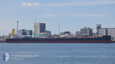
CSSC BRIGHT
Cargo
Current Trip
| Time Travelled | 10 days |
|---|---|
| Remaining Time | --- |
| Distance Travelled | 1510.13 nm |
| Remaining Distance | --- |
| AVG Speed | 11.4 Knots |
| MAX Speed | 15.3 Knots |
| AVG Wind | 11.3 knots |
| MAX Wind | 33.8 knots |
| MIN Temp | 0.4°C / 32.72°F |
| MAX Temp | 18.9°C / 66.02°F |
| Draught | 14.6 m |
| Position Received | 1 d ago |
Current Position
| Longitude | --- |
|---|---|
| Latitude | --- |
| Status | Under way using engine |
| Speed | 6.4 Knots |
| Course | 48.9° |
| Area | Inland Sea |
| Station | T-AIS |
| Position Received | 1 d ago |
Info
Information
The current position of CSSC BRIGHT is in Inland Sea with coordinates 34.62932° / 134.75170° as reported on 2025-12-19 06:11 by AIS to our vessel tracker app. The vessel's current speed is 6.4 Knots
The vessel CSSC BRIGHT (IMO: 9830068, MMSI: 477233600) is a Cargo It's sailing under the flag of [HK] Hong Kong.
In this page you can find informations about the vessels current position, last detected port calls, and current voyage information. If the vessels is not in coverage by AIS you will find the latest position.
The current position of CSSC BRIGHT is detected by our AIS receivers and we are not responsible for the reliability of the data. The last position was recorded while the vessel was in Coverage by the Ais receivers of our vessel tracking app.
The current draught of CSSC BRIGHT as reported by AIS is 14.6 meters
Weather
| Temperature | 14.5°C / 58.1°F |
|---|---|
| Wind Speed | 3 knots |
| Direction | 58° ENE |
| Pressure | 1020.6 hPa |
| Humidity | 87.3 % |
| Cloud Coverage | 16 % |
Featured Company
Most Visited Ports (Last year)
| Port | Arrivals | |
|---|---|---|
| 2 | ||
| 1 | ||
| 1 | ||
| 1 | ||
| 1 |
Last Trips
| Origin | Departure | Destination | Arrival | Distance | |
|---|---|---|---|---|---|
| 2025-09-28 10:05 | 2025-12-03 11:25 | 6860.23 nm |
Events
| Time | Event | Details | Position / Dest | Info |
|---|---|---|---|---|
| 2025-12-19 06:58 | STOP Moving | 3.63 nm, South West of KAKOGAWA |
34.66766 / 134.76842
JPHHR
|
Speed: 0.1 kn Course: 339° |
| 2025-12-19 06:18 | Status Changed | Default Under way using engine |
34.63652 / 134.76209
JPHHR
|
Speed: 6.4 kn Course: 48.9° |
| 2025-12-19 06:11 | Status Changed | Under way using engine Default |
34.62932 / 134.75170
JPHHR
|
Speed: 6.5 kn Course: 49° |
| 2025-12-19 06:11 | OUT of Coverage |
34.62932 / 134.75170
Inland Sea
JPHHR
|
Speed: 6.4 kn Course: 48.9° |
|
| 2025-12-19 06:10 | IN Coverage |
34.62932 / 134.75170
Inland Sea
JPHHR
|
Speed: 6.4 kn Course: 48.9° |
|
| 2025-12-19 05:09 | Status Changed | Default Under way using engine |
34.57684 / 134.84952
JPHHR
|
Speed: 9.6 kn Course: 247.5° |
| 2025-12-19 05:03 | Status Changed | Under way using engine Default |
34.58349 / 134.87023
JPHHR
|
Speed: 9.3 kn Course: 243° |
| 2025-12-19 05:03 | OUT of Coverage |
34.58349 / 134.87023
Inland Sea
JPHHR
|
Speed: 9.6 kn Course: 247.5° |
|
| 2025-12-19 04:58 | Status Changed | Default Under way using engine |
34.58838 / 134.88373
JPHHR
|
Speed: 9.2 kn Course: 243.9° |
| 2025-12-19 04:34 | Status Changed | Under way using engine Default |
34.61162 / 134.94271
JPHHR
|
Speed: 8.9 kn Course: 250° |