
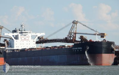
CS HANG ZHOU
Cargo
Current Trip
| Time Travelled | 8 days |
|---|---|
| Remaining Time | --- |
| Distance Travelled | 2252.64 nm |
| Remaining Distance | --- |
| AVG Speed | 12.5 Knots |
| MAX Speed | 14.8 Knots |
| AVG Wind | 12.2 knots |
| MAX Wind | 24 knots |
| MIN Temp | 8.1°C / 46.58°F |
| MAX Temp | 30.3°C / 86.54°F |
| Draught | 18.2 m |
| Position Received | 2024-04-03 17:36 |
Current Position
| Longitude | 118.00376° |
|---|---|
| Latitude | -18.13185° |
| Status | Under way using engine |
| Speed | 11.7 Knots |
| Course | 346.4° |
| Area | Indian Ocean |
| Station | T-AIS |
| Position Received | 2024-04-03 17:36 |
Info
Information
The current position of CS HANG ZHOU is in Indian Ocean with coordinates -18.13185° / 118.00376° as reported on 2024-04-03 17:36 by AIS to our vessel tracker app. The vessel's current speed is 11.7 Knots and is heading at the port of LIANYUNGANG.
The vessel CS HANG ZHOU (IMO: 9874703, MMSI: 477717600) is a Cargo It's sailing under the flag of [HK] Hong Kong.
In this page you can find informations about the vessels current position, last detected port calls, and current voyage information. If the vessels is not in coverage by AIS you will find the latest position.
The current position of CS HANG ZHOU is detected by our AIS receivers and we are not responsible for the reliability of the data. The last position was recorded while the vessel was in Coverage by the Ais receivers of our vessel tracking app.
The current draught of CS HANG ZHOU as reported by AIS is 18.2 meters
Weather
| Temperature | 29.1°C / 84.38°F |
|---|---|
| Wind Speed | 6 knots |
| Direction | 30° NNE |
| Pressure | 1009 hPa |
| Humidity | 72.8 % |
| Cloud Coverage | 100 % |
Featured Company
Last Port Calls
| Port | Arrival | Departure | Time In Port |
|---|---|---|---|
| 2024-04-26 08:32 | 2024-04-29 00:04 | 2 d | |
| 2024-04-01 15:55 | 2024-04-03 05:23 | 1 d | |
| 2024-03-20 04:36 |
Most Visited Ports (Last year)
| Port | Arrivals | |
|---|---|---|
| 3 | ||
| 2 | ||
| 1 | ||
| 1 | ||
| 1 | ||
| 1 |
Last Trips
| Origin | Departure | Destination | Arrival | Distance | |
|---|---|---|---|---|---|
| 2024-04-03 13:23 | 2024-04-26 16:32 | 3846.13 nm | |||
| 2024-03-20 12:36 | 2024-04-01 23:55 | 3617.71 nm |
Events
| Time | Event | Details | Position / Dest | Info |
|---|---|---|---|---|
| 2024-05-02 09:44 | START Moving | 20.05 nm, South of ZHOUSHAN |
29.64870 / 122.32037
CN LYG
|
Speed: 5.5 kn Course: 43° |
| 2024-05-01 11:22 | STOP Moving | 20.34 nm, South of ZHOUSHAN |
29.64264 / 122.31642
CN LYG
|
Speed: 0.3 kn Course: 320° |
| 2024-05-01 07:20 | START Moving |
29.77077 / 123.03223
CN LYG
|
Speed: 4.7 kn Course: 289° |
|
| 2024-05-01 05:56 | STOP Moving |
29.76992 / 123.03630
CN LYG
|
Speed: 0.1 kn Course: 19° |
|
| 2024-04-29 00:04 | PORT DEPARTURE |
|
39.18251 / 119.03142
CN LYG
|
Speed: 8.1 kn Course: 152° |
| 2024-04-28 23:52 | START Moving |
39.20602 / 119.02424
[CN] JINGTANG
|
Speed: 3.9 kn Course: 190° |