
CREADOR
Fishing
Current Trip
AREA PESCA
| Time Travelled | 1 day |
|---|---|
| Remaining Time | --- |
| Distance Travelled | 7.01 nm |
| Remaining Distance | --- |
| AVG Speed | 8.6 Knots |
| MAX Speed | 9.2 Knots |
| AVG Wind | 15 knots |
| MAX Wind | 15 knots |
| MIN Temp | 14.1°C / 57.38°F |
| MAX Temp | 14.2°C / 57.56°F |
| Draught | 3.3 m |
| Position Received | 1 d ago |
Current Position
| Longitude | --- |
|---|---|
| Latitude | --- |
| Status | Under way using engine |
| Speed | 8.3 Knots |
| Course | 79.3° |
| Area | Bay of Biscay |
| Station | T-AIS |
| Position Received | 1 d ago |
Info
Information
The current position of CREADOR is in Bay of Biscay with coordinates 43.52033° / -3.60582° as reported on 2025-03-03 17:10 by AIS to our vessel tracker app. The vessel's current speed is 8.3 Knots
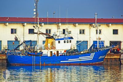
The vessel CREADOR (MMSI: 224102000) is a Fishing It's sailing under the flag of [ES] Spain.
In this page you can find informations about the vessels current position, last detected port calls, and current voyage information. If the vessels is not in coverage by AIS you will find the latest position.
The current position of CREADOR is detected by our AIS receivers and we are not responsible for the reliability of the data. The last position was recorded while the vessel was in Coverage by the Ais receivers of our vessel tracking app.
The current draught of CREADOR as reported by AIS is 3.3 meters
Weather
| Temperature | 12.9°C / 55.22°F |
|---|---|
| Wind Speed | 14 knots |
| Direction | 96° E |
| Pressure | 1019 hPa |
| Humidity | 74.2 % |
| Cloud Coverage | 45 % |
Featured Company
Most Visited Ports (Last year)
| Port | Arrivals | |
|---|---|---|
| 70 | ||
| 18 | ||
| 10 | ||
| 6 | ||
| 4 | ||
| 3 |
Events
| Time | Event | Details | Position / Dest | Info |
|---|---|---|---|---|
| 2025-03-03 17:10 | OUT of Coverage |
43.52033 / -3.60582
Bay of Biscay
|
Speed: 8.3 kn Course: 79.3° |
|
| 2025-03-03 16:06 | PORT DEPARTURE |
|
43.45896 / -3.78641
AREA PESCA
|
Speed: 6.6 kn Course: 75° |
| 2025-03-03 15:49 | START Moving |
43.44871 / -3.81776
[ES] SANTANDER
|
Speed: 3.6 kn Course: 90° |
|
| 2025-03-03 15:24 | IN Coverage |
43.44967 / -3.81993
Bay of Biscay
[ES] SANTANDER
|
Speed: Course: 151.6° |
|
| 2025-02-27 19:31 | OUT of Coverage |
43.44967 / -3.81997
Bay of Biscay
[ES] SANTANDER
|
Speed: Course: 73.4° |
|
| 2025-02-27 19:13 | STOP Moving |
43.44966 / -3.81990
[ES] SANTANDER
|
Speed: 0.3 kn Course: 83° |
|
| 2025-02-27 19:09 | START Moving |
43.44839 / -3.81524
[ES] SANTANDER
|
Speed: 5.9 kn Course: 280° |
|
| 2025-02-27 19:05 | STOP Moving |
43.44716 / -3.81328
[ES] SANTANDER
|
Speed: 0.3 kn Course: 111° |
|
| 2025-02-27 19:05 | PORT ARRIVAL |
|
43.44716 / -3.81327
[ES] SANTANDER
|
Speed: 0.7 kn Course: 128° |
| 2025-02-27 17:47 | IN Coverage |
43.49954 / -3.92805
Bay of Biscay
|
Speed: 8.9 kn Course: 82.2° |