
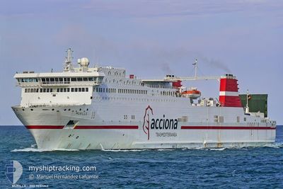
CRACOVIA
Ro-Ro/Passenger Ship
Current Trip
ALGER
| Time Travelled | 1 day |
|---|---|
| Remaining Time | --- |
| Distance Travelled | 6.06 nm |
| Remaining Distance | --- |
| AVG Speed | --- |
| MAX Speed | --- |
| AVG Wind | 2.8 knots |
| MAX Wind | 5 knots |
| MIN Temp | 14.9°C / 58.82°F |
| MAX Temp | 19.7°C / 67.46°F |
| Draught | 6.1 m |
| Position Received | 2 d ago |
Current Position
| Longitude | --- |
|---|---|
| Latitude | --- |
| Status | Under way using engine |
| Speed | 20.5 Knots |
| Course | 187.5° |
| Area | Mediterranean Sea - Western Basin |
| Station | T-AIS |
| Position Received | 2 d ago |
Info
Information
The current position of CRACOVIA is in Mediterranean Sea - Western Basin with coordinates 39.41108° / 3.57785° as reported on 2025-12-06 07:34 by AIS to our vessel tracker app. The vessel's current speed is 20.5 Knots
The vessel CRACOVIA (IMO: 9237242, MMSI: 311000671) is a Ro-Ro/Passenger Ship that was built in 2002 ( 23 years old ). It's sailing under the flag of [BS] Bahamas.
In this page you can find informations about the vessels current position, last detected port calls, and current voyage information. If the vessels is not in coverage by AIS you will find the latest position.
The current position of CRACOVIA is detected by our AIS receivers and we are not responsible for the reliability of the data. The last position was recorded while the vessel was in Coverage by the Ais receivers of our vessel tracking app.
The current draught of CRACOVIA as reported by AIS is 6.1 meters
Weather
| Temperature | 19.2°C / 66.56°F |
|---|---|
| Wind Speed | 4 knots |
| Direction | 24° NNE |
| Pressure | 1022.3 hPa |
| Humidity | 49.2 % |
| Cloud Coverage | 100 % |
Featured Company
Last Port Calls
| Port | Arrival | Departure | Time In Port |
|---|---|---|---|
| 2025-12-06 16:49 | 2025-12-07 12:01 | 19 h | |
| 2025-12-05 14:04 | 2025-12-05 19:05 | 5 h | |
| 2025-12-04 07:57 | 2025-12-04 15:20 | 7 h | |
| 2025-12-03 09:35 | 2025-12-03 18:19 | 8 h | |
| 2025-12-02 07:43 | 2025-12-02 22:10 | 14 h | |
| 2025-12-01 09:46 | 2025-12-01 18:55 | 9 h | |
| 2025-11-29 16:45 | 2025-11-30 20:33 | 1 d | |
| 2025-11-28 12:42 | 2025-11-28 18:30 | 5 h | |
| 2025-11-27 06:41 | 2025-11-27 13:08 | 6 h | |
| 2025-11-26 08:14 | 2025-11-26 18:14 | 9 h |
Last Trips
| Origin | Departure | Destination | Arrival | Distance | |
|---|---|---|---|---|---|
| 2025-12-05 19:05 | 2025-12-06 16:49 | 411.91 nm | |||
| 2025-12-04 15:20 | 2025-12-05 14:04 | 438.04 nm | |||
| 2025-12-03 18:19 | 2025-12-04 07:57 | 198.38 nm | |||
| 2025-12-02 22:10 | 2025-12-03 09:35 | 162.20 nm | |||
| 2025-12-01 18:55 | 2025-12-02 07:43 | 160.18 nm | |||
| 2025-11-30 20:33 | 2025-12-01 09:46 | 203.40 nm | |||
| 2025-11-28 18:30 | 2025-11-29 16:45 | 415.25 nm | |||
| 2025-11-27 13:08 | 2025-11-28 12:42 | 453.76 nm | |||
| 2025-11-26 18:14 | 2025-11-27 06:41 | 199.20 nm | |||
| 2025-11-25 23:13 | 2025-11-26 08:14 | 158.96 nm |
Events
| Time | Event | Details | Position / Dest | Info |
|---|---|---|---|---|
| 2025-12-07 11:35 | STOP Moving | 1.58 nm, East of ALGER |
36.77278 / 3.10393
ALGER
|
Speed: 0.2 kn Course: 6° |
| 2025-12-07 11:01 | PORT DEPARTURE |
|
36.77077 / 3.08333
ALGER
|
Speed: 7.8 kn Course: 129° |
| 2025-12-07 10:57 | START Moving |
36.77677 / 3.07410
[DZ] ALGER
|
Speed: 7.8 kn Course: 129° |
|
| 2025-12-06 16:07 | STOP Moving |
36.77633 / 3.06407
[DZ] ALGER
|
Speed: 0.1 kn Course: 76° |
|
| 2025-12-06 15:49 | PORT ARRIVAL |
|
36.77803 / 3.06782
[DZ] ALGER
|
Speed: 7.9 kn Course: 297° |
| 2025-12-06 07:41 | Status Changed | Default Under way using engine |
39.36990 / 3.57085
ALGER
|
Speed: 20.5 kn Course: 187.5° |
| 2025-12-06 07:34 | OUT of Coverage |
39.41108 / 3.57785
Mediterranean Sea - Western Basin
ALGER
|
Speed: 20.5 kn Course: 187.5° |
|
| 2025-12-06 07:30 | Change Sea Area | Spanish part of the Mediterranean Sea - Western Basin Spanish part of the Balearic Sea |
39.43358 / 3.58190
Mediterranean Sea - Western Basin
ALGER
|
Speed: 20.5 kn Course: 188.3° |
| 2025-12-06 07:30 | Status Changed | Under way using engine Default |
39.43358 / 3.58190
ALGER
|
Speed: 20.6 kn Course: 189° |
| 2025-12-06 06:28 | OUT of Coverage |
39.78081 / 3.64293
Balearic Sea
ALGER
|
Speed: 20 kn Course: 189° |