
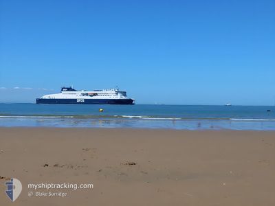
COTE D'OPALE
Passenger A
Current Trip
CALAIS DOVER CALAIS
| Time Travelled | 2 h, 36 mins |
|---|---|
| Remaining Time | --- |
| Distance Travelled | 22.18 nm |
| Remaining Distance | --- |
| AVG Speed | 11 Knots |
| MAX Speed | 18.4 Knots |
| AVG Wind | 21.2 knots |
| MAX Wind | 22.7 knots |
| MIN Temp | 2°C / 35.6°F |
| MAX Temp | 5.5°C / 41.9°F |
| Draught | 5.3 m |
| Position Received | 2 m ago |
Current Position
| Longitude | --- |
|---|---|
| Latitude | --- |
| Status | Under way using engine |
| Speed | 9 Knots |
| Course | 258.7° |
| Area | North Sea |
| Station | T-AIS |
| Position Received | 2 m ago |
Info
Information
The current position of COTE D'OPALE is in North Sea with coordinates 50.97830° / 1.85997° as reported on 2026-01-05 22:13 by AIS to our vessel tracker app. The vessel's current speed is 9 Knots
The vessel COTE D'OPALE (IMO: 9858321, MMSI: 228417600) is a Passenger A It's sailing under the flag of [FR] France.
In this page you can find informations about the vessels current position, last detected port calls, and current voyage information. If the vessels is not in coverage by AIS you will find the latest position.
The current position of COTE D'OPALE is detected by our AIS receivers and we are not responsible for the reliability of the data. The last position was recorded while the vessel was in Coverage by the Ais receivers of our vessel tracking app.
The current draught of COTE D'OPALE as reported by AIS is 5.3 meters
Weather
| Temperature | 5.5°C / 41.9°F |
|---|---|
| Wind Speed | 20 knots |
| Direction | 353° N |
| Pressure | 1015 hPa |
| Humidity | 58.1 % |
| Cloud Coverage | 98 % |
Featured Company
Last Port Calls
| Port | Arrival | Departure | Time In Port |
|---|---|---|---|
| 2026-01-05 18:36 | 2026-01-05 19:39 | 1 h | |
| 2026-01-05 13:19 | 2026-01-05 14:24 | 1 h | |
| 2026-01-05 08:03 | 2026-01-05 09:07 | 1 h | |
| 2026-01-04 23:44 | 2026-01-05 00:35 | 50 m | |
| 2026-01-04 18:36 | 2026-01-04 19:40 | 1 h | |
| 2026-01-04 13:21 | 2026-01-04 14:21 | 1 h | |
| 2026-01-04 08:05 | 2026-01-04 09:02 | 56 m | |
| 2026-01-03 23:40 | 2026-01-04 00:43 | 1 h | |
| 2026-01-03 18:33 | 2026-01-03 19:31 | 57 m | |
| 2026-01-03 13:15 | 2026-01-03 14:21 | 1 h |
Last Trips
| Origin | Departure | Destination | Arrival | Distance | |
|---|---|---|---|---|---|
| 2026-01-05 14:24 | 2026-01-05 18:36 | 47.22 nm | |||
| 2026-01-05 09:07 | 2026-01-05 13:19 | 46.96 nm | |||
| 2026-01-05 00:35 | 2026-01-05 08:03 | 46.19 nm | |||
| 2026-01-04 19:40 | 2026-01-04 23:44 | 46.04 nm | |||
| 2026-01-04 14:21 | 2026-01-04 18:36 | 47.20 nm | |||
| 2026-01-04 09:02 | 2026-01-04 13:21 | 47.35 nm | |||
| 2026-01-04 00:43 | 2026-01-04 08:05 | 45.07 nm | |||
| 2026-01-03 19:31 | 2026-01-03 23:40 | 46.61 nm | |||
| 2026-01-03 14:21 | 2026-01-03 18:33 | 45.94 nm | |||
| 2026-01-03 09:13 | 2026-01-03 13:15 | 45.18 nm |
Events
| Time | Event | Details | Position / Dest | Info |
|---|---|---|---|---|
| 2026-01-05 22:07 | START Moving | 0.88 nm, North East of CALAIS |
50.97782 / 1.86870
CALAIS DOVER CALAIS
|
Speed: 3.5 kn Course: 104° |
| 2026-01-05 21:12 | STOP Moving | 0.98 nm, North East of CALAIS |
50.97802 / 1.87162
CALAIS DOVER CALAIS
|
Speed: 0.3 kn Course: 102° |
| 2026-01-05 20:35 | Change Sea Area | French part of the North Sea French part of the English Channel |
50.97170 / 1.66538
North Sea
CALAIS DOVER CALAIS
|
Speed: 12.8 kn Course: 102.9° |
| 2026-01-05 20:09 | Change Sea Area | French part of the English Channel United Kingdom part of the English Channel |
51.02825 / 1.52732
English Channel
CALAIS DOVER CALAIS
|
Speed: 15.2 kn Course: 124.1° |
| 2026-01-05 19:39 | PORT DEPARTURE |
|
51.10573 / 1.36775
CALAIS DOVER CALAIS
|
Speed: 9.8 kn Course: 105° |
| 2026-01-05 19:32 | START Moving |
51.12190 / 1.33940
[GB] DOVER
|
Speed: 8.8 kn Course: 113° |
|
| 2026-01-05 18:44 | STOP Moving |
51.12380 / 1.33575
[GB] DOVER
|
Speed: 0.3 kn Course: 138° |
|
| 2026-01-05 18:39 | Status Changed | Under way using engine Default |
51.12103 / 1.33667
[GB] DOVER
|
Speed: 8.2 kn Course: 298° |
| 2026-01-05 18:37 | Status Changed | Default Under way using engine |
51.12145 / 1.34018
[GB] DOVER
|
Speed: 8.4 kn Course: 297° |
| 2026-01-05 18:36 | PORT ARRIVAL |
|
51.12110 / 1.34195
[GB] DOVER
|
Speed: 21 kn Course: 274.2° |