
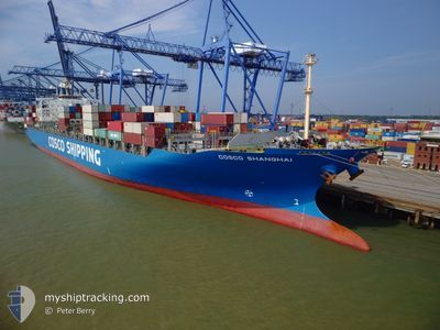
COSCO SHANGHAI
Container Ship
Current Trip
| Time Travelled | 4 days |
|---|---|
| Remaining Time | 3 days |
| Distance Travelled | 1509.28 nm |
| Remaining Distance | 1348.19 nm |
| AVG Speed | 14.2 Knots |
| MAX Speed | 16.3 Knots |
| AVG Wind | 10.6 knots |
| MAX Wind | 22.3 knots |
| MIN Temp | 9.6°C / 49.28°F |
| MAX Temp | 18.4°C / 65.12°F |
| Draught | 14 m |
| Position Received | 3 h, 0 m ago |
Current Position
| Longitude | --- |
|---|---|
| Latitude | --- |
| Status | Under way using engine |
| Speed | 15.5 Knots |
| Course | 290° |
| Area | North Atlantic Ocean |
| Station | T-AIS |
| Position Received | 3 h, 0 m ago |
Info
Information
The current position of COSCO SHANGHAI is in North Atlantic Ocean with coordinates 37.93442° / -35.16070° as reported on 2025-12-21 10:00 by AIS to our vessel tracker app. The vessel's current speed is 15.5 Knots and is heading at the port of HALIFAX. The estimated time of arrival as calculated by MyShipTracking vessel tracking app is 2025-12-24 22:42 LT
The vessel COSCO SHANGHAI (IMO: 9221097, MMSI: 235067987) is a Container Ship that was built in 2001 ( 24 years old ). It's sailing under the flag of [GB] United Kingdom.
In this page you can find informations about the vessels current position, last detected port calls, and current voyage information. If the vessels is not in coverage by AIS you will find the latest position.
The current position of COSCO SHANGHAI is detected by our AIS receivers and we are not responsible for the reliability of the data. The last position was recorded while the vessel was in Coverage by the Ais receivers of our vessel tracking app.
The current draught of COSCO SHANGHAI as reported by AIS is 14 meters
Weather
| Temperature | 17.6°C / 63.68°F |
|---|---|
| Wind Speed | 18 knots |
| Direction | 181° S |
| Pressure | 1027.2 hPa |
| Humidity | 73.5 % |
| Cloud Coverage | 89 % |
Featured Company
Last Port Calls
| Port | Arrival | Departure | Time In Port |
|---|---|---|---|
| 2025-12-16 08:31 | 2025-12-17 03:32 | 19 h | |
| 2025-12-12 20:41 | 2025-12-14 07:01 | 1 d | |
| 2025-12-07 05:19 | 2025-12-08 18:29 | 1 d | |
| 2025-12-05 16:09 | 2025-12-06 17:29 | 1 d | |
| 2025-12-03 18:57 | 2025-12-04 18:37 | 23 h | |
| 2025-11-29 14:31 | 2025-11-30 12:35 | 22 h | |
| 2025-11-10 07:39 | 2025-11-11 04:01 | 20 h | |
| 2025-11-07 06:14 | 2025-11-08 09:32 | 1 d | |
| 2025-11-04 04:13 | 2025-11-05 02:56 | 22 h | |
| 2025-11-03 05:29 | 2025-11-03 06:32 | 1 h |
Most Visited Ports (Last year)
| Port | Arrivals | |
|---|---|---|
| 8 | ||
| 7 | ||
| 5 | ||
| 5 | ||
| 5 | ||
| 5 |
Last Trips
| Origin | Departure | Destination | Arrival | Distance | |
|---|---|---|---|---|---|
| 2025-12-14 07:01 | 2025-12-16 08:31 | 417.30 nm | |||
| 2025-12-08 18:29 | 2025-12-12 20:41 | 518.30 nm | |||
| 2025-12-06 17:29 | 2025-12-07 05:19 | 66.54 nm | |||
| 2025-12-04 18:37 | 2025-12-05 16:09 | 367.73 nm | |||
| 2025-11-30 12:35 | 2025-12-03 18:57 | 1028.82 nm | |||
| 2025-11-11 04:01 | 2025-11-29 14:31 | 3985.49 nm | |||
| 2025-11-08 09:32 | 2025-11-10 07:39 | 466.67 nm | |||
| 2025-11-05 02:56 | 2025-11-07 06:14 | 510.25 nm | |||
| 2025-11-03 06:32 | 2025-11-04 04:13 | 295.28 nm | |||
| 2025-11-02 07:42 | 2025-11-03 05:29 | 7.42 nm |
Events
| Time | Event | Details | Position / Dest | Info |
|---|---|---|---|---|
| 2025-12-21 10:02 | Status Changed | Default Under way using engine |
37.93500 / -35.16667
CA HAL
|
Speed: 15.5 kn Course: 290° |
| 2025-12-21 10:00 | OUT of Coverage |
37.93442 / -35.16070
North Atlantic Ocean
CA HAL
|
Speed: 15.5 kn Course: 290° |
|
| 2025-12-21 09:52 | IN Coverage |
37.92943 / -35.14203
North Atlantic Ocean
CA HAL
|
Speed: 15.4 kn Course: 286° |
|
| 2025-12-21 09:50 | Status Changed | Under way using engine Default |
37.92045 / -35.11042
CA HAL
|
Speed: 15.5 kn Course: 289° |
| 2025-12-21 08:05 | Status Changed | Default Under way using engine |
37.76500 / -34.56500
CA HAL
|
Speed: 15.6 kn Course: 289° |
| 2025-12-21 07:57 | Status Changed | Under way using engine Default |
37.75582 / -34.52685
CA HAL
|
Speed: 15 kn Course: 289° |
| 2025-12-21 07:57 | OUT of Coverage |
37.75582 / -34.52685
North Atlantic Ocean
CA HAL
|
Speed: 15.6 kn Course: 289° |
|
| 2025-12-21 07:44 | IN Coverage |
37.75582 / -34.52685
North Atlantic Ocean
CA HAL
|
Speed: 15.6 kn Course: 289° |
|
| 2025-12-17 12:44 | Status Changed | Default Under way using engine |
35.95051 / -6.29620
CA HAL
|
Speed: 14 kn Course: 276° |
| 2025-12-17 12:39 | OUT of Coverage |
35.94874 / -6.27245
North Atlantic Ocean
CA HAL
|
Speed: 14 kn Course: 276° |