
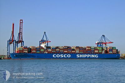
COSCO NEBULA
Cargo
Current Trip
| Time Travelled | 13 h, 50 mins |
|---|---|
| Remaining Time | 9 h, 33 mins |
| Distance Travelled | 144.82 nm |
| Remaining Distance | 107.56 nm |
| AVG Speed | 10.9 Knots |
| MAX Speed | 12.8 Knots |
| AVG Wind | 5.9 knots |
| MAX Wind | 10.9 knots |
| MIN Temp | 18.2°C / 64.76°F |
| MAX Temp | 19.9°C / 67.82°F |
| Draught | 12.2 m |
| Position Received | Now |
Current Position
| Longitude | 6.98830° |
|---|---|
| Latitude | 42.94612° |
| Status | Under way using engine |
| Speed | 10.8 Knots |
| Course | 240° |
| Area | Mediterranean Sea - Western Basin |
| Station | T-AIS |
| Position Received | Now |
Info
Information
The current position of COSCO NEBULA is in Mediterranean Sea - Western Basin with coordinates 42.94612° / 6.98830° as reported on 2024-05-13 04:05 by AIS to our vessel tracker app. The vessel's current speed is 10.8 Knots and is heading at the port of FOS. The estimated time of arrival as calculated by MyShipTracking vessel tracking app is 2024-05-13 13:39 LT
The vessel COSCO NEBULA (IMO: 9795622, MMSI: 477194400) is a Cargo It's sailing under the flag of [HK] Hong Kong.
In this page you can find informations about the vessels current position, last detected port calls, and current voyage information. If the vessels is not in coverage by AIS you will find the latest position.
The current position of COSCO NEBULA is detected by our AIS receivers and we are not responsible for the reliability of the data. The last position was recorded while the vessel was in Coverage by the Ais receivers of our vessel tracking app.
The current draught of COSCO NEBULA as reported by AIS is 12.2 meters
Weather
| Temperature | 18.2°C / 64.76°F |
|---|---|
| Wind Speed | 6 knots |
| Direction | 268° W |
| Pressure | 1014.9 hPa |
| Humidity | 74.1 % |
| Cloud Coverage | 100 % |
Featured Company
Last Port Calls
| Port | Arrival | Departure | Time In Port |
|---|---|---|---|
| 2024-05-10 18:32 | 2024-05-12 14:16 | 1 d | |
| 2024-05-07 06:52 | 2024-05-08 13:09 | 1 d | |
| 2024-04-29 17:10 | 2024-05-04 12:38 | 4 d | |
| 2024-04-01 01:29 | 2024-04-01 18:16 | 16 h | |
| 2024-03-27 22:51 | 2024-03-28 11:59 | 13 h | |
| 2024-03-27 03:47 | 2024-03-27 17:34 | 13 h | |
| 2024-03-25 18:57 | 2024-03-26 06:08 | 11 h | |
| 2024-03-20 09:07 | 2024-03-21 22:11 | 1 d | |
| 2024-03-18 07:48 | 2024-03-19 06:10 | 22 h | |
| 2024-03-12 09:54 | 2024-03-13 04:33 | 18 h |
Last Trips
| Origin | Departure | Destination | Arrival | Distance | |
|---|---|---|---|---|---|
| 2024-05-08 15:09 | 2024-05-10 20:32 | 106.21 nm | |||
| 2024-05-04 15:38 | 2024-05-07 08:52 | 1017.35 nm | |||
| 2024-04-02 02:16 | 2024-04-29 20:10 | 12398.54 nm | |||
| 2024-03-28 19:59 | 2024-04-01 09:29 | 1471.59 nm | |||
| 2024-03-28 01:34 | 2024-03-28 06:51 | 59.60 nm | |||
| 2024-03-26 14:08 | 2024-03-27 11:47 | 352.44 nm | |||
| 2024-03-22 06:11 | 2024-03-26 02:57 | 663.91 nm | |||
| 2024-03-19 14:10 | 2024-03-20 17:07 | 415.59 nm | |||
| 2024-03-13 12:33 | 2024-03-18 15:48 | 1141.35 nm | |||
| 2024-03-07 10:38 | 2024-03-12 17:54 | 1472.49 nm |
Events
| Time | Event | Details | Position / Dest | Info |
|---|---|---|---|---|
| 2024-05-13 01:11 | Detected in Sea | French part of the Mediterranean Sea - Western Basin |
43.19674 / 7.61748
Mediterranean Sea - Western Basin
FRFOS
|
Speed: 10.8 kn Course: 240.7° |
| 2024-05-13 01:02 | Change Sea Area | Mon�gasque part of the Mediterranean Sea - Western Basin French part of the Mediterranean Sea - Western Basin |
43.21021 / 7.65032
Mediterranean Sea - Western Basin
FRFOS
|
Speed: 10.7 kn Course: 240.4° |
| 2024-05-13 00:29 | Change Sea Area | French part of the Mediterranean Sea - Western Basin Italian part of the Mediterranean Sea - Western Basin |
43.25796 / 7.76560
Mediterranean Sea - Western Basin
FRFOS
|
Speed: 10.5 kn Course: 240.4° |
| 2024-05-12 21:53 | Change Sea Area | Italian part of the Mediterranean Sea - Western Basin Italian part of the Ligurian Sea |
43.44505 / 8.34638
Mediterranean Sea - Western Basin
FRFOS
|
Speed: 10.7 kn Course: 239.3° |
| 2024-05-12 15:08 | Change Sea Area | Italian part of the Ligurian Sea Italian part of the Tyrrhenian Sea |
43.95557 / 9.81752
Ligurian Sea
FRFOS
|
Speed: 10.4 kn Course: 265.4° |
| 2024-05-12 14:16 | PORT DEPARTURE |
|
44.07373 / 9.85125
FRFOS
|
Speed: 8.5 kn Course: 160° |
| 2024-05-12 14:01 | Status Changed | Under way using engine Moored |
44.10191 / 9.84518
[IT] LA SPEZIA
|
Speed: 4.7 kn Course: 203° |
| 2024-05-12 13:59 | START Moving |
44.10397 / 9.84656
[IT] LA SPEZIA
|
Speed: 3.1 kn Course: 198° |
|
| 2024-05-12 12:44 | Draught Changed | 12.2 12.4 |
44.10547 / 9.84667
[IT] LA SPEZIA
|
Speed: Course: 198° |
| 2024-05-12 12:26 | Destination Changed | FRFOS ITSPE |
44.10552 / 9.84661
[IT] LA SPEZIA
|
Speed: Course: 198° |