
COSCO CAMELLIA
Cargo A
Current Trip
PANAMA CANAL
| Time Travelled | 2 days |
|---|---|
| Remaining Time | --- |
| Distance Travelled | 489.21 nm |
| Remaining Distance | --- |
| AVG Speed | 11.1 Knots |
| MAX Speed | 16.2 Knots |
| AVG Wind | 17.5 knots |
| MAX Wind | 32.5 knots |
| MIN Temp | 3.3°C / 37.94°F |
| MAX Temp | 11.1°C / 51.98°F |
| Draught | 11.9 m |
| Position Received | 26 d ago |
Current Position
| Longitude | --- |
|---|---|
| Latitude | --- |
| Status | Under way using engine |
| Speed | 19.9 Knots |
| Course | 293.1° |
| Area | North Pacific Ocean |
| Station | T-AIS |
| Position Received | 26 d ago |
Info
Information
The current position of COSCO CAMELLIA is in North Pacific Ocean with coordinates 20.80348° / -110.96752° as reported on 2025-11-18 10:32 by AIS to our vessel tracker app. The vessel's current speed is 19.9 Knots
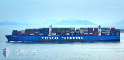
The vessel COSCO CAMELLIA (IMO: 9785782, MMSI: 477286300) is a Cargo A It's sailing under the flag of [HK] Hong Kong.
In this page you can find informations about the vessels current position, last detected port calls, and current voyage information. If the vessels is not in coverage by AIS you will find the latest position.
The current position of COSCO CAMELLIA is detected by our AIS receivers and we are not responsible for the reliability of the data. The last position was recorded while the vessel was in Coverage by the Ais receivers of our vessel tracking app.
The current draught of COSCO CAMELLIA as reported by AIS is 11.9 meters
Weather
| Temperature | 4.5°C / 40.1°F |
|---|---|
| Wind Speed | 3 knots |
| Direction | 300° WNW |
| Pressure | 1026.9 hPa |
| Humidity | 57 % |
| Cloud Coverage | --- |
Featured Company
Last Port Calls
| Port | Arrival | Departure | Time In Port |
|---|---|---|---|
| 2025-12-11 04:00 | 2025-12-12 13:01 | 1 d | |
| 2025-12-04 23:45 | 2025-12-06 04:45 | 1 d | |
| 2025-11-05 16:43 | 2025-11-08 02:25 | 2 d | |
| 2025-11-02 09:12 | 2025-11-03 17:50 | 1 d | |
| 2025-10-29 11:38 | 2025-11-01 11:33 | 2 d | |
| 2025-10-03 14:36 | 2025-10-04 06:52 | 16 h | |
| 2025-10-01 23:20 |
Last Trips
| Origin | Departure | Destination | Arrival | Distance | |
|---|---|---|---|---|---|
| 2025-12-06 04:45 | 2025-12-11 04:00 | 501.42 nm | |||
| 2025-11-08 02:25 | 2025-12-04 23:45 | 11046.57 nm | |||
| 2025-11-03 17:50 | 2025-11-05 16:43 | 518.18 nm | |||
| 2025-11-01 11:33 | 2025-11-02 09:12 | 299.46 nm | |||
| 2025-10-04 06:52 | 2025-10-29 11:38 | 10612.79 nm | |||
| 2025-10-01 23:20 | 2025-10-03 14:36 | 496.48 nm |
Events
| Time | Event | Details | Position / Dest | Info |
|---|---|---|---|---|
| 2025-12-14 00:49 | STOP Moving | 13.4 nm, South East of NINGBO |
29.77621 / 122.01627
PANAMA CANAL
|
Speed: 0.3 kn Course: 241° |
| 2025-12-12 05:01 | PORT DEPARTURE |
|
36.01447 / 120.35565
PANAMA CANAL
|
Speed: 11.2 kn Course: 103° |
| 2025-12-12 04:25 | START Moving |
36.01765 / 120.23412
[CN] QINGDAO
|
Speed: 6.7 kn Course: 38° |
|
| 2025-12-10 21:09 | STOP Moving |
36.00619 / 120.22098
[CN] QINGDAO
|
Speed: 0.3 kn Course: 233° |
|
| 2025-12-10 20:00 | PORT ARRIVAL |
|
36.02439 / 120.35715
[CN] QINGDAO
|
Speed: 8.2 kn Course: 279° |
| 2025-12-10 14:37 | START Moving |
36.05255 / 121.09501
PANAMA CANAL
|
Speed: 6.1 kn Course: 244° |
|
| 2025-12-07 12:56 | STOP Moving |
36.05656 / 121.10055
PANAMA CANAL
|
Speed: 0.3 kn Course: 356° |
|
| 2025-12-05 20:45 | PORT DEPARTURE |
|
38.95516 / 117.88866
PANAMA CANAL
|
Speed: 11.9 kn Course: 102° |
| 2025-12-05 20:13 | START Moving |
38.98971 / 117.78540
[CN] TIANJIN
|
Speed: 5.7 kn Course: 167° |